Storm Goretti brings snow for only parts of region

 BBC
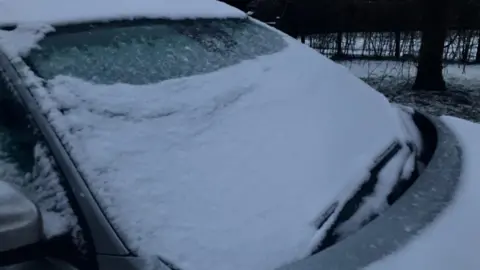
BBCThe impact of Storm Goretti on the Thames Valley appears to have been less severe than anticipated, with snow only falling in higher areas.
Snow was reported in areas including Chipping Norton and Nettlebed in Oxfordshire overnight and while the storm is expected to slowly edge away later, it will stay cold over the weekend.
Prof Liz Bentley, chief executive of the Reading-based Royal Meteorological Society, said wet roads and pavements were likely to turn icy overnight but that there would be no more snow.
The south west appears to have been the worst hit, with tens of thousands of properties there and in the Midlands left without power.
"It was really a case of wind, rain, sleet or snow and that really depended on where you were. Going round our region, if you were on higher ground, it would have been snow; if you were at lower levels then there was more sleet and rain," Bentley said.
She said there could still be some light snow across Friday in some places but that it was unlikely to stick given how wet it had been in most places.
Bentley said the very slight differences in temperatures across the country was the reason disruptive snow fell in the Midlands and not further south.
"That's always the challenge in the UK [in forecasting]. If you're in Scandinavia, the temperatures are so low, whatever falls from the sky is going to be snow. For us, it's on that borderline," she added.
Just one school appears to have been shut by the weather. Sibford Gower Primary School, near Banbury, hopes to reopen on Monday following "localised adverse weather conditions", including snow and ice.
You can follow BBC Oxfordshire on Facebook, X (Twitter), or Instagram.
