Ice warning after Storm Goretti brings school closures and travel disruption

 PA Media
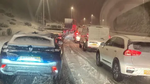
Dozens of schools were closed on Friday after Storm Goretti brought thundersnow and travel disruption to Wales.
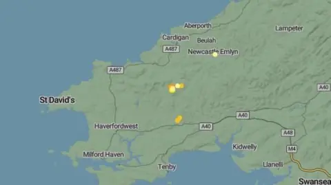
An amber weather warning for heavy snow was in force for the south Wales valleys, mid and north Wales, until 09:00 GMT on Friday.
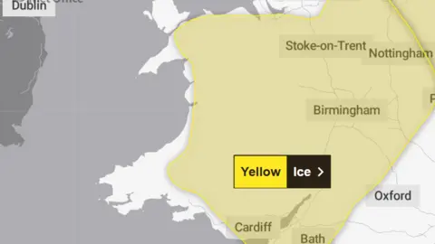
A separate yellow warning for ice covers large parts of Wales from midday Friday until midday Saturday as partially thawed snow refreezes, accompanied by wintry showers and freezing fog.
Some 16cm of snow fell at Lake Vyrnwy in Powys overnight, according to the area's Met Office weather station. Hundreds of homes have been affected by power cuts.
Police advised motorists to avoid mountain roads in Rhondda Cynon Taf, with a number of vehicles having broken down.
Some rail services have been cancelled through to the end of Friday, with passengers advised to check before travelling.
The storm also led to power cuts, with around 150 homes in south and west Wales without power on Friday evening, according to the National Grid. No figures were available for north and mid Wales.
At least 150 schools were closed, with Powys, Blaenau Gwent and Wrexham the worst affected areas.
The exam board WJEC confirmed that 129 students have had their Welsh Literature GCSE exam moved to the summer term, because of two of the school closures.
The FAW cancelled all Welsh Premier League matches for Friday evening, saying all fixtures in the league needed to start simultaneously "to protect sporting integrity and mitigate against the risk of betting market manipulation".
 Met Office
In Pembrokeshire, the council said on Thursday night that snow ploughs and gritters had faced "extremely challenging conditions", with ploughing "becoming unsafe at times for our crews leading to accidents", adding that they may propose activities due to health and safety concerns.
Dyfed-Powys Police warned motorists to "avoid all but extremely essential journeys" across Ceredigion and Powys.
The force said extreme weather conditions across both counties had led to "numerous incidents".
 PA Media
Wendy Francis-Scott from Llanfyllin in Powys said the village was "not as bad as we thought", describing the area as "a bit of a microclimate".
"We've got all the hills and around us and the worst of the weather, on the whole, tends to drift over the top – a little bit like a saucer over a teacup," she said.
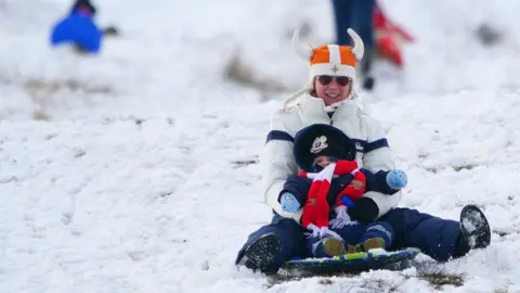
"We thought we'd have the sledges out and be making snowmen this morning – but not to be."

Aled Jones, who runs a local butcher shop, said business has been good.
"People are staying locally to buy things, as they cannot go to the big towns to get food from the supermarkets," he said.
"We often see it when the weather gets bad, people don't fancy travelling," Jones added.
"I definitely expected to see more snow this morning because everyone were panicking.
"There wasn't much here."
 PA Media
How have rail services been hit?
Transport for Wales said on Friday evening that some lines remained closed and some services could still be delayed, amended or cancelled at short notice, but added many routes had reopened.
Disruption on the Heart of Wales line and between Shrewsbury and Birmingham was expected to continue into Saturday, it said.
Patrick Allinson from Transport for Wales said: "Please continue to check before you travel and allow extra time for your journey. Take care when travelling to and from stations as some surfaces may still be slippery."
Cross Country Trains said services were not running between Cardiff and Birmingham.
 BBC Weatherwatchers/wiggy
Some major roads were also affected overnight and early on, while unstable and fallen trees were causing issues on the A483 Newtown bypass.
Mountain roads in the south Wales valleys were also hit, while snow blocked the A542 Horseshoe Pass in north Wales although it was later "passable with care".
Alex Burkill, meteorologist at the Met Office, said snow was difficult to forecast.
"Southern parts of Wales were always less likely to see the snow, because it was that cold air coming in from the north that was leading to the rain falling as snow instead, and so the greatest chances of seeing the disruptive snow was always across more central northern parts of Wales," he said.
"In this instance, it's fair to say that the forecast was pretty accurate, in as much as lots of places around Wales and nearby areas have seen unofficial reports of snow."
What is 'thundersnow'?
 Met Office
This rare phenomenon, which can only happen in very specific conditions, can bring heavy downpours of snow.
As with usual thunderstorms, thundersnow also comes with lightning, which the Met Office says will look "brighter" as the light reflects off the snowflakes.
However, because the snowflakes dampen the sound, it's often much quieter than a typical thunderstorm. This rare phenomenon, which can only happen in very specific conditions, can bring heavy downpours of snow.
