Avalanche warning and thundersnow in Wales as Storm Goretti hits

 Llanberis Mountain Rescue
An avalanche warning is in place with roads in "extremely poor condition" in parts of Wales as Storm Goretti hits, police have said.
An amber weather warning for heavy snow is in force for parts of the country, running from 20:00 GMT on Thursday to 09:00 on Friday.
The Met Office has forecast snow as deep as 20-30cm (8-12 in) in some locations, with instances of thundersnow reported in west Wales.
Llanberis Mountain Rescue Team has warned of possible localised avalanches on Yr Wyddfa, also known as Snowdon, in Gwynedd, while many train services have been suspended.
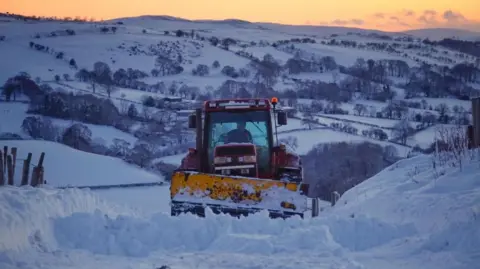
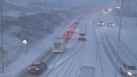 Traffic Wales
The Met Office reported several instances of thundersnow in the Preseli Hills in west Wales on Thursday evening.
This phenomenon occurs when snow falls during a thunderstorm. When it occurs at night the lightning looks brighter because it reflects off the snowflakes.
A dramatic video shared online by Mathew Parry showed bright flashes as thundersnow struck amidst blizzards in the village of Crymych in Pembrokeshire.
He said local farmers had also come to the rescue of a stranded milk tanker, with another video he shared showing two tractors towing it out of the village.
Some people have experienced power cuts, with around 1,300 properties in Wales affected at 20:00 on Thursday.
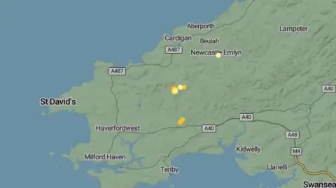 Met Office
Dyfed-Powys Police has warned motorists to "avoid all but extremely essential journeys" across Ceredigion and Powys.
The force said extreme weather conditions across both counties had led to "numerous incidents".
South Wales Police has also warned motorists to avoid the Rhigos and Bwlch mountain roads in Rhondda Cynon Taf due to the current dangerous road conditions, with a number of vehicles reported to have broken down in the area.
Traffic monitoring service Inrix described the A465 Heads of the Valleys road between Dowlais and Clydach as "just passable" due to the snow.
Meanwhile, Pembrokeshire council said heavy snowfall was leading to "treacherous driving conditions".
The B4329 remains closed "due to blizzard conditions" and would be for some time, it said, while issues were also being experienced on the B4313.
Power cuts were reported around Clunderwen and Bridell, and burst water mains were also reported around Clunderwen and Prendergast, Haverfordwest.
A council spokesperson said all available gritters and ploughs were currently deployed, with crews "working in extremely challenging conditions", to get the primary road network open as quickly as possible.
They said "ploughing is becoming unsafe at times for our crews leading to accidents, and therefore we may postpone actions to ensure the health and safety of our staff".
More than 40 schools in Powys will be closed on Friday, with other local authorities also announcing closures.
Llanidloes-based bus operator Celtic Travel posted on social media to say Powys council has cancelled all home to school transport on Friday.
Wales transport secretary Ken Skates said plans were in place to deal with adverse weather.
"We've got agents across the road network. But I would appeal to people, please please ask yourselves do you need to travel when it snows heavily," he said.
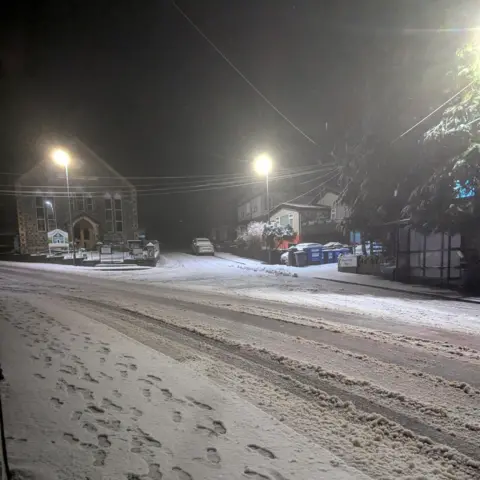 Weather Watchers / Paul
Rail services across Wales affected
National Rail said a number of services had been suspended on Thursday and would remain so on Friday, with no bus replacement services due to the forecasted weather conditions.
These include the line between Bidston and Wrexham, along with lines between Llandudno and Llandudno Junction, Llandudno Junction and Blaenau Ffestiniog, Machynlleth and Pwllheli (Cambrian Coast line), Shrewsbury and Swansea (via Heart of Wales line), Carmarthen and Whitland / Pembroke Dock / Milford Haven / Fishguard Harbour and Maesteg and Ebbw Vale Town.
Reduced services will also be operating until the end of Friday for lines including Holyhead to Shrewsbury and the Merthyr Tydfil / Treherbert / Rhymney and Cardiff Central line and between Cardiff Central and Carmarthen.
"Storm Goretti is expected to bring challenging conditions from Thursday afternoon and overnight, including snow, ice and strong winds, which can have a significant impact on the railway," said Nick Millington, route director at Network Rail Wales and Borders in a statement.
"From mid-afternoon Thursday and into Friday we anticipate the need to close some lines to keep passengers and our colleagues safe," he added.
Patrick Allinson from Transport for Wales passengers should check before travelling for up to date information on rail services and routes.
 Weather Watchers/Alastair Llangollen
Llanberis Mountain Rescue Team said there were areas of unstable snow in several locations near the top of Yr Wyddfa.
"These overhanging snow features can be difficult to spot, especially in poor visibility, and may collapse without warning," it said.
"In certain circumstances, this could lead to serious falls or trigger localised avalanches, particularly where paths run close to steep ground.
"Fresh snow can be very tempting, but winter mountain environments bring additional risks."
It warned anyone heading into the mountains to assess conditions, check the forecast and consider how confident they feel managing winter terrain.
Bethan Andrews, assistant general manager for Glangwili Hospital in Hywel Dda Health Board, said they were advising patients to come in for any planned appointments "as long as they feel safe to do so" but to get in touch to reschedule if they were at all concerned.
She said they had volunteers with 4x4 vehicles and local farmers on standby to help transport their staff to "make sure the hospital and the community is well staffed throughout this period".
The Welsh Ambulance Service is also urging people to take extra care ahead of heavy snowfall and strong winds.
Judith Bryce, assistant director of operations, said: "Unfortunately, severe weather means it may take longer to reach some patients, but if you have a genuine life-threatening emergency, please do continue to call us."
The ambulance service advised people to stock up on medications, only travel if needed, and look out for vulnerable neighbours.
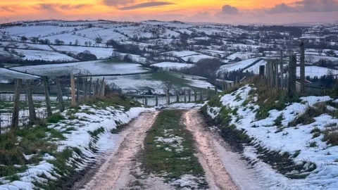 Ruth Davies / Weather Watchers
The recent temperature plunge has triggered the first cold weather payments of the winter in England and Wales.
A less severe yellow warning for snow has been issued for parts of Wales running from 17:00 Thursday until 12:00 GMT on Friday.
An additional yellow warning for rain covers Carmarthenshire, Ceredigion, Neath Port Talbot, Pembrokeshire and Swansea from 12:00 on Thursday until 10:00 on Friday.
The following local authorities are covered by the amber snow warning:
- Blaenau Gwent
- Caerphilly
- Carmarthenshire
- Ceredigion
- Conwy
- Denbighshire
- Gwynedd
- Merthyr Tydfil
- Monmouthshire
- Powys
- Rhondda Cynon Taf
- Torfaen
- Wrexham
 Ruth Davies / Weather Watchers
Carmarthenshire council said it had activated its severe weather arrangements and had "increased operational resilience with extra 4x4 capability, additional supervisory cover, and redeployment of staff".
"Winter maintenance crews are on extended standby throughout the event to respond to changing conditions."
Powys councillor Jackie Charlton said preparation had been taking place over the last few days, including emergency teams to establish where vulnerable people are.
"We have teams of 4x4s, so we have access to vulnerable people," she told BBC Radio Wales Breakfast, adding that the council was focusing on keeping main roads open. She also told people not to travel unless it is essential.
Analysis - Sabrina Lee and Derek Brockway, BBC Weather
Storm Goretti started off as a shallow area of low pressure over the Atlantic.
But as the low pressure engages with the jet stream it will undergo a process called explosive cyclogenesis, where the central pressure drops by 24 millibars or more in 24 hours.
A "weather bomb" is an unofficial term to describe this rapid deepening of low pressure.
The most damaging winds associated with Storm Goretti are expected to affect Cornwall, the Isles of Scilly, the Channel Islands and northern France.
What is an amber weather warning?
- There is an increased likelihood of impacts from severe weather, which could potentially disrupt your plans
- Travel delays, road and rail closures and power cuts
- Potential risk to life and property
What are cold weather payments?
Cold weather payments are triggered by average temperature measurements made by the Met Office at 71 weather stations in Wales and England.
Each residential postcode is linked to a weather station.
A £25 payment is made to eligible recipients within each weather station area where the average temperature has been recorded as, or is forecast to be, 0C or below over seven consecutive days.
It is targeted at people on benefits who are considered most vulnerable to the cold, including older residents receiving pension credit and universal credit claimants who meet certain conditions.
Payments should be received within 14 days.
The scheme runs from 1 November to 31 March each year, but this is the first time payments have been made during 2025/26.
A total of 17 out of the Met Office's 71 weather stations triggered the payment during the week ending January 2.
