Historic England: 100 years of aerial images go online

 Historic England/Aerofilms Ltd
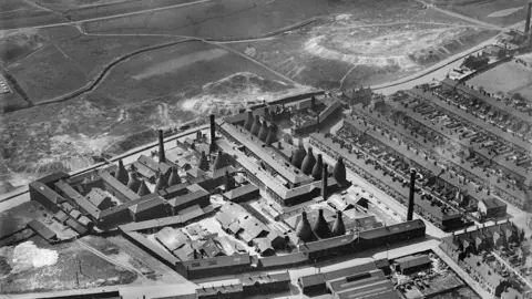
 Landmarks in the West Midlands region feature among more than 400,000 aerial photographs being made available online.
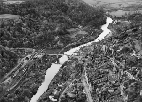
Historic England has launched its Aerial Photography Explorer tool, which allows people to examine how landscapes have changed during 100 years.
Ironbridge, Stoke-on-Trent potteries and Coventry all feature.
Images will be added as more of the six million aerial photos in the Historic England archive are digitised.
 Historic England/Damian Grady
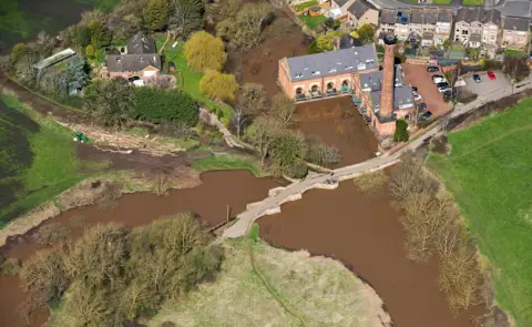
Among the images available are photos of Powick Bridge in Worcestershire.
Monks constructed the original bridge before 1447, but the two arches over the brook were deliberately broken down in 1651 as part of Worcester's defences during the Battle of Worcester and rebuilt during the 17th Century, Historic England said.
 Historic England/Damian Grady
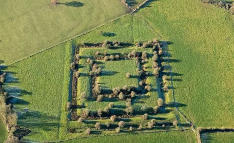
Also included is the medieval Blithewood moated site in Staffordshire. Historic England said the moats were intended as a status symbol rather than defence and also stated that most moated sites were built between 1250 and 1350.
 Historic England/Damian Grady
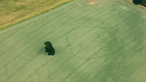
In one image, a long rectangular shape marks the presence of a Neolithic cursus at Sherbourne, Warwickshire, with cursus monuments "generally thought of as enclosed paths or processional ways", Historic England said.
To the right of the cursus is a larger enclosure with curved sides and a smaller curved enclosure inside. It is thought to be surrounding a farmstead dating roughly from the Iron Age or Roman periods.
 Historic England/RAF
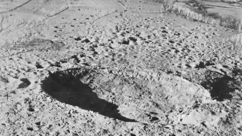 Historic England/RAF
Images from 1919 to the present day have been added to the tool, covering nearly 30% of England.
About 300,000 images are the work of Historic England's aerial investigation and mapping team, which was established in 1967.
 Historic England/Aerofilms Ltd
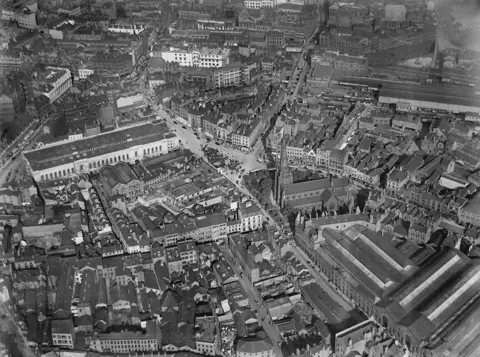 Historic England/Aerofilms Ltd
Follow BBC West Midlands on Facebook, Twitter and Instagram. Send your story ideas to: newsonline.westmidlands@bbc.co.uk
