Permission sought for removal of damaged Spey viaduct

 BBC
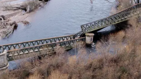
BBCMoray Council has applied for permission to remove the damaged sections of a former railway bridge near Garmouth.
The Spey Viaduct, which was popular with cyclists and walkers, collapsed in December.
The local authority said it was seeking listed building consent to dismantle the failed sections into smaller parts, so that the iron girder structure could be safely removed.
A spokesperson for the council said the application did not include replacement works.
An investigation into the cause of the collapse is expected after the removal process.
The council confirmed it would begin work on temporary diversion routes for walkers and cyclists by clearing vegetation along Stynie Road, between Mosstodloch and Garmouth.
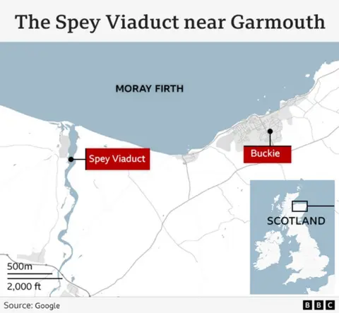
The bridge spans 350ft (107m) over the River Spey, regarded as the fastest flowing river in Scotland
The railway line closed in the 1960s but the bridge, also known as the Garmouth Viaduct, was later paved.
The Speyside Way, a long-distance trail which traces the River Spey from the Moray Firth to the Cairngorms National Park, passes the east end of the bridge.
It is also part of the National Cycle Network.
Moray Council, which manages the trail, said the bridge would remain closed until further notice.
