Nuclear bunker topples from crumbling cliff

 Joe Bilton/BBC
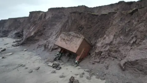
A nuclear bunker that was teetering on the edge of a rapidly eroding cliff is now at the mercy of the sea after collapsing further.
The brick building, near Tunstall, East Yorkshire, is believed to be almost 70 years old and was designed as a monitoring post in the event of a nuclear war.
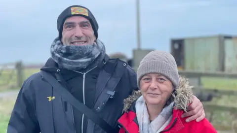
Amateur historian Davey Robinson, who has been filming its final days, said he believed it fell at some point in the night.
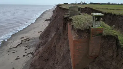
The area has some of the fastest eroding coastline in the UK, according to the Environment Agency.
The clifftop bunker was one of a number of nuclear monitoring posts around the UK, according to the historical research group Subterranea Brittannica.
Known as the Tunstall ROC (Royal Observer Corps) Post, it is believed to have been built in 1959 and decommissioned in the early 1990s.
Robinson and his partner, Tracy Charlton, said their YouTube channel videos of the bunker had attracted interest from all over the world.
"The story of it just captured people's hearts," Robinson said.
"So many people have been invested in it - it's not just bricks and mortar, it's something else."
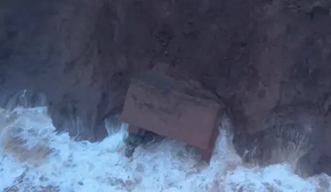
The latest footage shows the bunker sitting at the foot of the cliff, although appearing largely intact.
Robinson said that even though he knew it was going to come at some point "it was really shocking to see her just tumble down like that".
"It was really quite emotional and sad," he added.
Robinson said it was a "symbol of erosion in this area", adding they would continue to document what happened going forward.
 Timothy's Travels
East Riding of Yorkshire Council previously urged people to avoid the area, both at the clifftop and on the beach, and "always maintain a safe distance to the base of eroding cliffs due to the risks associated".
The Holderness coastline is eroding at an average annual rate of about 6.5ft (2m), according to the Environment Agency.
Approximately 3 miles (5km) of land is thought to have been lost since Roman times, including 23 villages, according to Internet Geography.
Listen to highlights fromHull and East Yorkshire on BBC Sounds, watch the latest episode of Look Northor tell us about a story you think we should be coveringhere.
Download the BBC News app from the App Storefor iPhone and iPad orGoogle Play for Android devices
