Your Voice: David Braine answers your weather questions

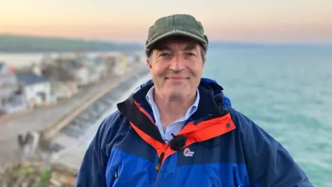 BBC
BBCOver the past week we have been taking a closer look at the weather in the South West and speaking to the experts and communities who have been affected by this year's storms.
As part of our coverage we gave you the chance to ask questions to BBC meteorologist David Braine, and from jet streams and climate change to the impact of war, the queries came rolling in.
Here is a selection of some of the questions we received.
Has forecasting become more difficult?
Nigel from Devon asked:
Has weather forecasting become more difficult? I use the Met Office weather app which, since it's update, seems less accurate than the old one and no longer has a long range forecast.
Is this because the weather has become less predictable? Or is it because the new app is more confusing and difficult to read easily? Which weather app would David recommend to quick and easily access to the most accurate local forecast?
Answer:
Hi Nigel, whilst advances in weather forecast modelling is now much more detailed and more accurate for most weather situations, there will be some errors in forecasting because of the more turbulent atmosphere which is a direct result of climate change.
A warmer atmosphere tends to be more chaotic and more difficult to predict in detail. An example could be a weather front bringing rain at a certain time and place, the timing of arrival and clearance is often quite accurate, what is more difficult is the intensity of the rain, the possibility of embedded thunder, and the local topographic effects.
Various weather apps use different sources of forecast data, some single source, others use a blend of models, some models handle certain weather types better than others and switching between models is not easy.
The BBC uses a blended model and is regularly updated, as a result I would recommend the BBC weather app.
 PA Media
Richard from Cornwall asked:
When I look at the BBC forecast for winds in the Falmouth area, there is never a 30 knot wind, in rising winds, it goes from 27, 29, straight to 40 and above, and the same in moderating weather, this gives me no confidence in the BBC weather forecasts which I would like to have.
It's been like this for years, any idea why?
Answer:
Hi Richard, when the forecast predicts gusts of wind over 40mph, the white wind icon - which usually shows the sustained wind speed - will change to a black icon showing the expected wind gust speed. This black icon will help to inform you in advance of potential hazards that may shape your day, for example severe impacts on transport.
Once sustained winds are above 30mph, it is more likely that the wind gusts will be above 40mph. You may find, therefore, that sustained wind speeds between 30mph and 40mph rarely appear on both the app and online BBC weather sites, since the more important information becomes the wind gust rather than the average wind speed due to the potential for damage.
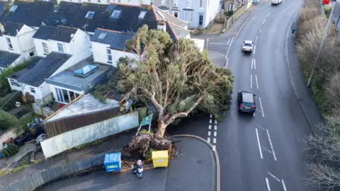
Impact of war
Tim from Devon asked:
I am curious if research has been done into the impact of war, specifically bomb explosions and their impact, upon the atmosphere and weather patterns?
Answer:
Hi Tim, local effects of explosions and smoke will have an effect in the immediate area of a war zone, the main effect being the increase in particulate matter in the atmosphere and the increase in condensation nuclei (the starting point for a rain drop).
However these will only be minor effects on a wider scale, since the amount of material ejected into the atmosphere is only a fraction of that from natural events such as dust storms or volcanic eruptions which have a much bigger effect on weather patterns.
Most explosive material contains sulphate or nitrate based material and the longer term effects of the increase in greenhouse gases are being studied.
Technology advances
Penny from Cornwall asked:
With the advance in technology why does the forecast keep changing so much? You can go to bed on one forecast and wake up to a completely different one.
Answer:
Hi Penny, with a much more frequent and more accurate computer modelling the forecast can change slightly in the short term, for example - in the next 24 or 36 hours this could be due to timing of weather fronts or a better indication of rainfall.
In the longer term, say five to ten days ahead, the accuracy is reduced and the model runs may pick up something that was not seen in the previous run. As a result you may see on the BBC Weather app a rain symbol for 10 days ahead, then in the morning for the same day that has become a shower.
Always look at the detail within the day rather than just the one symbol, since the system is set to display the worst weather as a single icon even if it is just a bit of rain at 4am in the morning.
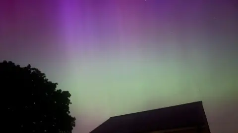
Northern Lights
Helen from Devon asked:
With more solar flares and higher possibilities of seeing the Aurora Borealis is there any month that would be better viewing than others in our part of the country?
Answer:
Hi Helen, we are currently at a time when the solar activity is at a maximum, the sun has an 11-year cycle which means that it will reach its minimum in about five years time and a maximum again in 2035/2036.
For us, the best time of year or season is the winter with more darkness and a longer viewing opportunity. Higher aurora activity can be found in September and March, coinciding with the autumn and spring equinoxes, when geomagnetic activity is higher due to Earth's orientation to the solar wind.
Where does wind come from?
Four-year-old Edith from Cornwall asked:
Where does wind come from?
Answer:
Hi Edith, wind is caused by the uneven heating of the earth's surface by the sun. This causes differences in air pressure.
Air moves from areas of high pressure to areas of low pressure (a bit like a ball rolling down from the top of a hill to the bottom) to equalise this difference, but as it does so the rotation of the earth causes it to rotate to the right (Northern hemisphere) this creates a wind.
The bigger the pressure difference, the stronger the wind.
Working out the probability of rain
James from Devon asked:
The BBC weather app gives an hourly percentage figure for rain. Does this reflect the percentage chance of any rain, the percentage of time it will actually be raining, the proportion of different forecast sources that think it will rain, or something else?
Answer:
Hi James, this is a probability of precipitation (% chance), and this ranges from 0% (no chance at all) to 100% (it will be wet). So, what does a 20% chance of rain actually mean? It means that out of 100 situations with similar weather, it should rain on 20 of those, and not rain on 80.
In a nutshell, it means that while you may get some rain, it's much more likely (but not certain) to stay dry.
The probabilities are given for the location chosen, and thus are valid for that location only so you may notice the probabilities changing in the short-term (next two to three hours) as the forecast is constantly updated with new information.
This gives you the chance to spot when, for example, a shower may be approaching your location, as the probabilities will tend to rise.
