Snow and ice warnings issued across Wales

 Martin Humphreys
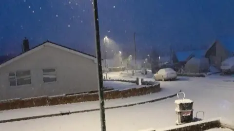
Outbreaks of rain and freezing temperatures have led to widespread icy patches across much of Wales.
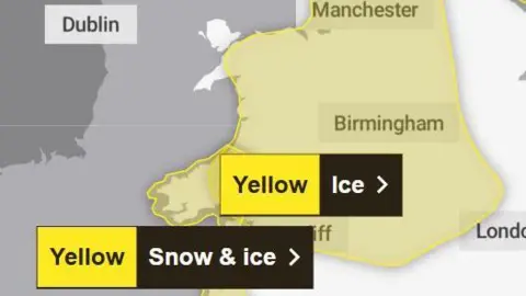
A Met Office yellow weather warning for snow and ice is in place from midday on Wednesday until midnight on Thursday, mainly across the south-west.
Forecasters have cautioned that buses and trains may be cancelled or delayed due to the weather, and advised planning ahead for car journeys and allowing more time.
Untreated pavements or cycle paths may become treacherous or impassable for those travelling on foot, they warned.
There is also a slight chance of power cuts in more exposed areas.
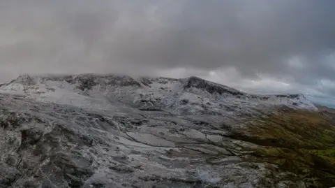
The Met Office said most areas will see little, or no, lying snow, but warned any light snow in the hills is likely to turn to ice or slush.
 Ruth Davies
Which areas are affected?
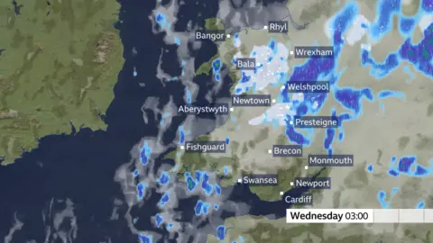 Met Office
The B4391 in Gwynedd, between the A496 in Rhyd y Sarn in Blaenau Ffestiniog and A470 Pen y Bryn in Ffestiniog, has been closed in both directions.
On Wednesday, the yellow ice warning covers:
- Blaenau Gwent
- Bridgend
- Caerphilly
- Cardiff
- Carmarthenshire
- Ceredigion
- Conwy
- Denbighshire
- Flintshire
- Gwynedd
- Merthyr Tydfil
- Monmouthshire
- Neath Port Talbot
- Newport
- Pembrokeshire
- Powys
- Rhondda Cynon Taf
- Swansea
- Torfaen
- Vale of Glamorgan
- Wrexham
What is the Pembrokeshire Dangler?
 Met Office
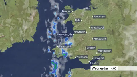
Meanwhile, wintry showers will feed southwards across south-west Wales through Wednesday and Thursday, moving inland on brisk northerly winds.
Small snow accumulations are possible in places, especially overnight and farther inland, with expectations of up to 5cm - with about 10cm forecast in some elevated spots in Pembrokeshire and west Carmarthenshire.
Gusty winds and hail may accompany some of the showers, and wet conditions and freezing temperature will, again, bring a risk of ice.
The Wednesday/Thursday warning covers the following regions:
• Carmarthenshire
• Ceredigion
• Pembrokeshire
• Swansea
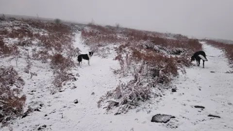 The Lonely Shepherdess/Weather Watchers
BBC Wales meteorologist Derek Brockway said although the Pembrokeshire Dangler sounds amusing, it is "actually a real thing".
"It's a persistent narrow band of heavy showers over the Irish Sea which often sits or dangles over Pembrokeshire," he said.
"It forms with a cold, northerly wind blowing across the relatively warmer sea.
"The air converges, forcing it to rise, forming towering clouds and frequent heavy showers of rain, hail, sleet and snow with a risk of thunder.
"While locations under the dangler can get hammered, places nearby only 10 miles away remain dry.
"Pembrokeshire Danglers are most common during the autumn and winter and can last for a few hours or a few days.
"In winter, they have been known to dump as much as 20cm (8in) of snow in places."
 Rassauboyo/Weather Watchers
Staying safe
"Plan to leave the house at least five minutes earlier than normal to reduce your risk of accidents, slips and falls," weather pundits have advised.
"If making a journey on foot, try to use pavements along main roads which are likely to be less slippery. Similarly, if cycling, try and stick to main roads which are more likely to have been treated."
Check on any elderly relatives or neighbours and offer to clear paths with salt to limit slippery access points, and ask if they need any practical help with shopping or medical support.
 Met Office
Driving in snow and ice
The Met Office said it is safer not to drive in icy conditions but if you must make a journey, the key advice is to drive slowly, "accelerating, braking, steering and changing gear as smoothly as possible to reduce the risk of a skid".
"Using a higher gear may be more appropriate to help grip on packed ice."
It is also advisable to allow more time for your journey, check your tyres and screen wash, and pack warm clothing, food, drink, a blanket and a torch.
