The triangulation points that mapped Britain

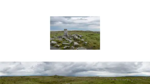
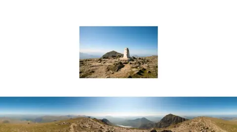
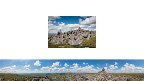
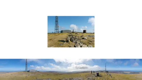
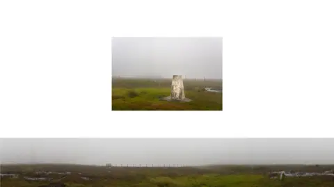
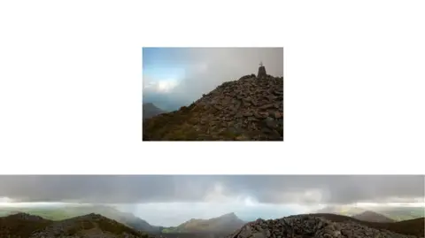
In 1936, the Ordnance Survey began to construct concrete triangulation pillars, or trig points, to aid accurate measurement and map-making using the principles of trigonometry. By 1962, more than 6,000 had been built. And Stephen McCoy and Stephanie Wynne are trying to photograph the 310 primary pillars still standing.

News imageBlack Combe
Black Combe, Cumbria, 600m (2,000ft)
News imagePresentational grey line
News imageCadair Berwyn
Cadair Berwyn, Powys, 827m
News imagePresentational grey line
News imageCold Ashby
Cold Ashby, Northamptonshire, 210m

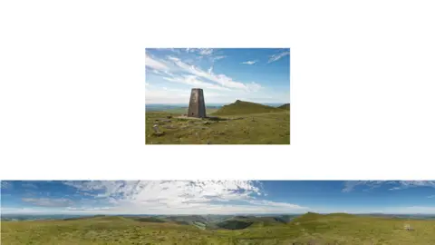
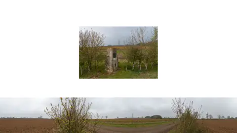
The pillars were built in positions where at least two other points could be seen in order to form triangles for accurate measurement.

McCoy and Wynne's work comprises large 360-degree panoramic photographs produced by placing the camera on top of the triangulation pillar, alongside a picture of the pillar itself.

News imageCriffel
Criffel, Dumfries and Galloway, 569m
News imagePresentational grey line
News imageGarnedd Ugain
Garnedd Ugain, Gwynedd, 1065m
News imagePresentational grey line
News imageGreat Whernside
Great Whernside, North Yorkshire, 704m
News imagePresentational grey line
News imageMartinsell Hill
Martinsell Hill, Wiltshire, 289m
News imagePresentational grey line
News imageRottington
Rottington, Cumbria, 141m
News imagePresentational grey line
News imageSnaefell
Snaefell, Isle of Man, 621m
News imagePresentational grey line
News imageStiperstones
The Stiperstones, Shropshire, 536m
News imagePresentational grey line
News imageUpton Beacon
Upton Beacon, Derbyshire, 538m
News imagePresentational grey line
News imageWinter Hill
Winter Hill, Lancashire, 456m
News imagePresentational grey line
News imageWyck Beacon
Wyck Beacon, Gloucestershire, 250m
News imagePresentational grey line
News imageYr Eifl
Yr Eifl, Gwynedd, 564m
News imagePresentational grey line

All photographs copyright Stephen McCoy and Stephanie Wynne.