Venezuela earthquakes in maps and graphics - where they hit and how severe they could be
Two strong earthquakes that struck Venezuela within seconds of one another caused widespread damage to homes and buildings in several parts of the country, the deaths of at least 2,600 people and left thousands more injured.
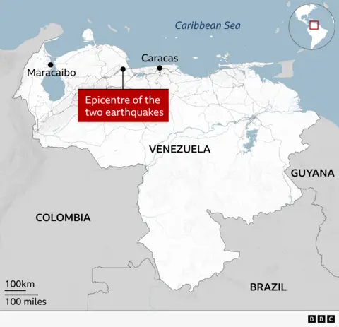
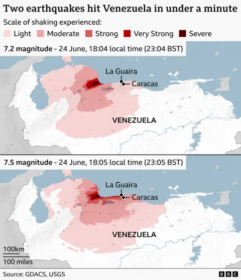
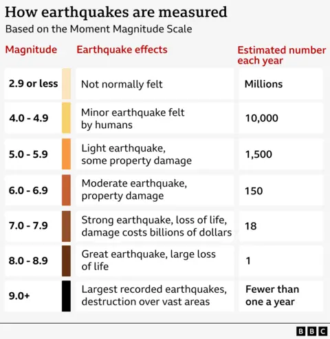
The first earthquake - with a magnitude of 7.2 - struck at 18:04 local time (22:04 GMT) on 24 June 23km south-east of Yumare, a town to the west of the capital, Caracas, according to the US Geological Survey (USGS).
The second 7.5-magnitude quake hit in a similar location just 38 seconds later.

The shaking, particularly from the second quake, caused buildings in Caracas and the nearby seaside city of La Guaira to be damaged or completely collapse.
Venezuela's interior minister said the states of Trujillo, Yaracuy, Carabobo, Aragua and Miranda had also been affected.
The country's main international airport, on the outskirts of Caracas, was closed due to serious damage, the Latin American nation's interim President Delcy Rodríguez said.
Video from inside the terminal shows dust and debris falling from the ceiling.
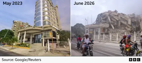
The BBC has verified footage of a 10-storey hotel in La Guaira that has been reduced to rubble.
Only the entrance to Eduard's Hotel can be seen standing, with the debris of the rest of the structure piled on top of it.
Preliminary analysis of Sentinel-1 satellite imagery from the European Space Agency taken after the earthquakes suggests an estimated 80% of buildings - about 58,870 - were likely to have been damaged or destroyed in the affected region.
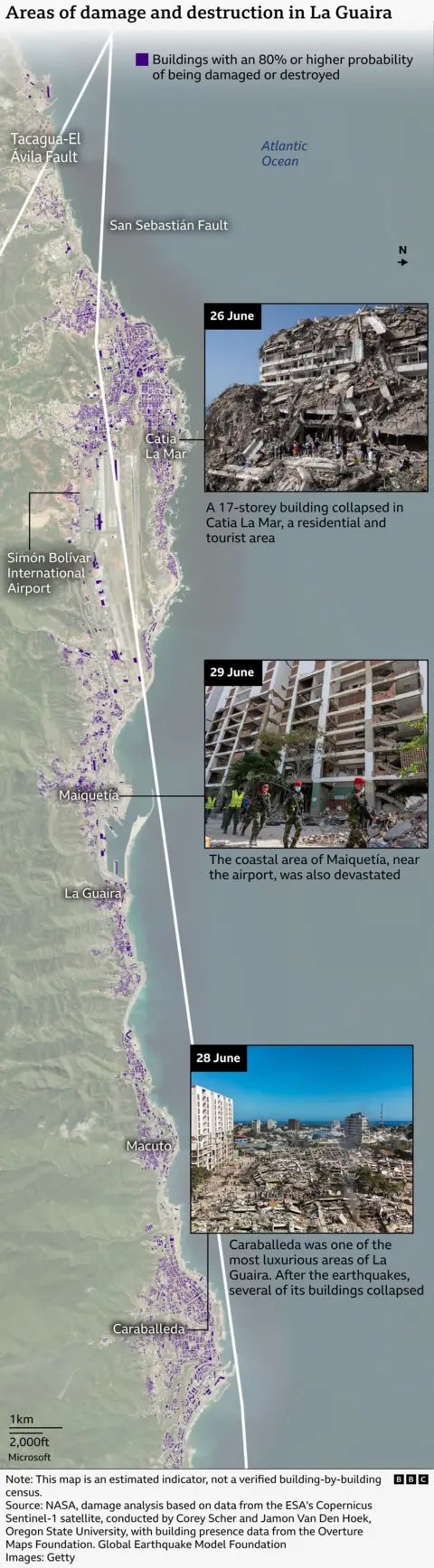
For this assessment, the study's authors define "damage" as a change in a building's condition compared with its state before the earthquakes, Nasa told BBC Mundo.
However, they warn that the map is an indicator of damage based on "abrupt surface changes consistent with damage", rather than a building-by-building verification, because the data have not been verified on the ground.
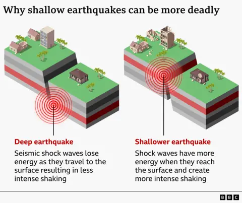
It's not just the magnitude of the earthquake that has a bearing on its destructive power, but how close to the surface it occurs, as well as the size of the nearby population and the quality of the buildings in the area.
The first quake was 20.3km below the surface and the second at a depth of just 10km, according to the USGS, increasing the likelihood of damage on the surface.
The agency estimated a 44% chance of more than 10,000 deaths.
Venezuela lies along the boundary between the Caribbean and South American tectonic plates, which are moving past one another.
The USGS says the sudden release of friction between these two plates is likely to have triggered the earthquakes.
