Scotland's population is shifting - could it affect the election outcome?

 Getty Images
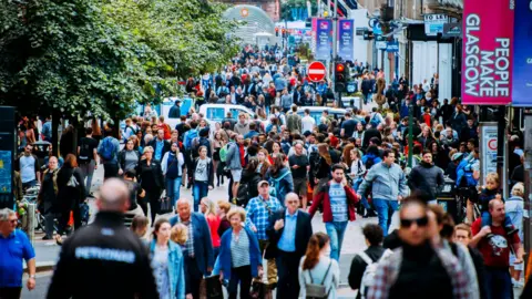
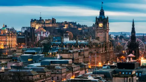
Scotland's population is on the move.
People move house every day, up and down and across the country. Over time, the citizenry of one town will boom, while another will shrink in on itself.
And that requires constant redrawing of the electoral map.
The independent boundary commission has concluded its third review of Holyrood's constituencies and regions, to make sure each MSP represents roughly the same number of people.
The new map could have a bearing on how parties campaign, and how the election plays out.
In fact, it's technically already seen one seat change hands.
The broad trend within Scotland's shifting population is a move east, along the central belt.
And this is visible in Holyrood's constituencies, which are all meant to contain roughly 60,000 voters.
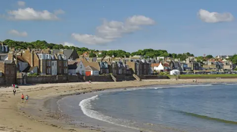
The Inverclyde seat, perched on the west coast, originally consisted pretty much just of Greenock, when boundaries were first drawn in 1999.
But the area has suffered from one of the fastest rates of population decline in Scotland, dropping by almost 9% from 1998 through 2021.
Reflecting this, in 2011 the Holyrood seat expanded eastward, to include Port Glasgow, and from this election it has spread further inland too, taking in Kilmacolm.
It keeps having to get bigger to make sure it takes in enough voters, so that the local MSP represents as many people as their colleagues at Holyrood.
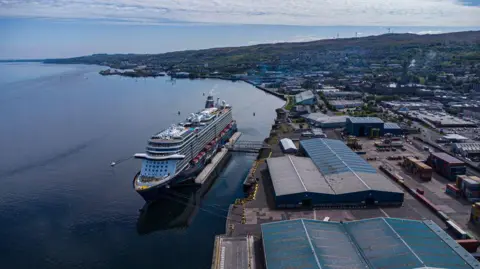 Getty Images
For a contrasting tale turn to the opposite coast, where East Lothian was originally drawn up to cover the whole council area sharing that name.
But as a popular commuter hub for Edinburgh, it has been growing fast. It is now home to more than 88,000 voters - far in excess of the ideal quota.
So in 2011's review it ceded its claim to Musselburgh, and this year is losing another town - Tranent, which will form a new seat lumped in with the eastern edge of the capital.
Because the shrinking seat no longer comes close to the council boundaries, it has had to be given a new name too - East Lothian Coast and Lammermuirs.
 Getty Images
The central belt is of course not the only part of the country where the population is moving around.
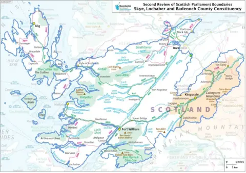
There has long been an issue with the sheer size of the seats spanning Scotland's sparsely-populated highlands, where you have to cross thousands of square kilometres to round up a large enough group of voters to call it a constituency.
Complicating this is the fact that the highland capital of Inverness is actually growing, as other towns shrink.
So the Inverness and Nairn seat has had to lose the town of Grantown-on-Spey, which has instead been added into the Skye, Badenoch and Lochaber constituency.
It's a neat solution in terms of balancing voter numbers. But it has made an already vast constituency even bigger.
Grantown-on-Spey is significantly closer to Aberdeen than it is to Skye.
In fact as the crow flies, it's almost exactly as close to Edinburgh as it is to Portree.
A campaigning road trip from the westernmost tip of the constituency across to the east would take over three and a half hours, in favourable traffic, without actually stopping to canvas a single voter.
 Boundaries Scotland
The biggest changes to the electoral map have occurred in Edinburgh and Glasgow.
Given Glasgow returned a full slate of safe seats for the SNP in 2021 (followed by a full slate of safe Labour seats in the UK election of 2024), the changes there are not as politically dramatic.
But the capital has a diverse political character, with areas of strong support for the SNP, Labour, and the Lib Dems, while the Conservatives and Greens both have decent electoral history too.
The changes to the map raise all kinds of possibilities.
Edinburgh Southern was won by Labour in 2021, but the boundary changes have shifted it east, into an area which leaned more towards the SNP at that point.
And when the "notional" results for this election were calculated - figuring out how Scotland would have voted in 2021 using these new boundaries - Edinburgh Southern actually popped out as an SNP seat.
So if Labour manage to retain the seat on 7 May it will be reported as a "gain", while the SNP capturing it will technically count as a "hold".
 Getty Images
The upside for Labour is that some favourable wards from the old Southern seat have now gone into Edinburgh Central, which has shifted south.
The notional result there has them leapfrogging the Tories into second place, with a reasonable shot at taking on the SNP.
However the Greens are also eyeing up this seat - it could be a true three-way contest, the likes of which have been fairly rare at Holyrood of late.
Meanwhile the Lib Dem stronghold of Edinburgh North Western has shifted south a bit too - but the upshot is that those wards have gone into Edinburgh Northern, which becomes a more attractive prospect as a target for the party.

All that is just the constituencies, too.
There have also been changes to Scotland's larger electoral regions, each of which elects seven MSPs.
These are drawn from top-up lists designed to counterbalance the first-past-the-post constituencies, to stop any one party romping to a majority without a large share of the vote.
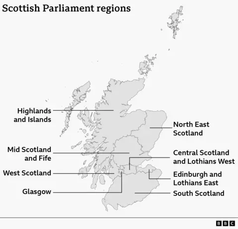
Thanks to the changes in East Lothian, that seat has now been added to the same region as Edinburgh, rather than South Scotland.
The knock-on effect is that Central Scotland has now shifted west a bit to include West Lothian - and two central belt constituencies, in East Kilbride and Hamilton, Larkhall and Stonehouse, have been shunted into South Scotland.
This complicates the calculations for parties still further, given those suburban seats, generally seen as SNP-Labour contests, have added a new pool of central-belt voters into the largely rural South Scotland electorate.
And because there is now one extra SNP-held constituency in this new version of South Scotland, the notional result using 2021 votes is to remove the party's sole regional seat while awarding one to the Greens.
With most parties pushing hard for regional votes in particular, this part of the electoral map could have a big bearing on the eventual makeup of parliament.
