Developer partially blamed for severe flooding

 Norfolk Fire Museum
Some of Norfolk's worst flash-flooding in recent years was partially caused by builders on a housing development blocking a stream, a report has found.
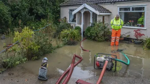
Norfolk County Council investigators concluded that the 2023 Attleborough floods, which damaged more than 100 homes, were partially due to workers building a temporary road across the stream.
The report found that the road providing access to the 165-home Gables housing development on the edge of the town did not have planning permission.
About 130 homes were flooded, with some residents forced to move out for up to a year while their properties were repaired.
A county council spokesperson said: "The flood investigation report has identified several factors that contributed to the flooding in Attleborough and Besthorpe.
"These include heavy rainfall and saturated ground conditions in October 2023, historic changes to watercourses linked to housing developments since the 1970s, local land and farming practices, and issues within the Norwich Road development site."
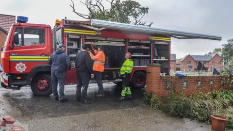
The council said work had since been carried out to clear watercourses, and it was looking at ways to slow water entering Attleborough and to clear downstream areas, according to the Local Democracy Reporting Service.
The road was built across the Besthorpe Stream, and when Attleborough suffered a period of extreme rainfall during Storm Babet, it backed up and floodwater spread through nearby streets.
 Norfolk Fire Museum
Breckland Council had initially refused planning permission for the housing scheme, on the north side of Norwich Road, because the land was a floodplain.
However, developer The Hill Group appealed to the Planning Inspectorate, and the decision was overturned.
The new report found the blocked Besthorpe Stream, which runs underneath the A11 near the housing development, caused water to back up about 300m (about 330yds) upstream.
A council officer said: "This restricted the natural flow of floodwater along this stretch of the watercourse and contributed to the flooding of the affected properties in this sub-catchment."
Following the flooding, The Hill Group was ordered to remove the temporary road by East Harling Internal Drainage Board.
The report also found that other ditches and culverts had not been properly cleared and debris had contributed to the flooding.
The Hill Group had received the report and was reviewing the information, a spokesperson said.
Mid Norfolk Conservative MP George Freeman said Attleborough's experience was an example of a wider problem of new developments increasing flooding risks.
New homes have the right to be connected to existing drainage and sewer systems, and he fears the ageing infrastructure is becoming overwhelmed with the demand.
Freeman said he wanted the county council, as the lead flood authority in Norfolk, to highlight where flooding had taken place and where new homes had been built, in a bid to better understand the relationship between the two.
Surface flooding is expected to put more than six million properties at risk between 2040 and 2060, the Environment Agency has said.
Follow Norfolk news on BBC Sounds, Facebook, Instagram and X.
