Campaign to change route of Dartmoor's Abbot's Way

 BBC
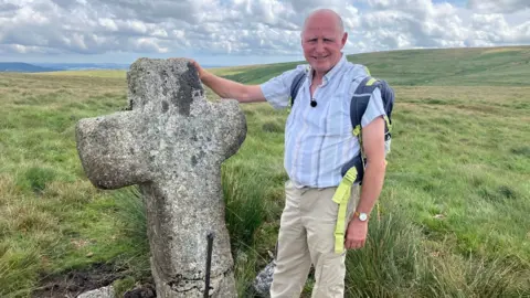
BBCHikers using a famous walk across Dartmoor have been following the wrong route for almost 140 years, an author and local historian says.
Nick Pannell said he was lobbying Ordnance Survey (OS) to change its maps so that the Abbot's Way, from Buckfast to Tavistock, took a more northerly route along one section than the current one.
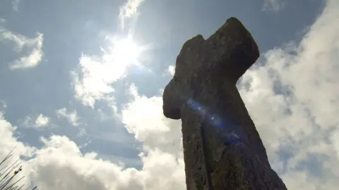
He said he believed monks in medieval times followed a different path between stone crosses which were spaced out across the moor and acted as waypoints, directing them along the route.
Ordnance Survey said it could not dispute Mr Pannell's research, but any petition would have to go through Historic England, which was the recognised authority it used.
Mr Pannell has published his findings in a book after researching the route for four years.
He said: "Along that eastern section of the Abbot's Way on the OS map, there is just one cross, and that was erected after the dissolution of the monasteries, so no monks used that way mark.
"The route that I am championing is lined by a procession of medieval crosses linking the Cistercian monasteries at Buckfast and Tavistock, and people moved between the two."
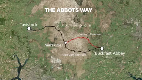
A spokesman for Ordnance Survey said the current route shown on OS maps followed paths and tracks that existed for more than 130 years from when the area was first surveyed.
Maps held by the National Library of Scotland show that the route shown on maps in 1886 is the same as it is on current OS mapping, following designated tracks and paths.
The spokesman went on: "Whilst I don't think that OS can dispute Nick Pannell's four years of research into the precise route of the Abbot's Way, there is no designated track or path linking these crosses; although looking at imagery shows many potential routes across Dartmoor that aren't shown on the mapping."
A spokesman for Historic England said the organisation informed Ordnance Survey where to mark antiquaries [historic features] on maps,
They added: "This is a function that we inherited when the archive of the Ordnance Survey Archaeology Division was transferred to ourselves.
"Historical features are listed in italic script, and we can see all the crosses are marked in this way.
"The 'Abbot's Way' text on the map, however, is not in this italicised script, so is not there as a historic feature.
"We think this is probably included as the name of a modern public right of way (created as a recreational path)."
Follow BBC Devon on X, Facebook and Instagram. Send your story ideas to spotlight@bbc.co.uk.
