New Suffolk waterfront walk is unveiled

 Suffolk County Council
A new walking route aimed at giving ramblers a "richer and more engaging way" to experience their local landscape has been unveiled.
The Ipswich Waterfront Walk, part of the King Charles III England Coast Path (ECP), is designed to showcase the best of Suffolk's county town and its surroundings.
Developed by Suffolk County Council, it passes through Orwell Country Park, Pipers Vale, Landseer Park, and Holywells Park to the town's waterfront.
Paul West, Suffolk County Council's cabinet member for Ipswich and operational highways, said the 8.5km (5.5-mile) route explored "our most treasured green spaces".
"This route not only supports public health and active travel but also highlights the best of what Ipswich and the surrounding landscape have to offer."
 Suffolk County Council
The walk is part of the ECP, which in Suffolk, was opened in 2025 and runs between Felixstowe and Shotley, with the first river crossing being the Orwell Bridge.
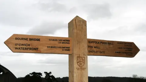
It is marked by two gateways – the east gateway south of Pipers Vale below the Orwell Bridge, and the west gateway, north of Suffolk Food Hall, also underneath the bridge.
They each feature a bench containing a QR code promoting walks across Suffolk, and a wooden finger post made by students at St Joseph's College.
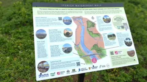
The gateways also feature an interpretation panel depicting the route, plus historical information and links to websites promoting access to the countryside.
"The new walk is a fantastic addition to the King Charles III England Coast Path," added West, who is a Conservative councillor.
"Giving walkers a richer and more engaging way to experience the landscape in and around Ipswich."
Follow Suffolk news on BBC Sounds, Facebook, Instagram and X.
