More flooding expected as weather warnings issued

 Cloud9Weather
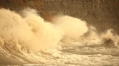
Flooding is expected in coastal areas and near rivers across Dorset as Storm Ingrid brings heavy rain and coastal gales to the south west of England.
The Sandbanks Ferry was suspended in the morning "due to the weather and high tide" but later resumed service.
Dorset Council previously said Portland Beach Road and causeway would likely close from 20:00 GMT due to "expected severe weather conditions".
However, a flood warning for the area was lifted by the Environment Agency at 16:00 GMT.
Work on Portland Ferry Bridge has been paused for safety reasons and the temporary traffic lights switched off until Monday.
 Paul Smith
Dorset Council previously said areas most at risk on Portland included the A354 Chiswell, Brandy Row, Pebble Lane, Victoria Square up to the junction with Queens Road, the car parks along the A354 and the yard along Lerret Road.
"Teams are currently on site, closely monitoring the road, weather conditions, and local water levels," a spokesperson said.
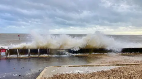
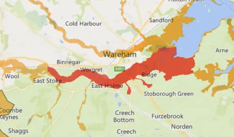
By 18:00 GMT on Friday there were 12 flood warnings in Dorset including parts of the Stour, Avon and Frome rivers, parts of Poole, Portland, Lyme Regis and Christchurch harbours and at West Bay East Beach.
Groundwater is predicted to rise in the South Winterbourne Valley, Iwerne Minster, Hooke and Toller Pocorum.
On Friday afternoon, flood warnings were stood down for Poole Harbour and Weymouth Harbour.
 Environment Agency
Bournemouth Christchurch and Poole (BCP) Council urged people to "avoid walking, cycling or driving through floodwater".
"There may be hazards under the water you can't see, or it may be a lot deeper than you realise," a spokesperson said.
Dorset and Wiltshire Fire and Rescue rescued three people from vehicles stranded in floodwater on Wednesday, at Hammoon and Holnest.
A spokesperson said: "If you are travelling in unfamiliar areas and come across flooded roads, please do not put yourself at risk by attempting to drive through it."
