Rider maps new routes across the Shropshire hills

 BBC
BBCA young equestrian has mapped 47 safe, circular routes for horse riders, cyclists and walkers across the Shropshire hills.
The paths are in areas including the Long Mynd, Stiperstones, Clee Hills, Wenlock Edge and Clun.
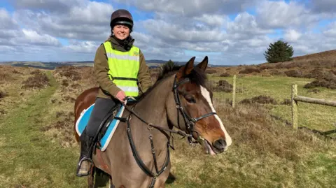
Katy Mellor, who has been working on the Pathfinder Project for eight months, wanted others to enjoy the county's areas of outstanding natural beauty (AONB).
The 26-year-old said she also wanted to offer a safe alternative to riding on the roads.
'Lovely places to ride'
The endurance rider said the idea was to create between 40 and 50 new rides, using the existing bridleway network.
She said there were lots of long-distance, linear routes, but she wanted to map some shorter circular rides of between 5 and 15 miles that people could do in a day.
Ms Mellor, who works at Shropshire Farm Vets in Hanwood, has tried to minimise the use of country lanes for safety reasons.
The British Horse Society, which is supporting the Pathfinder Project, said in the past two years there were 120 incidents involving horses on Shropshire's roads.
The BHS figures show two riders were injured, two horses died and two horses were injured in 2023-24.
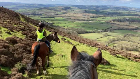
Ms Mellor, whose family have a smallholding on the Long Mynd, said she had "tried to use areas that were less popular... away from the more popular so-called honeypot sites, where all the tourists tend to go".
She said the project had been inspired by her love for the area and a desire to "share this with everyone else".
She also wanted to make it as easy as possible for horse riders and others to access the routes, so included details such as where to park, the distance, difficulty and number of gates.
The Pathfinder Project was funded by the Shropshire Hills National Landscape Programme and supported by the The Long Mynd & District Bridleways Association (LMDBA).
The routes have been published on the LMDBA website and on social media.
Follow BBC Shropshire on BBC Sounds, Facebook, X and Instagram.
