Northern Ireland weather: Storms brew after weeks of early summer sun

 David North
It has been three weeks since Northern Ireland last had a decent drop of rain - something of a shock given its meteorological reputation.
And although that might be about to change, with some thundery downpours due, there is no sign of any cooler weather on the way.
If anything temperatures will be on the rise again and that warming trend will continue into next week.
It will, however, be more humid and feel quite clammy and sticky at times.
 Rachel Cassidy
The last time many parts of Northern Ireland had measurable rain was on 20 May, according to the Met Office's official rainfall accumulations.
In some areas there have been several days of full sunshine.
Belfast International Airport had a particularly sunny start to the month, with nearly 53 hours recorded in the first four days - that's almost a third of the average for the whole month.
 Steven Morgan
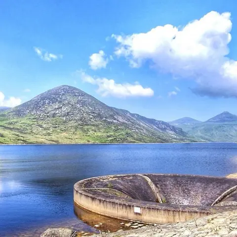
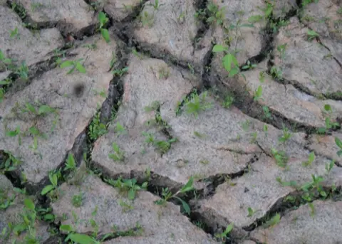
The ground has dried out considerably although water levels are still quite healthy in the reservoirs.
Gardens and fields will welcome some rainfall and wide cracks are beginning to appear in parched ground.
A band of showers with thundery downpours will move north across the island of Ireland.
 Sam
SamThe storms will be scattered and rainfall amounts will vary considerably so some places will stay dry while in others the gardens and farmland will benefit from long-overdue wet weather.
But the localised nature of the thundery deluges could mean they are torrential, with as much as 30mm or 40mm of rain falling within an hour.
As the ground is so dry the rain may not soak in and that could lead to sudden flooding.
The less-settled weather will continue into next week with a chance of showers, some heavy with possible thunder, but they will be hit and miss and so there will still a lot of dry weather around.
 Paul Moane
Temperatures will continue to rise with the mercury forecast to hit 26C by Wednesday, which is higher than it has been so far this year.
Night-time values will also be high, in the low to mid teens.
The average temperatures for June are 17C for a maximum and 9C for a minimum.
