BBC HomeExplore the BBC
This page has been archived and is no longer updated. Find out more about page archiving.

24 September 2014
threecountiesthreecounties

BBC Homepage
England
»BBC Local
Beds, Herts & Bucks
Things to do
People & Places
Nature
History
Religion & Ethics
Arts and Culture
BBC Introducing
TV & Radio

Neighbouring Sites

  • Berkshire
  • Cambridgeshire
  • Essex
  • London
  • Northampton
  • Oxford
  • Related BBC Sites

    England

    Contact Us


    NATURE
    You are in: Beds, Herts and Bucks > Nature > Walks > From a river to the Romans and beyond > Stage 5
    St Albans Abbey
    A view of the Abbey above the lake and over the wall
    Turn round and return the way you came and walk towards the lake in the bottom of the valley. When you get back to the signposts, stop and look to your left.
    PREVIOUS
    123456789101112
    NEXT

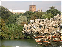
    From here there is also a very good view of the river valley's southern slope, which runs down to the river irregularly. It's quite bumpy looking and there are a number of possible explanations for this.

    Roman wall
    Another section of wall to your right gives an idea of the limits of the city
    Walk Picture Gallery 1

    Some of this irregularity is archaeological. To your right beyond the hedge there is another piece of Roman wall so you can begin to see exactly where the Roman city was situated.

    Here you are looking towards the centre of the Roman city and beneath the grass are all sorts of foundations of buildings, shops and old streets

    But some of the irregularity of this slope was created during the very cold stage about 10,000 years ago by the formation of large masses of ice on the ground surface.

    The upper layers of chalk were frozen but springs still flowed out from the side of the valley, and there would have been crevices through the frozen layers bringing water to the surface. The water would then freeze on the ground surface forming large masses of ice, 20-40 metres across and several metres thick.

    Sludge
    From time to time, sediment would sludge down the slope and accumulate round the ice, so when the ice melted you'd be left with a little hollow surrounded by sludging sediment, making the ground surface uneven.

    Another explanation for the unevenness of this slope is that it is the remains of a Medieval field system. River banks are renowned for having fertile soil so it would have been a very good place for crop gowing.

    Verulamium Park slope
    The 'bumpy' slope down to the lake
    Walk Picture Gallery 1

    If you walk on the grass to the left of the path as you go down to the lake, where the wall would have been (the wall goes round behind the hedge and carries on) you can feel it get harder under your feet. And in the winter you can see some lines and bumps, across the field which is probably a legacy from the Medieval ridge and furrow field system.

    If you look to your front and to the right you can see a hospital chimney. From this direction, from Batchwood, another sizeable little valley cuts into the northern slope and has reduced it in size. It isn't strongly developed again till you get further along the Redbourn road (A5).

    The river provided a form of defence on this side of the city but it did cause the Romans to bend some of their strict town building rules though!

    Normally Roman theatres were built outside the main town but for Verulamium they bent the rules because it was very marshy outside the walls on the north eastern side. They therefore built it in the town on slightly higher and dryer land.

    Flooding of the river also caused problems for them. There was a bath house near the river in Branch Road. The Romans had a heating system where the floor was supported on piles of brick above a hollow where fires were lit and hot air circulated.

    Every time the river flooded it would flow into this hollow area and deposit mud that had to be scraped out. Eventually they abandoned it because the water kept putting the fires out!

    PREVIOUS
    123456789101112
    NEXT
    You are in: Beds, Herts and Bucks > Nature > Walks > From a river to the Romans and beyond > Stage 5
    Return to homepage
    HOME
    Email your comments to sitename@bbc.co.uk
    EMAIL
    Print out this page
    PRINT
    Return to the top of the page
    TOP
    SITE CONTENTS
    Return to start of walk

    map of the walk© Crown copyright. All rights reserved. BBC licence number 100019855, 2004. Map not reproduced to scale.

    Enlarge this mapEnlarge map

    Print map
    Print this page
    or ..
    Print the entire walk

    WATCH/LISTEN TO WALKS

    Audio Listen to the whole WALK THROUGH TIME BROADCAST from BBC Three Counties Radio

    Audio Listen to Alan Titchmarsh on BBC Three Counties Radio

    Audio Listen to Dr John Catt talk about Hertfordshire Puddingstone

    Audio Listen to Dr John Catt talk about chalk rock

    Audio Listen to Andy Webb from the Ver Valley Society

    Audio Listen to Brian Adams talk about the Roman Wall and Verulamium

    Audio Listen to Brian Adams talk about mills in St Albans

     Realplayer required
    SEE ALSO
    GraphicBritish Isles: A Natural History - local events
    GraphicWalk Picture Gallery 1
    GraphicWalk Picture Gallery 2
    GraphicWalk Picture Gallery 3
    Graphic Sopwell Trail Gallery
    Sopwell Trail
    More about St Albans Abbey
    Download wallpapers
    Send an e-card
    On bbc.co.uk
    GraphicBBC Berkshire Walk Through Time
    GraphicBBC Cambridgeshire Walk Through Time
    GraphicBBC Essex Walk Through Time
    GraphicBBC Science and Nature
    BBC History
    Dawn Gallery
    Habitats
    Look around wildlife
    Wildlife Articles
    Wildfacts
    Rest of the web
    GraphicHertfordshire Countryside Management Service
    GraphicHertfordshire Geological Society
    GraphicVer Valley Society
    GraphicVerulamium Website
    GraphicVerulamium Museum
    GraphicHerts and Middlesex Wildlife Trust
    GraphicSt Albans attractions
    GraphicSt Albans District Council Tourism
    GraphicBritish Geological Survey
    GraphicBat Conservation Trust
    GraphicEnglish Nature
    GraphicDefra
    GraphicFroglife
    GraphicRSPB
    GraphicThe National Trust
    The BBC is not responsible for the content of external websites
    On Science & Nature
    Fox illustration, on Science & Nature
    Landscape and local history
    Field Guides
    Link
    Visit Open2.net's Natural History section
    Snail
    bullet pointFlint
    bullet pointChalk
    bullet pointIce Age

    BBC Beds, Herts and Bucks Website, 1 Hastings Street, Luton, LU1 5XL. Tel: (+44)1582 637400
    e-mail: bedfordshire@bbc.co.ukhertfordshire@bbc.co.ukbuckinghamshire@bbc.co.uk


    About the BBC | Help | Terms of Use | Privacy & Cookies Policy