Warm weather continues in UK as Friday could hit 24C

- Published
Sunshine has been in abundance for much of the UK over the last few days and as the temperatures build, don't put away your sunglasses just yet, Friday could be the warmest day of the year so far.
With high pressure still in charge of our weather, we could see highs reaching 23C or 24C in central, southern and south-eastern parts of England.
But if you have been enjoying the brilliant blue skies and sunny weather that April has had to offer, make the most of it as this period of settled weather is coming to an end.
Cloud and rain arrives on Saturday for some and it will be cooler and fresher on Sunday, though temperatures in many areas will still be above average for the time of year.

Cloudy skies have been plaguing North Sea-facing coasts
Gear change in temperatures
At the start of the week the large area of high pressure that has dominated our weather brought clear and sunny skies, but its position to the north of the UK fed in chillier air from Scandinavia.
So although it was warm and sunny for many, out of the sunshine there was a distinct chill in the air.
The strength of the breeze added to the colder feel, especially along eastern-facing coasts where the wind has been blowing in off seas that are just 7C or 8C right now.
It all changed on Thursday as the centre of the high pressure sank southwards. The north-easterly wind swung around to more of a westerly, bringing warmer air and significantly higher temperatures to those eastern areas and North Sea-facing coasts.
On Wednesday, Boulmer in Northumberland reached a maximum temperature of 8.5C and on Thursday it was 21C; a 12.5C jump in temperature in 24 hours.

These eastern parts of Scotland and England were much warmer on Thursday in the sunshine, with a gentle westerly breeze
Warmest day of the year so far?
On Friday, with fine and dry weather for most, we could see highs of 23C or 24C in the south of the UK and the warmest day of the year so far.
Currently the highest temperature of the year is 23.7C recorded at Otterbourne in Hampshire last week.
Recently the warmest weather has been across inland parts of Scotland and Northern Ireland.
The temperature reached 21.8C at Castlederg in Northern Ireland on Thursday for the first time this year and Aboyne in Scotland reached 22.8C.
A cautionary note for gardeners and growers though: while daytime temperatures are well above the mid April average of 11C to 14C, the nights have been chilly. In Aboyne, for example, Thursday's high came after a minimum of -3.2C at dawn. There was a 26C diurnal range temperature difference between the minimum and maximum.
Bournemouth Airport recorded the lowest temperature in the UK on Friday morning with a minimum of -1.5C.
Going forward, the risk of frost will be much reduced.

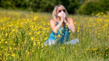
Very high pollen levels in England and Wales on Friday
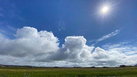
Strong spring sunshine
It is worth remembering that UV levels increase in the spring. In fact the Sun is as powerful now as it is in late summer.
Index values are at around medium at the moment. Levels of UV radiation vary throughout the day but are usually higher around midday.
To avoid UV damage you should regularly apply a high factor sunscreen - especially if you are fair-skinned. You should also avoid being out in the Sun during the middle of the day, and wear sunglasses.
Pollen levels are also very high across England and Wales on Friday, with tree pollen the main culprit at this time in the season. Warmth and sunshine tend to boost pollen, which is why hay fever sufferers in Northern Ireland and central, southern, and western areas of the UK will be most impacted.
Up to date pollen forecasts are available on the BBC Weather website and app throughout the spring and summer.
Just search for your location and you will find the latest pollen data alongside the UV forecast.
Will Easter be a washout or will sunshine remain?

There'll be some changes to the weather this weekend. Falling pressure will mean more cloud and the chance of rain and lower temperatures. Present timings indicate rain could arrive in the south-west on Saturday. It could be that most of us will have rain overnight that will clear to sunny spells and showers on Sunday. By then temperatures will be lower.
Into next week, most computer models continue with the changeable weather patterns that bring some sunny days interspersed with showery ones. However, some show the potential for another area of high pressure to build in from the north, returning to largely dry conditions nearer Easter.
As any UK meteorologist will tell you, snow is more likely to fall at Easter than it is at Christmas, although this is more accurate when Easter falls earlier on in the calendar.
Snow looks unlikely this year, but in weather terms Easter is still too far away to pinpoint the exact details.
Don't forget to keep ahead of any Easter surprises with our Monthly Outlook.
- Published3 May 2022
- Published31 March 2021