Is the snow and ice set to return again this January?

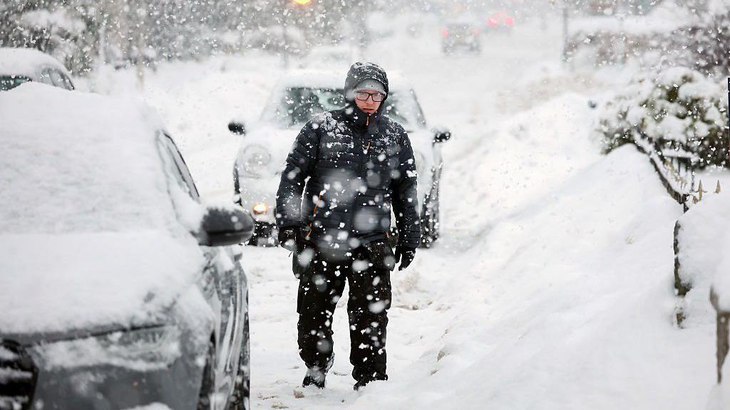
Snow in early January turned parts of the UK into a winter wonderland
- Published
If you think we've said goodbye to bitter winter weather then think again. There's a battleground of air masses beginning to build across the UK and it's far from clear which will win out.
At the start of January a spell of notably harsh winter weather brought Arctic winds southwards along with heavy snow, widespread ice and biting temperatures.
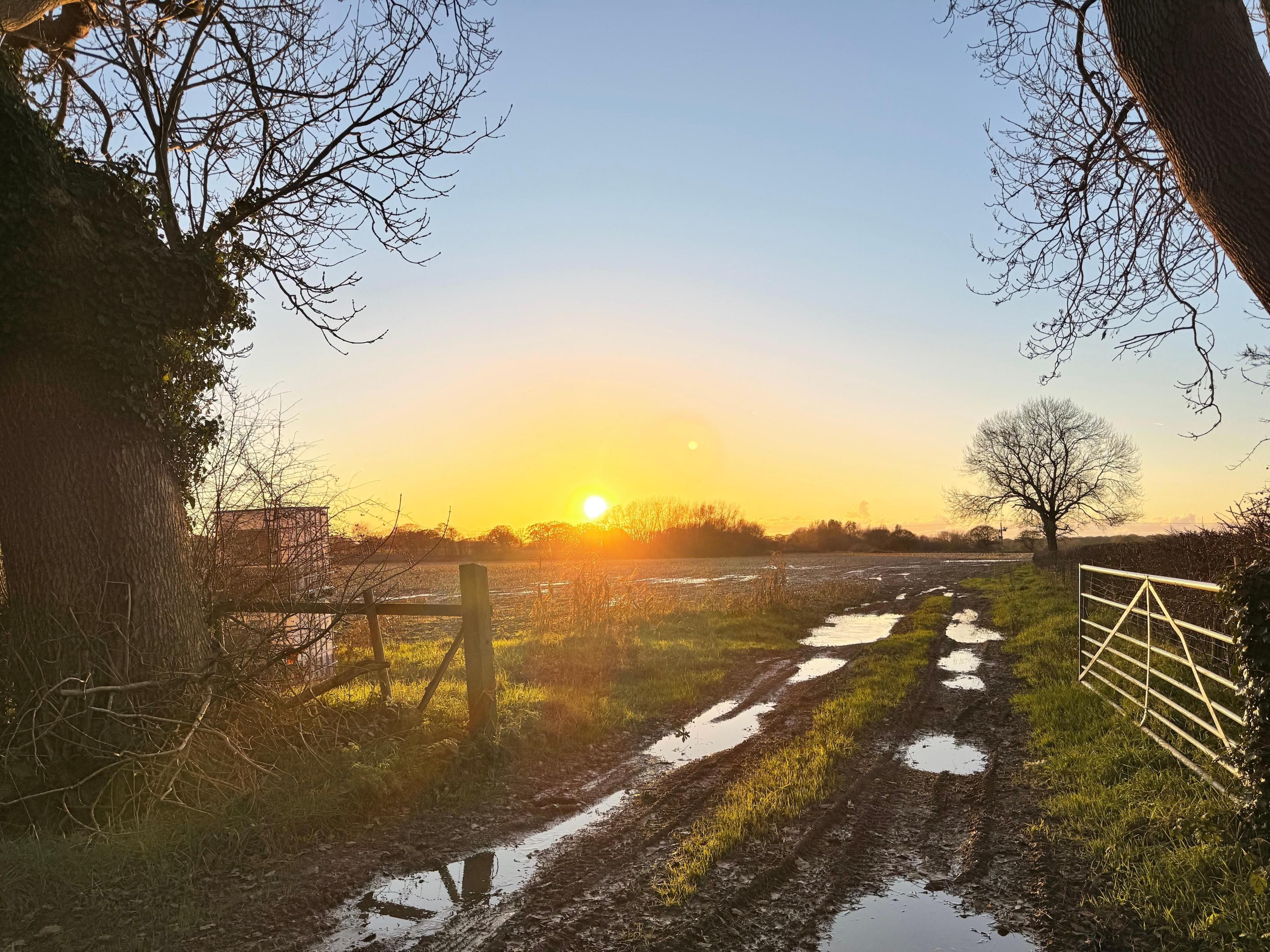
A recent shift in the jet stream has allowed milder Atlantic air to be ushered in lifting temperatures to around the seasonal average. This sudden change introduced a different set of hazards, with frequent rainfall, strong winds and the rapid thaw of lying snow bringing about localised flooding in some areas.
However, now we're entering a new phase with two competing weather influences and it's a waiting games to see which will dominate - more wind and rain, or more snow and ice.

Flooding from a combination of heavy rain on saturated ground and snow melt has led to disruption in places
When are we expecting a change to colder weather?
As we push into the second half of the month there is a signal that temperatures could once again drop with an increased chance of snow for some.
It's not that straightforward, however, as the UK is expected to sit right in the middle of two vying systems.
On one hand an Atlantic low pressure system will repeatedly attempt to move in from the west, bringing relatively mild, moist air and unsettled conditions.
At the same time, areas of higher pressure over eastern Europe and Scandinavia may intermittently push westwards, encouraging colder and more stable air to edge into eastern parts of the UK.

The UK lies on the boundary of air masses for the foreseeable future, with colder air around high pressure towards the east of the country perhaps winning out later in the month
For the next few days the Atlantic influence is likely to dominate. Many areas can therefore expect largely cloudy skies and changeable weather, with frequent showers or longer spells of rain at times.
Temperatures during this phase are expected to be close to the seasonal average overall, reflecting the balance between mild-Atlantic air and occasional cooler interludes. Where skies clear overnight, especially in more sheltered or rural locations, there will be a continued risk of night frosts.
As we head through next week the forecast confidence decreases but there is an increasing indication that colder conditions could begin to take hold.
This would occur if high pressure to the east becomes more influential, allowing colder air to spread westwards across the UK.
Should this transition develop, temperatures are likely to fall below average and the risk of wintry weather would increase. Any precipitation could potentially turn to snow — particularly over higher ground but possibly at lower levels too in some areas.
However, the exact timing and extent of any colder spell remains uncertain at this stage.
A colder than normal January?
With the prospect of temperatures falling below average towards the end of the month, alongside an increasing likelihood of further snowfall, there is growing potential for a renewed cold spell.
When this is considered together with the notable cold snap experienced at the start of the month, it raises the possibility that January as a whole could end up being colder than the long-term average.
Such an outcome would be relatively unusual in the context of recent years.
As the climate continues to warm, months that finish below average have become less frequent, particularly during winter, when milder Atlantic influences increasingly dominate. But does highlight how short-lived but significant cold spells can still occur and have a meaningful impact on monthly averages, even in a changing climate.
- Published6 hours ago

- Published7 January

- Published5 hours ago