UK braces for more rain as flood warnings remain in place

Clapham in Bedford saw widespread flooding on Tuesday
- Published
One hundred areas of the UK face flooding overnight as heavy downpours continue to drench parts of the country, while the Met Office has issued yellow rain warnings for some areas.
The Environment Agency has issued 97 flood warnings and 153 flood alerts in England, external, with saturated ground and already-swollen rivers making flooding more likely.
There are currently two flood warnings and seven alerts in Scotland, external, and one flood alert in Wales, external.
The Environment Agency are advising the public to "remain vigilant to the risk of significant flooding" as further rain is expected on Wednesday after a wet Tuesday.

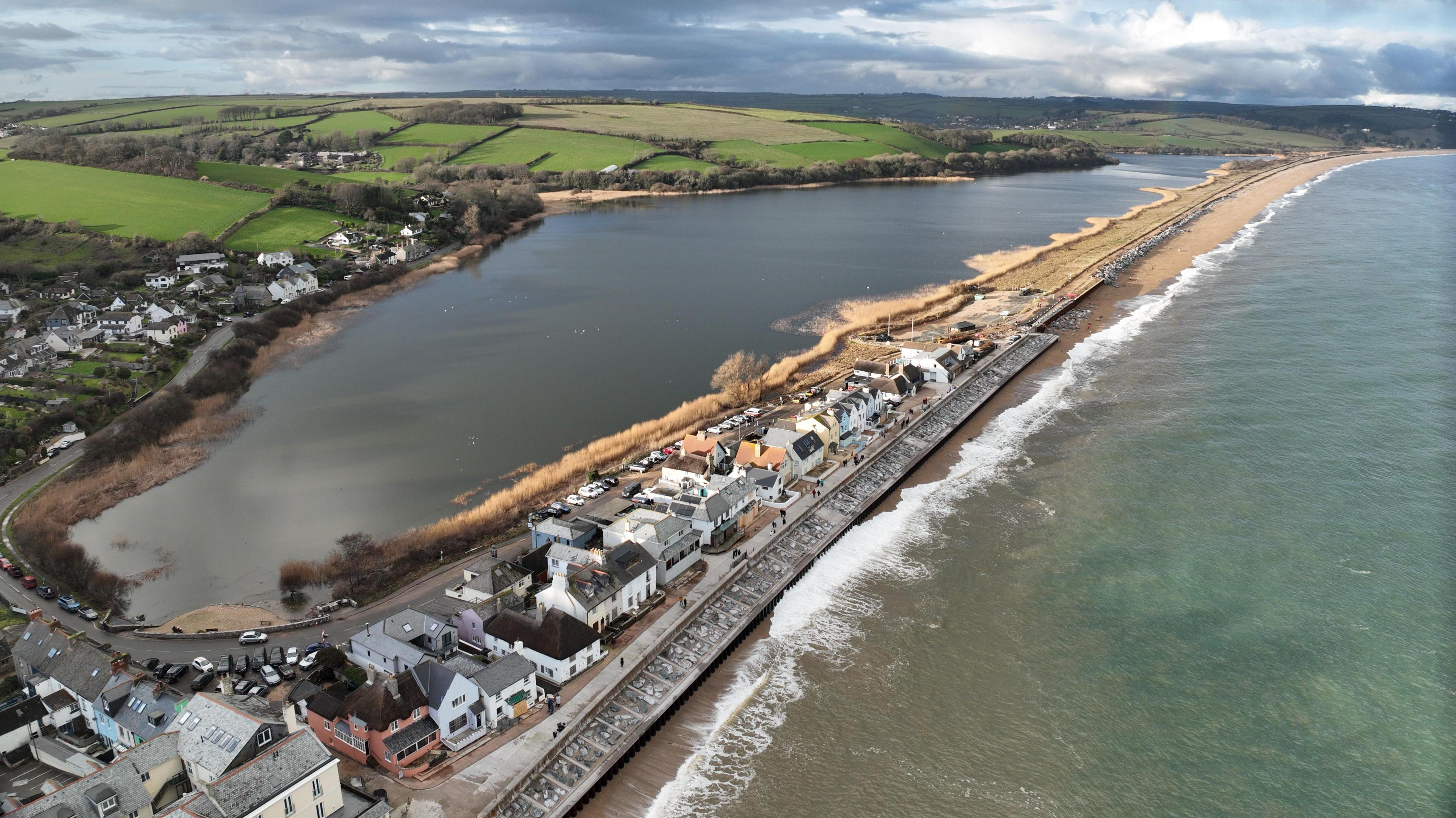
Parts of Worcestershire (pictured), Devon and Cornwall have recorded rainfall every day so far this year
The focus of Wednesday's wet weather will be across the northern half of England and once again for Scotland.
While a further 40-60mm of rain may fall across eastern Scotland, precipitation there will increasingly turn to snow.
Further south on Wednesday, rainfall will be more showery in nature with the chance of some brighter and drier spells developing.
For Thursday and Friday, colder and drier conditions are expected to develop from the north, slowly filtering south.
A yellow Met Office warning covering a large part of central and eastern Scotland will remain in place throughout Tuesday until 23:59 on Wednesday.
A warning covering parts of Argyll and Bute will come into effect on Wednesday at midnight, also due to expire at 23:59. Both warnings mean flooding and some transport disruption is likely.
This region has been exceptionally wet so far this February.
With 376mm of rainfall recorded, Aboyne in Aberdeenshire will soon surpass half its annual rainfall.
Further south, Worcestershire and the Isle of Wight have experienced around their February average rainfall in just the first week of the month.
This additional rainfall comes after very wet weather throughout January.
The Environment Agency (EA) estimates that 300 properties have already been flooded and around 16,000 properties have been protected by flood defences.
EA flood duty manager Andy Hitchings said: "As well as significant groundwater flooding remaining likely in parts of Dorset and Wiltshire, there are risks of significant river flooding impacts on the Somerset Levels, with minor river flooding impacts expected in parts of the East Midlands and probable in Worcestershire and Gloucestershire."

A large area of high pressure hasn't moved from Scandinavia and is blocking low pressure systems from moving east away from the UK and western Europe
Low-pressure weather systems have been stalling across the UK and western Europe in general, leading to days of rain and cloudy skies.
It has been caused by a large area of high pressure being stuck across Scandinavia and acting like a road-block preventing weather systems from moving eastward as we would normally see.
This is a "blocked" weather pattern and, while fairly common, it has been notable because of its consequences on the UK so far this year.
Blocked weather patterns can take on slightly different forms depending on where exactly large areas of high pressure can become stuck.
For example, if the blocked area of high pressure happens to be situated over the UK, it stops rain-bearing weather systems from arriving and gives us a prolonged dry spell.
In the summer, it can lead to droughts but also heatwaves as hot air is drawn in from the south-east.
Over the winter, it can make our weather dry, sunny and cold.
However, very small changes in position can make the difference.
If the blocking high was just to the north of the UK in winter, it allows very cold air from north-east Europe to arrive, resulting in similar conditions to the infamous "Beast from the East" in 2018.
Not quite the wettest winter on record
As wet as this winter has been, it's unlikely to beat the wettest winter on record, the winter of 2013-14.
In the southwest England and south Wales region, data from the Met Office shows that 691mm of rain fell in that record wet winter causing widespread severe flooding.
Combining the figures for December 2025 and January 2026 gives us 415mm, but already the record looks to be far out of reach.
One parallel between this winter and the winter of 2013-14 is the damage done to the main railway line at Dawlish that connects southwest England to the rest of the rail network.
In February 2014 that the track was left dangling precariously in the air as storms washed away the protective sea wall. This winter has also seen a section of sea wall collapse due to the onslaught of storms causing some disruption.
How do we get blocked patterns?
Blocking patterns are caused mostly due to changes in the jet stream - the fast wind high in the atmosphere.
In a normal situation the jet stream would flow west to east across the Atlantic with weather systems being created by minor wiggles along it.
Occasionally the wiggles get bigger and that can result in big curves in the flow - like a meandering river.
High pressure gets trapped underneath these big curves and the jet stream gets weaker and disrupted.
The high pressure becomes stronger and gets stuck so the low pressure systems cannot push through and get diverted, resulting in the same type of weather for an area for days or weeks.
Blocked patterns will eventually break, caused by renewed energy in the jet stream or stronger low pressure systems being able to push through the high pressure.
When is the rain going to stop?

There will be a brief respite with sunnier skies for many on Saturday
This current blocked pattern does show some signs of breaking down by the end of this week.
Low pressure makes some progress eastward on Saturday which will lead to a northerly wind.
While this will bring lower temperatures and some wintry showers, for most it will be drier and sunnier compared with recent weeks.
However, this will be a very brief break. Rain will return on Sunday with a strengthening wind.
And as the rain hits the colder air from Saturday, there will be a temporary spell of snow even to low levels for a time across northern England and Scotland on Sunday morning.
The weather into next week then remains unsettled with further spells of rain and therefore the continued risk of some localised flooding. For the hour-by-hour forecast in your area keep checking the BBC Weather website and app.
You can get more detail on the long-range forecast in the monthly outlook.
Get in touch
Has your area been flooded? Share your experiences
- Published27 January

- Published31 January