Identifying the seven continents, five oceans, the Equator, the Northern and Southern Hemisphere and the North and South Pole.
Hello, I'm Earth. I'm where you live. You and a few billion others.
People live all over me on bits of land called continents.
There are seven:
North America
South America
Africa
Europe
Asia
Oceania
and Antarctica.
Over two thirds of my surface is covered in water. Most of it is held in the five oceans:
The Atlantic Ocean
The Indian Ocean
The Pacific Ocean
The Southern Ocean
and The Arctic Ocean.
I orbit around the sun. Not that fast! It actually takes me a year.
There's an imaginary line that runs around my middle, which is always closest to the sun.
There it is, the Equator.
It marks the difference between my two parts: the northern hemisphere and the southern hemisphere.
This cold part at the top is my most northern point and is called the North Pole.
I also have another cold part at my bottom - I mean, my most southerly point - which is called the South Pole.
I have a lot going on, don't I?
So take care of me, please, because I'm your home.
Video summary
This video identifies the seven continents and five oceans of the Earth, and also where the Equator, Northern and Southern Hemispheres and the North and South Poles are located on the planet.
Teacher Notes
Download/print the Teacher Notes for this episode (pdf).
Teacher Notes prepared in partnership with the Geographical Association.
Central or big idea
- Earth is divided into seven continents and five oceans. It can also be divided into hemispheres, has two poles and an equator.
Think, work and apply like a geographer
- Sort, classify & rank
- Interconnect
- Scale
Questions to explore
- What are the seven continents? (North America, South America, Asia, Africa, Europe, Oceania, Antarctica.)
- What are the five oceans? (Pacific Ocean, Atlantic Ocean, Indian Ocean, Southern Ocean, Arctic Ocean.)
- Are more continents / land in the north or south hemisphere?
- What makes the equator special?
Key learning outcomes
- Know that the Earth can be organised into seven continents and five oceans.
- Know how to divide the Earth into hemispheres using the equator.
- Know how to name and locate the continents and oceans.
- Know that some parts of Earth are colder/hotter than others.
Suitable for teaching geography at KS1 and and 2nd level in Scotland and Foundation and KS1 in Northern Ireland.
Key geographical vocabulary and definitions
- Continent
- Country
- Hemisphere
- Pole
- Equator
Suggested learning opportunities
- Label the continents and oceans on a world base map, add in the poles and equator.
- Rank the continents by size.
- Design a mnemonic to remember the continent in size order.
- Create a packing list of the clothes needed to visit the North or South Pole.
Ideas for going further and links
- Explore photographs from across the seven continents and discuss the similarities and differences between the physical and human features found.
KS1/KS2 Primary Geography: Maps
KS2 Geography: UK settlements and navigating using maps
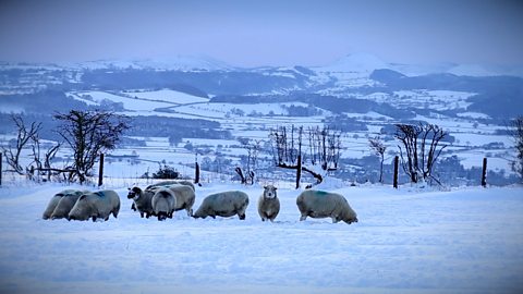
Weather, climate and climate change. video
Exploring the difference between weather and climate, climate zones around the world and climate change.
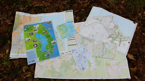
Maps. video
Maps, mapping and navigation - including map keys, symbols, compass points and co-ordinates.
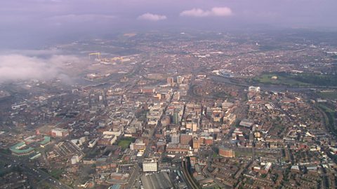
Cities, towns and villages. video
Exploring settlements to identify the key geographical features of villages, towns and cities, including their similarities and differences.
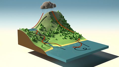
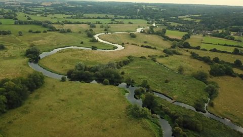
Rivers. video
Exploring the journey of water to the sea, including source, stream, river, meander, river mouth and estuary.
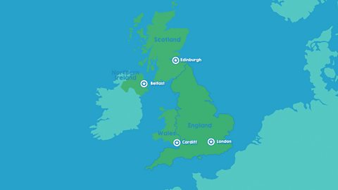
The United Kingdom. video
Identifying the four countries of the UK - England, Scotland, Wales, Northern Ireland - and their capital cities: London, Edinburgh, Cardiff, Belfast.
The seasons. video
Spring, summer, autumn, winter... Identifying the four seasons of the United Kingdom's temperate climate.
Earthquakes. video
An animation for KS2 pupils on tectonic plate movement and steps to lessen the impact of earthquakes.
The water cycle. video
An short animation for KS2 pupils explaining the water cycle, including evaporation, condensation and precipitation.