De-Graft explores different settlements in the UK - including villages, towns and cities - and their similarities and differences.
De-Graft: The United Kingdom of Great Britain and Northern Ireland, or the UK as it’s known, is made up of different countries, communities, and environments. There are loads of things to see and places to explore – for example, did you know, that there are more than two thousand miles of canal towpaths?
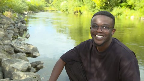
This is Manchester. Here waterways or canals were once the main way of transporting raw materials and trading goods, but now they’re used primarily for leisure.
Later, locals Haniyah and Lola will be helping me understand a lot more about using a map to navigate around the UK. But first, let's zoom out.
I’m here in Manchester, one of the biggest cities in England. The UK is made up of four countries: England, Scotland, Wales and Northern Ireland, which can be found on the two largest islands within the British Isles. The biggest island is called Great Britain, which contains England, Scotland and Wales.
The UK is made up of different communities, rural and urban, that are distinct and have unique traits. As you can see on this puzzle, in England the country is divided into different areas called counties. In Northern Ireland there are districts, Wales there are principal areas, and in Scotland there are council areas.
We call all the places that people live in ‘settlements’, and there are a few different shapes and sizes. A hamlet is a very small settlement, with just a group of houses. A village is also small but as well as houses, there may be a shop, a school, a place of worship or a village hall. A town has all of the same features as a village but there may also be a railway station, a shopping centre, more places of work and places of worship. A city is even larger. Cities have a lot of housing, schools, universities, hospitals, offices, and often a cathedral. And a megacity are when a number of large towns and cities combined to create a massive urban area.
OK, time to compare. Across all of the settlements in the UK, in England, Scotland, Northern Ireland and Wales, there’s a total population of over 66 million people spread out over 242,500 square kilometres.
The USA has around five times more people, living in an area of over nine million square kilometres.
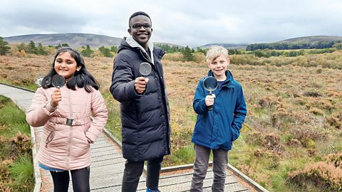
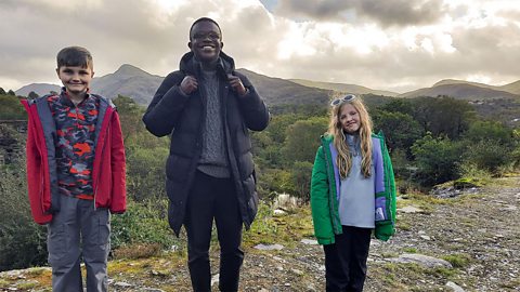
Looking at maps is a great way of spotting settlements and locals Lola and Haniyah have joined me on the outskirts of Manchester to have a go.
So guys, what do you make of this view around us?
Child: I think it’s really nice, it’s got lots of buildings.
Child: I think it’s a nice, calm, relaxing view.
De-Graft: We’ve got all the nice scenery behind us but in front of us we’ve got a big, old map. What kind of things do you use maps for?
Child: It tells you how to get to places or where places are.
De-Graft: Absolutely right! Maps are two-dimensional drawings of an area, and they can be digital, like on our phones, or on pieces of paper. But we don’t just have a map in front of us, we’ve also got a compass. Haniyah, can you grab the compass and show us where north is?
Child: So north, if I point the compass like that, would be facing there.
De-Graft: Very nice work. Maps are drawn to a much smaller scale so they can fit everything on a piece of paper. So, the map we've got in front of us is a 1:25000 scale map. That means every four centimetres on the map is the same as one kilometre in reality.
Now I’ve got a bit of a challenge for you guys. I need you to get your rulers to tell me how far is Salford Quays from Manchester City Centre.
Child: 12 centimetres but in real life it would be three kilometres.
De-Graft: That’s right, three kilometres ‘as the crow flies’ or if you were to draw a straight line.
So why don’t you have a go at map reading and plan some local routes to some nearby places. Zoom in and have a go for yourself.
Right guys, where are we off to next? Cool, let’s go!
Video summary
Download/print a transcript of the video.
De-Graft is in Manchester to find out about the different settlements and communities that make up the UK.
De-Graft explores the different types of settlement that exist - hamlet, village, town, city, and megacity - and their key features. He meets up with two children from Manchester to find out about maps, mapping and navigation - including using a compass and calculating distance using the scale on a map.
Teacher Notes
Questions to consider:
- What is the UK, what is Great Britain and what is the difference?
- What are the different types of settlement? What are the similarities and differences between them?
- What is your local area like? What type of settlement is it? Is it a rural or urban environment? What key features does it have? Where would you like to live: in a city or in the countryside, why?
- How do you feel about where you live? How might others feel about it?
- How can you get around your local area? What kind of transport is there? Are there lots of roads or footpaths?
- Can you think of examples when maps might be useful?
- How can you use a compass?
- How can you use a map to work out the distance between places?
- What else do maps show?
Suggested activities to further explore learning:
1. Create a treasure trail
Pupils could create a trail within their school grounds or local park with clues to help their classmates reach each destination. Clues might include the use of symbols, landscape features or even grid references, based around either a hand-drawn map or one printed from an online digital mapping platform, while others use directional language, observations, and measurements.
Alternatively a virtual or remote treasure hunt could be created around the wider local area using a digital platform. In either instance pupils then follow each other’s trails. Perhaps at each destination they write down the key feature they can spot in front of them e.g. bridge, offices, park, and see what word the trail spells out using the first letter from each destination e.g. ‘B.O.P.’, so they can solve the treasure trail puzzle.
As pupils explore the trails they could do annotated sketches or take photos from a range of perspectives such as ‘bird’s-eye’ or ‘bug's-eye’ of the key features and points of interest that they spot.
2. Exploring settlement shapes
Settlements can be organised or laid out in different ways. There are three terms that help describe this:
- Nucleated – where buildings are grouped together
- Dispersed – where buildings are randomly spread out
- Linear – where buildings are in a line often following a road or river
Pupils could draw annotated examples of each type and then find out which category their home or school falls into.
Pupils could scan an OS map for the different sorts of settlement shape and see whether there are any patterns. Do the shapes connect to any physical landscape features for example?
3. Discuss opinions on different settlements
Host a classroom debate where pupils are split into different groups and each group is assigned a different settlement size. Each group comes up with reasons as to why their settlement type is the best e.g. in villages the population size is quite small so you have more chance of knowing your neighbours, or in cities there are often lots of facilities which can provide opportunities to try new things.
Groups can prepare their arguments, their questions for other groups, and even draw annotated sketches of key settlement features or create a poster advertising their settlement to show to the classroom to help strengthen their argument. This will help pupils to understand that people have different opinions about settlements and not everyone feels the same. The debate could be repeated, but this time the pupils take on a range of roles such as: toddler, teenager, OAP, wheelchair user. Would different groups have different needs and therefore be more likely to choose a life in the countryside/city?
Key terminology:
City – a city is larger than a town. Cities often have a lot of housing, schools, universities, hospitals, offices, and often a cathedral.
County – a term used to refer to different areas across England usually consisting of various towns and villages. In Scotland the land is divided into ‘council areas’, in Wales it’s ‘principal areas’ and in Northern Ireland it’s ‘districts’.
Great Britain – the largest island of the British Isles, made up of England, Scotland and Wales.
Hamlet – a very small settlement, with just a group of houses, often centred around a farm.
Map – a two-dimensional drawing of an area.
Megacity – when a number of large towns and cities combine to create a massive urban area.
Population – the number of people living in a particular area.
Raw materials – a natural resource that has not been processed at all.
Residential – an area designed for people to live in.
Rural – areas which are not towns or cities and often have farming communities.
Scale – a scale of a map represents the relationship between distance on a map and distance in real life. It’s expressed as a ratio, for example 1:25000 – meaning that 1cm on the map is the same as 250 metres in real life.
Settlement – the places that people live. There are different shapes and sizes of settlement: hamlets, villages, towns, cities, and megacities.
Town – a town has all the same features of a village but is larger and may also have a railway station, a shopping centre, more places of work and places of worship.
Trade – the buying and selling of goods and services. Cities are often especially busy areas of trade.
United Kingdom – country made up of England, Scotland, Wales and Northern Ireland.
Urban – an area, usually cities and towns, where people live and work closely together.
Village – a small area with housing and maybe a shop, a school, a place of worship or a village hall.
Suitable for teaching geography at KS2 in England and Northern Ireland, Progression Step 3 in Wales and 2nd level in Scotland.
Food, farming and agriculture. video
Exploring farming and agriculture - a key UK industry. Includes arable, pastoral and mixed farming and examples of rural and urban farms.
Urban settlements - living in a city or megacity. video
Exploring key aspects of cities and megacities - building use, population density, environmental impact and sustainable choices.
Coasts and sustainable use of natural resources. video
Examining a coastal region of North Wales, including a local wind farm and examples of the sustainable use of natural resources.
Rivers - the course of a river from source to mouth. video
Exploring the key aspects of rivers - the source, tributaries, streams, meanders, ox-bow lakes, river mouth and estuary.
Mountains - how tectonic plates create mountain ranges. video
Exploring how tectonic plate movement creates mountains where the plates collide and single peaks formed by volcanoes.
Lakes, lochs, reservoirs and the water cycle. video
Visiting Lake Windermere to consider lakes, lochs and reservoirs and their place in the water cycle.
Forests - deciduous and coniferous woodland and biodivsity. video
Exploring a forest region in the Lake District to discover the rich biodiversity of woodland habitats.
Shore, coast and ocean. video
Visiting a marine reserve in Scotland to discover the biodiverse habitat it offers, but also the importance of conservation.
Peatlands, wetlands and the carbon cycle. video
Exploring the significance of peatland and wetland habitats to store water and absorb carbon or CO2.