Exploring the four countries of the UK - England, Scotland, Wales and Northern Ireland - and their capital cities: London, Edinburgh, Cardiff and Belfast.
Hi there, I'm Earth.
Come and take a look at one of my favourite places, the United Kingdom.
It's made up of England, Scotland, Wales and Northern Ireland.
This is England, the biggest country in the United Kingdom.
Its capital city is London.
This is the Tower of London, home of the Crown Jewels.
The north of England has many mountains and lakes, like Windermere, the largest lake in England.
Up here is Scotland. It has lots of lakes. They call them lochs.
The most famous is Loch Ness. Legend says it's home to the Loch Ness monster.
The capital city of Scotland is Edinburgh, with its famous castle.
Wales's capital city is Cardiff.
Here's Cardiff railway station. It was built to handle all the trains coming in and out of the city.
And this is Snowdon, Wales's highest mountain.
Beautiful, if I do say so myself!
Across the Irish Sea is Northern Ireland.
Its capital city is Belfast.
This is the Titanic Museum, which tells the story of the famous ship.
And this is the Giant's Causeway.
Legend says it was built by a giant who wanted a shortcut between Northern Ireland and Scotland, but really it was formed when the lava from a volcano cooled and formed these columns.
With so many amazing places, I bet you can see why the United Kingdom is so special to me.
Video summary
This short film offers primary pupils a journey around the four countries that make up the UK - England, Scotland, Wales and Northern Ireland.
It identifies the capital cities - London, Edinburgh, Cardiff and Belfast - and also the flag and a key human and physical feature of each country.
Teacher Notes
Download/print the Teacher Notes for this episode (pdf).
Teacher Notes prepared in partnership with the Geographical Association.
Central or big idea
- The UK is made up of four countries: England, Scotland, Wales and Northern Ireland.
Think, work and apply like a geographer
- Classify
- Justify
- Sense of place
- Compare
- Question
Questions to explore
- What are the four countries of the United Kingdom?
- Where are the four nations in relation to each other?
- What are the capital cities of each country?
- What is a human feature in geography?
- What is a physical feature in geography?
- What human and physical features make your local area special?
- Which kind of feature from the video do you like best and why?
- What questions could we ask to find out more about one of the countries/capital cities?
Key learning outcomes
- Know that the UK is made up from four separate countries, each with its own capital city.
- Know how to tell the difference between human and physical features of a landscape.
- Know how to locate places on a map.
- Know how to identify what makes a place special.
Suitable for teaching geography at KS1 and KS2 in England and Wales, Early and 1st and 2nd level in Scotland and Foundationand KS1 in Northern Ireland.
Key geographical vocabulary and definitions
- Country
- Capital city
- Mountain
- Lake
- Loch
- Volcano
Suggested learning opportunities
- Sort images from video (or word cards) into two categories of human and physical features. Add in more, including somethat will prompt discussion of any that don’t quite fit - eg garden or park.
- Look at map on video at 1’46’’ for 30 seconds and then draw it on a piece of paper. Repeat the next day. Is it asaccurate?
- Use map of countries with key cities to ask and answer positional and directional questions related to compass points - egwhich country is North of England?
Ideas for going further and links
- Go out into the school grounds and/or local area and identify human and physical features and ask which ones help make ourplace special.
KS1/KS2 Primary Geography: The world
KS2 Geography: UK settlements and navigating using maps
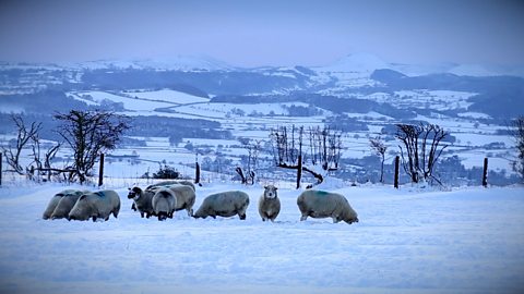
Weather, climate and climate change. video
Exploring the difference between weather and climate, climate zones around the world and climate change.
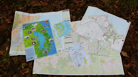
Maps. video
Maps, mapping and navigation - including map keys, symbols, compass points and co-ordinates.
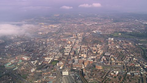
Cities, towns and villages. video
Exploring settlements to identify the key geographical features of villages, towns and cities, including their similarities and differences.
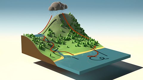
Rivers. video
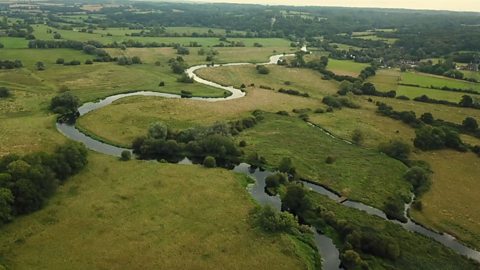
Exploring the journey of water to the sea, including source, stream, river, meander, river mouth and estuary.
The world. video
Exploring the regions of the Earth: the continents, oceans, Equator, Northern and Southern Hemispheres and the North and South Poles.

The world. video
Exploring the regions of the Earth: the continents, oceans, Equator, Northern and Southern Hemispheres and the North and South Poles.
Earthquakes. video
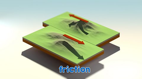
An animation for KS2 pupils on tectonic plate movement and steps to lessen the impact of earthquakes.
The water cycle. video
An short animation for KS2 pupils explaining the water cycle, including evaporation, condensation and precipitation.