Snow and ice warnings issued for UK after relentless rain

- Published
After relentless wet and gloomy conditions, wintry weather is set to return to parts of the UK with snow and ice in the forecast for many.
Arctic air will accompany the change in conditions, dropping temperatures as many as six degrees below average.
The Met Office has issued yellow warnings for snow and ice across Scotland and northern England from 16:00 GMT Thursday to 12:00 Friday.
Rain will fall as snow initially over higher ground before reaching to lower levels through Thursday night.
Settling snow will mostly be seen above 200m with as much as 10cm possible.
The rain and snow are expected to clear south during the early hours of Friday, though temperatures will fall quickly to around 3 to 6C below the average.
This will lead to ice on untreated surfaces and dangerous road conditions in some places.
Cold health alerts issued

Sunnier but colder weather is on the way for the end of this week
In anticipation of the plummeting temperatures, the UK's Health Security Agency has also issued yellow alerts for the colder weather across northern England and the Midlands, external from 06:00 GMT Friday to 08:00 Monday.
They warn that the weather is likely to have "minor impacts on health and social care services, including increased use of healthcare services and a greater risk to life of vulnerable people".
Temperatures should return to around average by Tuesday across most of the UK.
How do cold weather health alerts work?
- Published17 February
How to drive in snow and icy weather
- Published2 January
How to look after dogs, cats and other pets in cold weather
- Published4 January
How to stay safe during a storm and what to do in a power cut
- Published12 February

Into next week there will be areas of low pressure crossing the UK bringing some rain at times but also drier and brigher interludes
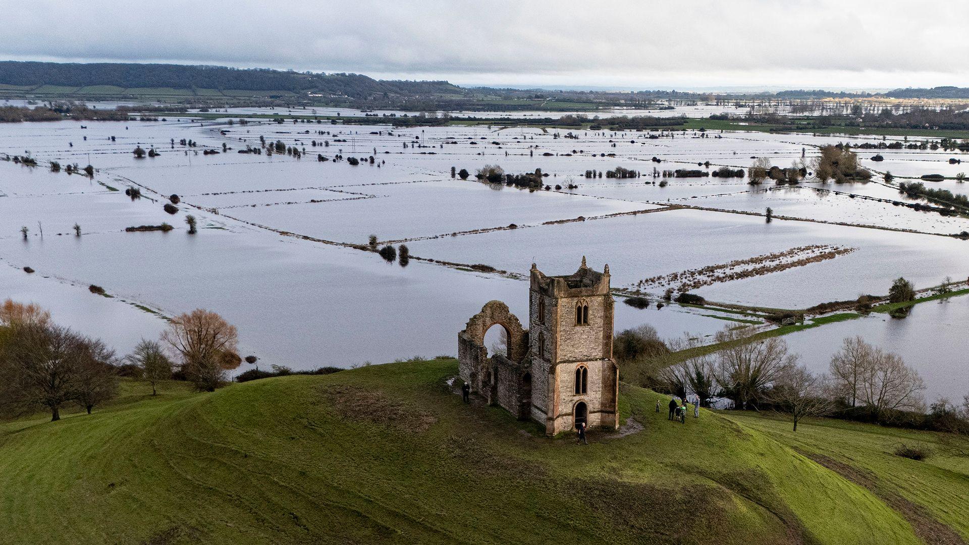
Flooding risk continues
The flooding problems of recent weeks have not gone away: as of Thursday morning, there are still 81 flood warnings in force, the majority of which are in Dorset, Wiltshire and Somerset. The warnings are for both river flooding and groundwater flooding.
Areas experiencing river flooding should improve over the next few days but it is a different story in terms of groundwater.
Some areas are experiencing flooding because of their geology, with porous chalk below the surface acting like an enormous sponge.
That forms an aquafer that is a really important source of drinking water in southern England.
But that layer of chalk is saturated and the groundwater flooding we are seeing as a result is likely to last a great deal longer, probably for many days or even weeks ahead.
Brief sunshine before rain returns
As colder Arctic air gradually extends southward across the UK on Friday and Saturday, sunshine will return for some.
Aberdeen may eventually see the Sun on Thursday afternoon for the first time since 21 January.
It is expected that much of the UK will have a sunny day on Saturday.
Changes will be short-lived however with further rain set to sweep across the UK on Saturday night.
There will be a temporary spell of snow over the higher ground of northern England and Scotland before it turns back to rain.
With the ground saturated, there may be additional warnings to cover the heavy rain and risk of flooding so stay tuned to the forecast.
You can stay up to date with the latest monthly outlook here .
- Published11 February
- Published2 January

- Published2 January