Bradford - Weather warnings issued

14-day forecast

Forecast - Bradford

Sleet and a moderate breezeLight rain and a moderate breezeLight rain and light windsSunny intervals and a gentle breezeLight rain and a gentle breezeLight rain and a gentle breezeLight rain and light windsLight rain and a gentle breezeLight rain and a gentle breezeLight rain and a gentle breezeLight rain and a gentle breezeLight rain and light windsLight rain showers and a gentle breezeLight rain and a gentle breeze

Environmental Summary

Sunrise Sunset

Sunrise08:21Sunset16:10
UVLowPollutionLow

Sunrise Sunset

Sunrise08:20Sunset16:12
UVLowPollutionLow

Sunrise Sunset

Sunrise08:19Sunset16:13
UVLowPollutionLow

Sunrise Sunset

Sunrise08:18Sunset16:15
UVLowPollutionLow

Sunrise Sunset

Sunrise08:17Sunset16:16
UVLowPollutionLow

Sunrise Sunset

Sunrise08:16Sunset16:18
UVLow

Sunrise Sunset

Sunrise08:15Sunset16:20
UVLow

Sunrise Sunset

Sunrise08:14Sunset16:22
UVLow

Sunrise Sunset

Sunrise08:13Sunset16:23
UVLow

Sunrise Sunset

Sunrise08:12Sunset16:25
UVLow

Sunrise Sunset

Sunrise08:10Sunset16:27
UVLow

Sunrise Sunset

Sunrise08:09Sunset16:29
UVLow

Sunrise Sunset

Sunrise08:08Sunset16:31
UVLow

Sunrise Sunset

Sunrise08:06Sunset16:33
UVLow

Hour by hour forecast

Last updated
Last updated

Environmental Summary

Sunrise Sunset

Sunrise08:21Sunset16:10
UVLowPollutionLow

Sunrise Sunset

Sunrise08:20Sunset16:12
UVLowPollutionLow

Sunrise Sunset

Sunrise08:19Sunset16:13
UVLowPollutionLow

Sunrise Sunset

Sunrise08:18Sunset16:15
UVLowPollutionLow

Sunrise Sunset

Sunrise08:17Sunset16:16
UVLowPollutionLow

Sunrise Sunset

Sunrise08:16Sunset16:18
UVLow

Sunrise Sunset

Sunrise08:15Sunset16:20
UVLow

Sunrise Sunset

Sunrise08:14Sunset16:22
UVLow

Sunrise Sunset

Sunrise08:13Sunset16:23
UVLow

Sunrise Sunset

Sunrise08:12Sunset16:25
UVLow

Sunrise Sunset

Sunrise08:10Sunset16:27
UVLow

Sunrise Sunset

Sunrise08:09Sunset16:29
UVLow

Sunrise Sunset

Sunrise08:08Sunset16:31
UVLow

Sunrise Sunset

Sunrise08:06Sunset16:33
UVLow
Back to top

Forecast for Yorkshire

Latest forecast for Yorkshire from BBC Look North

  • Last updated
    1 day ago
  • Updated Monday to Friday only

Latest forecast for Leeds

Last updated 23 minutes ago

Today

Today will be a cloudy day, with spells of rain gradually spreading to the east. Turning somewhat drier in the late afternoon before showery rain moves in in the evening. A milder day.

Tonight

Tonight will see any lingering spells of showery rain moving away, leaving it largely clear. Patchy cloud will move in overnight, but staying dry.

Monday

Mostly bright to start, but thicker cloud will move in the afternoon with spells of light rain and shower possible. Turning dry and clear in the evening. A milder day.

Outlook for Tuesday to Thursday

Tuesday will be dry at first, with cloudy skies. A spell of heavy and persistent rain will move in from the south-west in the afternoon, clearing to the north-east overnight, with some clear spells developing in the early hours. Wednesday will be largely dry and bright with plenty of wintry sunshine. Rain overnight, followed by bright spells, variable cloud and the odd shower.

Observations for Bradford

Observed at, 08:00 GMT Sunday 11 January
weather type not available
Temperature 1° CelsiusTemperature 34° Fahrenheit
Average wind speed, not available. Wind Direction, not availableAverage wind speed, not available. Wind Direction, not available
  • Humidity: 92%,
  • Visibility, not available,
  • Pressure, not available,
Observation station: Bradford (Latitude 53.8167, Longitude -1.7667)

Met Office warnings issued for West Yorkshire

  • Yellow warning of snow and ice

    Yellow - Possible

    Active Warning
    Started:02:00 GMT Sunday 11 January
    Ends:15:00 GMT Sunday 11 January

    A spell of snow and ice will lead to some disruption on Sunday. - Possible travel delays on roads stranding some vehicles and passengers - Possible delays or cancellations to rail and air travel - Bus and train services may be delayed or cancelled, with some road closures and longer journey times possible - Power cuts may occur, with the potential to affect other services, such as mobile phone coverage - Untreated pavements and cycle paths likely to be impassable, especially in the east of the warning area - A chance of injuries from slips and falls on icy surfaces

    Issued:08:30 GMT Friday 9 January
  • Yellow warning of ice

    Yellow - Possible

    Active Warning
    Started:03:00 GMT Sunday 11 January
    Ends:11:00 GMT Sunday 11 January

    Mix of rain and snow falling onto sub-zero surfaces leading to ice and some disruption during Sunday morning. - Probably some icy patches on some untreated roads, pavements and cycle paths - Some injuries from slips and falls on icy surfaces

    Issued:20:33 GMT Saturday 10 January

How UK weather warnings work

Warnings are issued for rain, thunderstorms, wind, snow, lightning, ice, extreme heat and fog. These warnings are given a colour depending on a combination of both the impact of the weather may have and the likelihood of those impacts occurring.

Weather warnings key

Yellow - Possible

Potential of bad weather situations causing disruption to travel and activities

Amber - Likely

Increased potential of bad weather situations causing disruption to travel, risk to life and property

Red - Expected

Dangerous weather is expected, take action to keep yourself and others safe

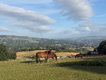
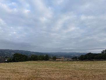
Our favourite Weather Watchers photos nearby
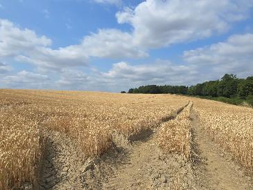
Report for Crofton West Yorks, Wakefield

Temperature not availableTemperature not available
Sunny intervals

Reported by sue

Report for Ryhill, Wakefield

Temperature not availableTemperature not available
Clear night

Reported by sue

Report for Moorthorpe, Wakefield

-1°30°
Clear night

Reported by KennyM69

Report for Ilkley, Bradford

-3°27°
Clear night

Reported by FionaC

Settings

BBC Weather in association with MeteoGroup, external

All times are Greenwich Mean Time (Europe/London, GMT) unless otherwise stated.