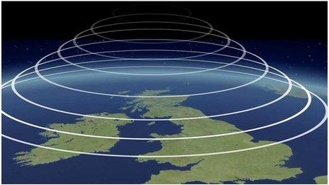
Monthly Outlook

- Published
After further unsettled and rather cool weather, the middle of June will have a warmer and drier trend as high pressure builds, with some hot days possible in parts of England and Wales.
However, there is a risk that high pressure is weaker, leading to wetter and cooler chances, particularly across the north.
Tuesday 10 to Sunday 14 June
Changeable. Warmer by the weekend
Wednesday will have a few sunny spells but scattered showers will develop again, turning heavy in places with a chance of localised hail and thunderstorms, particularly during the afternoon, along with gusty winds. It will be rather cool for June.
On Thursday a frontal system will bring rain from the west, some of it heavy, especially in western regions, with increasing winds. Temperatures are going to remain subdued in most areas but Wales and western England may turn warmer in the afternoon as rain clears.
Friday and the weekend will have a warming trend, with temperatures rising above the June average. Friday will still have some patchy rain, but southern regions may turn drier, with temperatures rising into the 20s Celsius.
High pressure building into southern regions will expand across the UK through the weekend. Saturday should turn out fine across much of England and Wales after some early fog patches but the north will have a chance of a little patchy rain, along with Scotland and Northern Ireland.
Any rain should be pushed farther north on Sunday. It will be a warm weekend, especially in central and southern England where temperatures may reach the mid to high 20s Celsius.
Monday 15 to Sunday 21 June
Unsettled in the north, warm in the south
Next week is rather uncertain. There is still a chance that high pressure will persist right across the UK like the last update suggested, but more recent trends have it declining a little to allow Atlantic low pressure circulations and frontal systems to move back across the UK. However, these will be aimed more at the north than the south, so it should be wetter across the northern half of the UK, especially Scotland, with occasional bands of rain or showers.
Elsewhere there is a greater chance of longer drier spells, especially in southern and eastern areas, with below-average rainfall overall. Temperatures will be closer to seasonal values across Northern Ireland and Scotland at times but England and Wales should remain warmer than average, with a chance of a couple of rather hot days, especially in central, eastern and southern areas.
The risk to this forecast is for weather systems to track farther south, making conditions somewhat wetter farther south with less heat, although temperatures should still be above the June average in the south and east.
Monday 22 June to Sunday 5 July
Becoming less warm by early July
A similar pattern may linger into the latter part of June, with warmer and drier weather than normal in most areas. The northern UK may be more susceptible to occasional rain, and there are the same provisos as before when considering any possible rainfall elsewhere – a risk of weather systems arriving farther south and bringing more widespread rain. Some notable warmth is still possible in the drier scenario, particularly across central and southern regions.
High pressure might shift to the Atlantic by early July. This could lead to a reduction in warmth across the UK. Nevertheless, temperatures are still more likely to be above average than below, or at least near seasonal. Rainfall amounts should be below or near average but conditions may become wetter before the end of the outlook period.
Further ahead
In Friday's outlook we will see if confidence is stronger in the forecast after this week, particularly concerning the whereabouts and strength of high pressure areas. We will also be able to look farther into July.
- Published1 May
- Published8 hours ago
- Published7 April 2022