 |  |
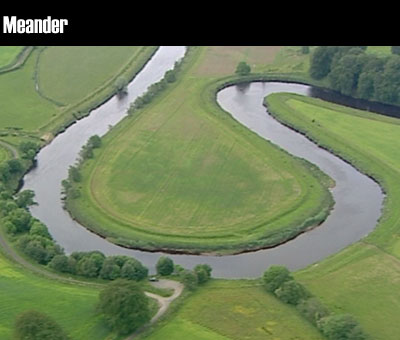
As a river reaches lowland areas it develops larger bends. The largest curves are known as meanders, these are large bends where the river swings round in a loop. This a meander found in the stretch of the Upper Bann between Portadown and Lough Neagh. On the outside bends the water is deeper and faster flowing. On the inside bend the water is shallower and flows more slowly. As the river goes round the bend the water is pushed outwards causing increased erosion of the river banks. On the inside of the bend the water cannot carry as much material so sand and shingle will be deposited. This is the River Strule near Omagh. The narrow strip of land between the two stretches of the river is called the meander neck. In time the river will erode through the neck and the loop will be cut off leaving an oxbow lake. The river will flow straighter and shorten its course. This could happen gradually over a number of years or suddenly in a flood when the river has masses of energy. The water is always being thrown to the outside of the bend and it is here that erosion is at its strongest. | As a river reaches lowland areas it develops larger bends. The largest curves are known as meanders. The narrow strip of land between the two stretches of the river is called the meander neck. In time the river will erode through the neck and the loop will be cut off leaving an oxbow lake. The river will flow straighter and shorten its course. |
16 October 2014 |
 |
