
Howling winds for Halloween? (updated Sun., 06.50hrs)
I've been keeping you updated in my last blog entry with the weekend forecast, when we'll see the recent benign and very mild weather come to a distinctly wet and windy end.
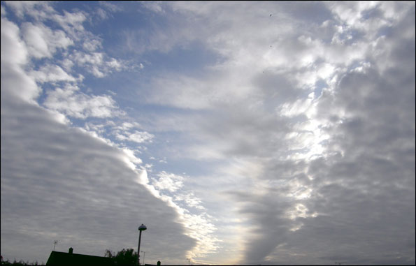
And of course, on Saturday it's Halloween. Will the weather turn into a horror story? Well, I can certainly see it conspiring to snuff-out some of those candles in carved-out pumpkins... but mostly after midnight.
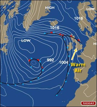
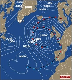
 The first signs of change arrive tomorrow evening (Friday), as a band of rain - heavy in places - moves eastwards overnight into Saturday morning, clearing around dawn. Beyond that, lingering uncertainties surround the regional detail of our forecast as we head through Saturday night and into Sunday, but one way or another, we'll see some heavy rain and pretty strong winds. A deep Atlantic low will spin-up south of Ireland during Saturday, tracking north-easterly across the British Isles - probably on a course taking it over Scotland - bringing gales and a swathe of wet weather for much of England, too.
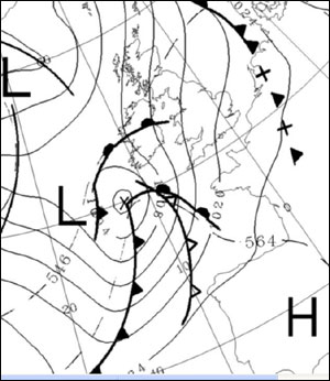 With the exact track of this depression still subject to some doubt, the extent and regional bias of any severe weather remains very uncertain. Some of the various forecast models we use suggest rainfall totals - at least in some areas - of 35mm or more in the West Country, but these predictions will be greatly refined (and possibly reduced) as we near the weekend. The worst conditions, however, are likely to occur through the nocturnal early hours of Sunday morning, after which we expect the heaviest rain to quickly clear eastwards. It's thus likely that by the time inclement weather arrives, most of the trick-or-treat youngsters out on Saturday evening are tucked-up in bed. Most...
Sunday daytime will remain very windy; feeling a good deal cooler than lately but largely bright, ahead of some further wet weather arriving off the Atlantic into Monday as we enter a distinctly unsettled spell.
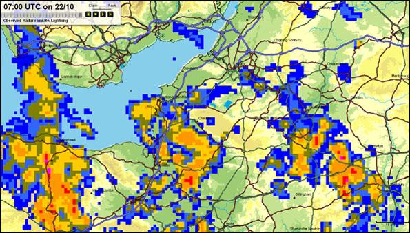
On BBC Radio Gloucestershire's Breakfast Show this morning, I was suggesting to presenter Steve Kitchen that the sudden combination of heavy rain and many leaves blown off the trees could give some localised flooding problems, with a lot of standing water on some roads. It's a feature of the weather likely to remain a problem into the next working week, doubtless keeping local councils rather busy keeping the drains clear. But then this is Autumn, and the expected weather by no means anything exceptional...
UPDATE, THURS 29 OCTOBER, 19:30HRS:
Earlier today, the Met Office issued an advisory for the likelihood of severe weather from this system, affecting Northern Ireland and various parts of Scotland. I'm anticipating this to be extended to some other parts of the UK as the forecast continues to be refined.
The expected track of this Atlantic cyclone continues to vary somewhat between different models and indeed different model runs. Some of these are leaning towards a more southerly track and if this became reality, stronger winds would sweep the West Country, readily gusting to 50-60mph inland in exposed districts and doubtless leaving barely a single leaf hanging on the autumnal trees.
However, despite this geographic variance in track (which will prove critical by even quite small margins), the broader timing remains largely similar between the models. As I mentioned earlier in this blog, the worsening weather is highly likely to arrive after midnight, rather than during Halloween evening itself.
UPDATE, SATURDAY 31 OCTOBER, 00.45hrs:
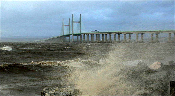
Still various forecasting uncertainties for this Sunday cyclone - not least how much it will deepen (or not) - and on balance, I'm leaning towards it being a spell of unexceptional wet (i.e., through early Sunday) and very windy (i.e., all Sunday!) spell of weather, rather than anything genuinely 'severe' in the truly statistical sense, at least for the West Country. Nonetheless, gusts of 50-60 mph for our region still very possible (and that's enough to trash weak or diseased trees, garden fences, etc) and local flooding certainly likely in some of our localities. I'll do my best to keep you abreast of the forecast developments....
UPDATE, SATURDAY 31 OCTOBER, 19.30hrs:
After settling down to watch the Abu Dhabi F1 Grand Prix qualifying session today, my planned day off work instead evolved into two hours spent back at the BBC Bristol weatherdesk.
A lengthy conversation on the 'phone at 12.15hrs with my Met Office colleague Darren Bett confirmed some of the nagging concerns we still have with detailed aspects of tomorrow morning's developments; but equally, it reaffirmed many of our firmer expectations.
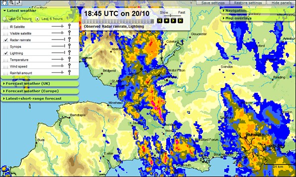
On BBC Points West this evening, I highlighted our forecast of heavy rain (perhaps 30-35mm) combining with winds gusting to 50+ mph in some districts across our region. That's certainly enough to cause trouble on the roads with localised flooding and I'd wager some older or diseased trees getting toppled, too. Some weaker garden fences surely likely to be flattened in the process... in fact, I'm just off into the garden here in Bradley Stoke, to make sure anything likely to get blown-around is well secured.
The infra-red EUMETSAT satellite image below shows trouble brewing, as expected, out SW of Ireland. 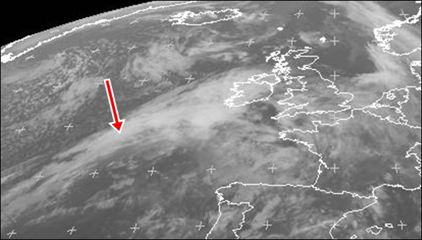
Here she comes... this 7pm infra-red satellite image may look innocuous, but wet and wild weather is quickly brewing in the eastern North Atlantic... (copyright EUMETSAT, 31 Oct. 2009)
The wave-like inflection is now developing into the anticipated cyclone that could deepen rather 'explosively', as we term it. But hopefully most of our viewers and listeners have got the basic weather message: one way or another, it's going to get wet and wild for at least the first part of Sunday morning.
And I doubt I'll get much sleep, frankly. One common characteristic of us dedicated weatherfolk is our concern - even on a supposed day off - about getting your forecast correct!
UPDATE, SUNDAY 01 NOVEMBER, 06.50hrs:
Well, I did say I wouldn't get any sleep...!
I'm watching the tree-tops swaying wildly here in the early gloom at Bradley Stoke; the sound of the wind and rain notifying just how dramatically our weather has changed overnight. Presently, we have winds gusting around 40mph down the road at Filton and I'm expecting the worst conditions - including heavy rain (up to 30mm) - to sweep through between now and 9 am. The Met Office has now issued a severe weather warning for our region, alongside a broad swathe of the country.
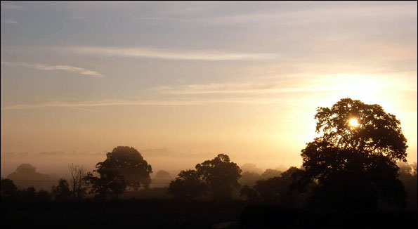
 Yes, it's nearly November - but positively balmy best describes the prospects for this week's weather. The warming trend has started today, as we draw up a very mild and moisture-laden southerly flow of air from the eastern North Atlantic Ocean.
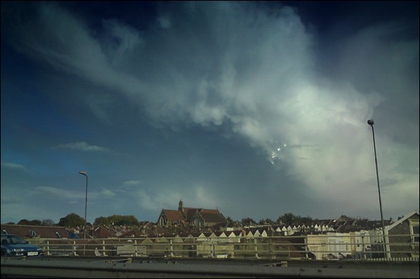
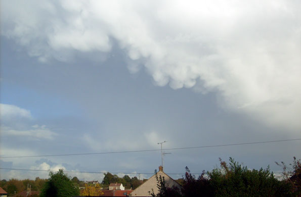


 ut looking at the set-up, I'm reckoning it's a very low likelihood for any tornado sightings tomorrow. I'd be interested to read the thoughts on this from the extreme weather aficionados, here on the blog...
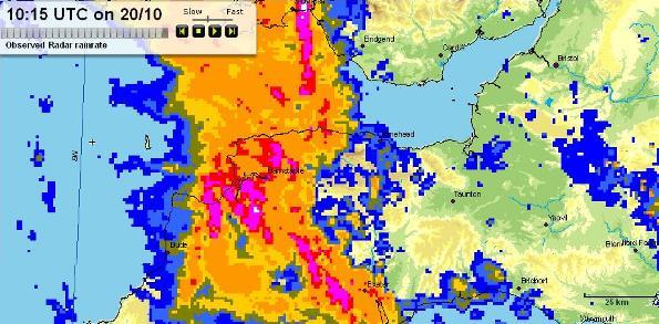


![Ex-Tropical Storm Grace, south of Ireland, on Tuesday 6 October 2009 (Copyright [2009] EUMETSAT](https://bbctodays.pages.dev/blogs/weather/ianfergusson/grace_vissat.jpg)

 I'm Ian Fergusson, a BBC Weather Presenter based in the West Country. From benign anticyclones to raging supercell storms, my blog discusses all manner of weather-related issues. I also provide updated race weekend forecasts tied to our BBC coverage of Formula One. You can follow me on