
North-west Wales has borne the brunt of the wind and heavy rain recently. We’ve seen over 150mm of rainfall Near Capel Curig in Snowdonia. In the past few days 6 inches of rain has fallen! This is very evident in some of the swollen rivers. At the moment, there are eight flood alerts in force and two flood warnings.
The wind is also a big presence this week; it will be strong to gale force. The highest gust recorded on Monday was 66mph in Aberdaron on the Llŷn Peninsula and 54mph at Mumbles Head in Swansea.
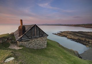
Llŷn Peninsula, Kris Williams
Monday night will continue to be breezy, and there will be further rain and drizzle as well. We will also see some low cloud and hill fog. It should remain a mild night; temperatures well above average for the time of year at 11 to 14°C.
Tuesday's chart shows high pressure over France, and a cold front lying through Scotland and N.Ireland with moist south-westerly winds for Wales.
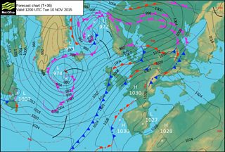
Weather chart for Tuesday 10 November
On Tuesday morning much of the country will see a dull and damp start to the day, with low cloud, mist and hill fog. The rain is heaviest on high ground and will continue to be breezy. The winds will be strongest on exposed coasts and hills. It should be drier in the marches and in the north-east and feeling relatively mild. Temperatures in Wrexham will reach 15°C.
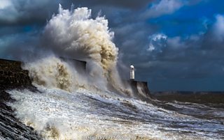
Powerful winds in Porthcawl, Daniel Ryan
During the day there will be little change and further outbreaks of rain and drizzle. It’ll be wetter on high ground in the south and west and slightly drier in the lee of the hills and mountains in the north and east. Temperatures will remain above average between 14 to 17°C. However it won’t feel mild at all in the wind!
Tuesday night into Wednesday should see the wind ease a little. There is more rain and drizzle however, and heavy rain in the north and north-west. It’ll be drier in the south and remaining mild.
On Armistice Day it’ll be breezy with spots of drizzle. There will also be some drier spells with possible glimpses of sunshine but during the afternoon into the evening a cold front will move south east bringing more persistent and heavier rain with it. Temperatures remain around 14 or 15°C with a south-westerly breeze.
On Wednesday night the rain will clear. I’ll be much clearer and cooler with temperatures falling as low as 8°C in Tredegar and Blaenau Ffestiniog by the end of the night.
Thursday morning should be dry and bright but it won't last as more rain is on the way during the afternoon and evening. The wind increasing again as well!

Aneurin Bevan Memorial in Tredegar, Karl McCarthy
So it’s fair to say it’ll be an unsettled and changeable this week. Damp, wet and windy at times with drier, brighter weather and showers in between. Generally the temperatures will be mild, but dropping by a few degrees on Friday.
Derek
