
We've had a taste of summer at times over the last couple of weeks - but this week's looking much more mixed.

Graigwen by Dai Parker
Monday will be largely overcast with some rain which will slowly ease but it will remain cloudy with some mist patches and south-westerly winds. Despite the lack of sunshine it will still feel a bit muggy with top temperatures 16ºC in Ceredigion and 19ºC in Flintshire.
On Monday evening patchy rain will continue before easing overnight. It will be quite a mild night with some mist and hill fog. The cloud will sustain temperatures between 11ºC and 16ºC.
A weather front has been waving back and forth bringing Monday’s rain, and pushing back northwards. There is some uncertainty about its exact positioning, but it will bring further rain on Tuesday morning - especially for mid and south Wales - probably patchier than Monday. On Tuesday afternoon it should turn drier from the northwest, brightening up slowly as that front moves south-eastwards but still remaining misty and murky with lighter winds leaving temperatures in the mid to high teens.
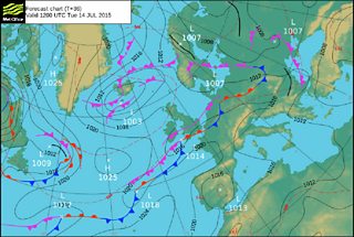
Met Office Pressure Chart for Tuesday 14 July
On Tuesday night the front will clear and a brief ridge of high pressure will build from the west into Wednesday. So any lingering rain and drizzle should clear on Tuesday night with some mist and fog patches remaining. It will still feel mild turning drier overnight.
Wednesday will be a big improvement feeling much brighter and warmer with sunny spells. Temperatures will be in the high teens possibly low 20s. However, the waving weather front that brought rain in on Monday and Tuesday is a long trailing system way out into the Atlantic - which could bring more rain on Thursday and Friday.
So a brief improvement midweek - brighter Wednesday - but it could turn more unsettled later in the week.
