
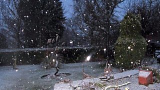
Snowfall in Llandrindod Wells by Sian Riley
Parts of Powys woke up to a white Christmas last year.
But the only snow we’ll see on Thursday morning will be on your Christmas cards although a few snow showers are possible on Snowdon!
In the meantime, the next 36 hours will continue mild and windy with some rain and drizzle at times. The heaviest rain will be in the north-west on the Snowdonia Mountains with a yellow warning in force.
Heavy rain tomorrow night will clear and Christmas Eve will be a much drier, clearer and colder day with sunshine and a few showers in the north. Top temperatures will be around 7 to 9° Celsius and it will be breezy with a brisk west to northwest-westerly wind.
On Christmas Day much of the country will be dry, bright and crisp with any showers in the north dying away. The wind will ease with temperatures rising to between 6 and 8° Celsius.
Christmas night will be fine and cold with light winds. A widespread frost is likely together with a few mist and freezing fog patches.
Boxing Day will start dry and cold but the wind will increase with rain spreading from the west during the afternoon and evening. Temperatures will recover reaching 5 to 9° Celsius with a freshening southerly wind.
The forecast into next weekend is more uncertain, depending on the depth and track of an area of a developing low pressure. However, there is a risk of some travel disruption by Saturday with a spell of heavy rain and gales followed by clearer, colder conditions and wintry showers.
