
The weather is looking pretty mixed over the coming days.
High pressure will build through Sunday bringing better conditions and sunny spells, but there's no sign of a heatwave just yet.
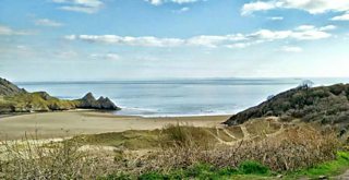
Three Cliffs Bay photograph by Mark Murphy
Friday afternoon is a cloudy and wet one. A cold front has brought a lot of cloud and some rain in from the west. Some heavy pulses are likely across Pembrokeshire and Snowdonia. There'll be brisk winds too, with gusts of up to 30mph for exposed areas.
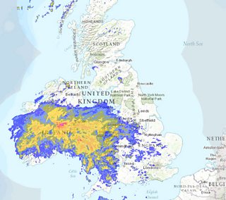
Friday's radar map
Through Friday night the rain will clear to showers. We'll hang on to a lot of low-level cloud with some hill fog. It should be a frost-free night thanks to the cloud and the gusty winds too - reaching 30-40mph during the overnight period. There'll be overnight temperature lows of 8-10°C.
We'll see a cloudy start to Saturday with showers or longer spells of rain. Then high pressure will build from the south and start to clear the showers. Any wet weather will become confined to the north. There'll be brighter spells by the afternoon with lighter winds and temperature highs of 12-15°C.
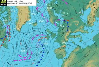
Pressure chart for Sunday 10 May
Sunday will be largely dry and bright, but it will turn cloudy from the west with rain arriving overnight.
There'll be some fair weather to look forward to next week.
