
It's been a good week of sunny weather - apart from Thursday, when I saw a lot of soaking wet people walking around and complaining. Not surprisingly, as Cardiff was the wettest place in the UK with over 30mm of rain - that's more than an inch in around 12 hours. It's always nice to end the week on a bright note. I must say my 4.15am alarm hurts much less this time of the year!
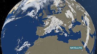
Satellite view
Here is the picture from space - as you can see Wales is not doing too bad today. Look out to the west of Ireland and you can see fronts gathering. That will bring thicker cloud from the west through Friday afternoon and some light and patchy rain in the night. I love evening rain, it's got to be the best time to have it - the garden needs it. The rain will clear before sunrise.
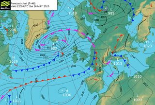
Pressure chart for Saturday 16 May
As you can see on the pressure chart by lunchtime on Saturday high pressure is trying to build from the south-west and low pressure is also trying to take charge from the north-west. There'll be a lot of dry weather on Saturday, although I can't rule out the odd shower in the north. The north-westerly breeze will take the edge off the temperatures. It will not be as warm as Friday with highs of 11-13°C.
Sunday will start off chilly and bright. With the cloud thickening and brisk winds it will feel fresher. There'll be a few showers across mid and north Wales. Rain will arrive through the evening and clear on Monday morning. Next week is looking unsettled with a mixture of sunshine and showers.
I'll leave you now with this lovely picture sent in by Colin Baglow showing apple blossoms at Three Cocks, Brecon. Have a fab weekend.
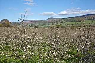
Apple blossom at Three Cocks, Brecon by Colin Baglow
