Flooding concerns remain but change to colder and wintry weather on way
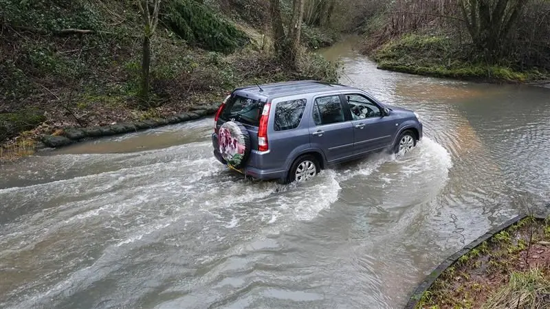
Roads flooded in Birmingham earlier this week after prolonged rain, with flood warnings still in place across the UK
- Published
Around ninety flood warnings, most across England but three in Scotland, remain in force as the UK's wet winter continues.
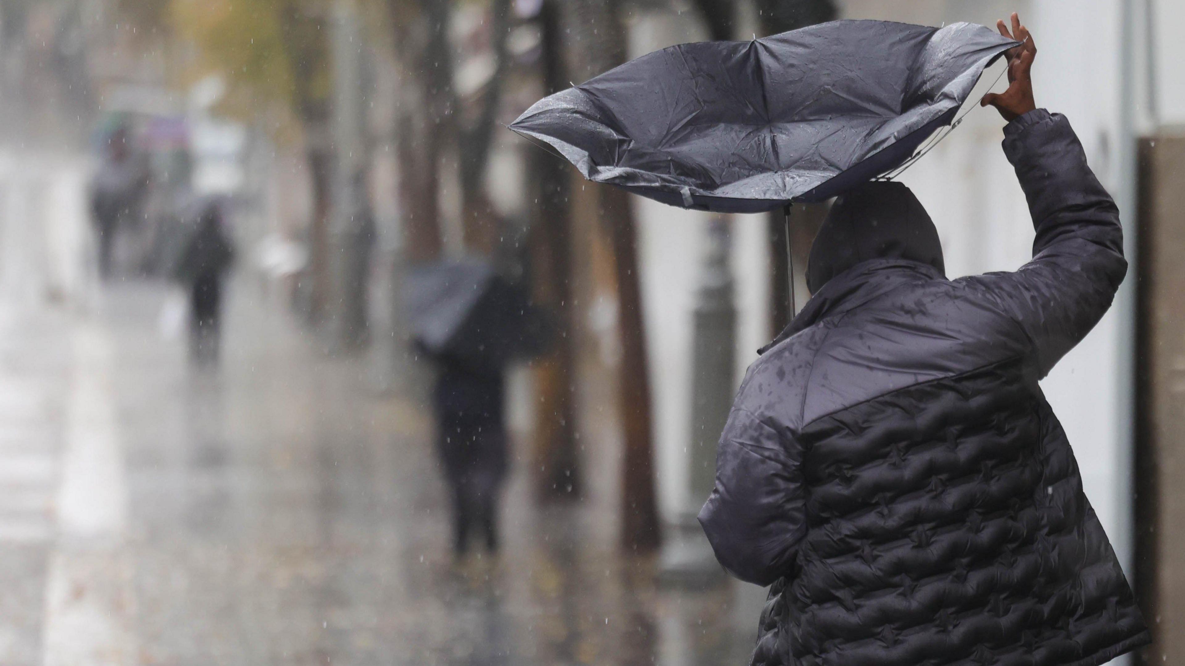
More rain is expected throughout Wednesday into Thursday, bringing an unwelcome top up.
But change is on the horizon with colder weather on Friday bringing the risk of snow and ice along with cold-health alerts issued.
And by the end of the month, it is possible high pressure may bring more settled weather conditions.
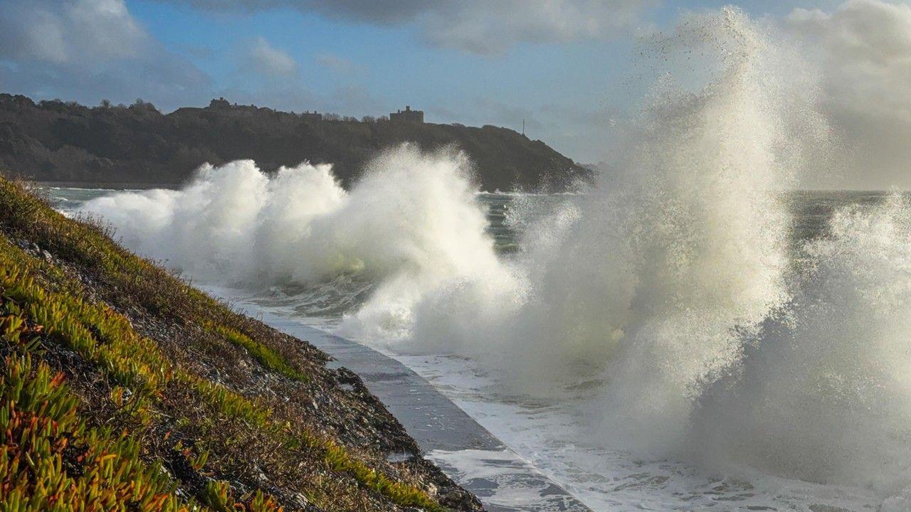
Parts of the UK have been hit with a real deluge of rain so far this year with Cornwall and County Down recording their wettest January on record.
It has been particularly wet in southern England, Northern Ireland and East Scotland.

The River Trent in flood as Beeston Weir, Nottinghamshire on Tuesday
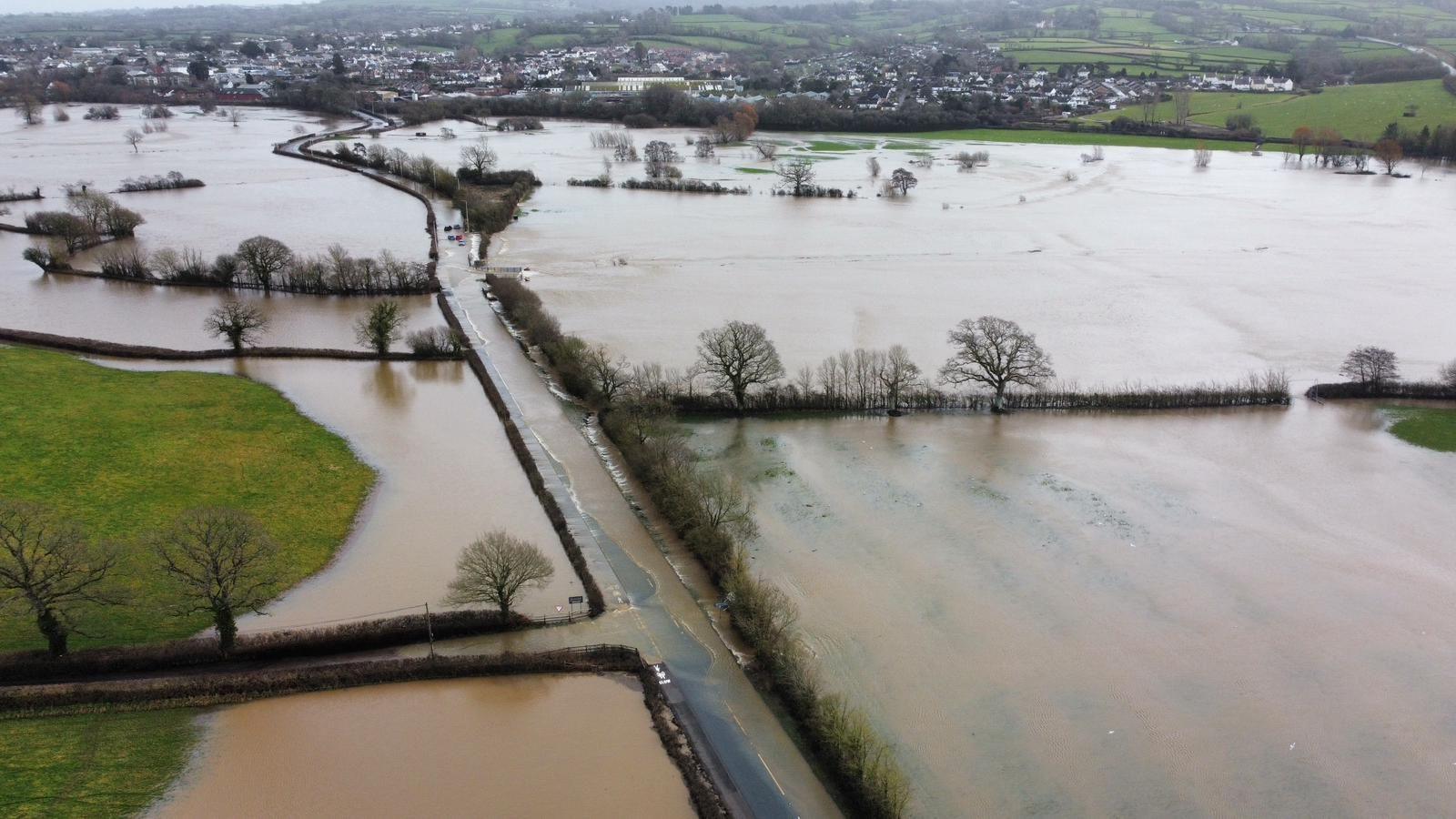
The majority of the flood warnings in place across the UK are for areas around Dorset and Somerset, with river flooding as well as flooding from ground water.
If recent history is anything to go by, we shouldn't expect any quick improvements in terms of the number of flood warnings in force in these areas over the next few days.
Elsewhere there are flood concerns along stretches of the River Trent and the River Severn in the Midlands. These rivers tend to be quite slow to respond to heavy rain, but the number of warnings in force should continue to drop as the flood waters flow out to sea.

A blocking area of high pressure in Scandinavia has prevented areas of low pressure from moving east over recent weeks
Our weather is stuck in a rut, but change is on the way
Around 17 January a blocking area of high pressure developed in Scandinavia and it's still there to this day.
This has prevented areas of low pressure from moving beyond the UK, so they've become slow-moving, bringing very wet weather, with south-west winds to the south of the UK and south-easterly winds to the north of the UK. This wind pattern is responsible for the distribution of rain.
The Scandinavian blocking area of high pressure is finally going to budge this week, allowing our weather to change.
On Friday colder air will start to move in from the north, not only bringing some welcome sunshine but also some snow and ice.
There are yellow Met Office snow and ice warnings issued for much of Scotland and northern England from 16:00 GMT Thursday to 12:00 Friday.
Rain will turn to snow initially over high ground but it could fall at lower levels for a time.
Above 300 metres, a few locations may see as much as 10 cm settling.
The rain and snow is expected to clear south during the early hours of Friday with temperatures expected to fall quickly as skies clear, leading to ice on untreated surfaces.
The UK's Health Security Agency has also issued yellow alerts for the colder weather across northern England and the Midlands from 06:00 GMT Friday to 08:00 Monday.
Next week our weather patterns will become more typical for the time of year with the Atlantic jet stream returning to the north-west of Scotland, rather than taking an unusual position near Morocco.
There will still be rain around as we'd expect in winter, but some of the wettest weather will return to west Scotland. The rain won't be as extreme in east Scotland. In the southwest of England, it won't rain every single day, there will be drier and sunnier days between our weather systems.
Heading towards the end of February, there are hints that an area of high pressure may visit our shores, bringing some more settled weather conditions. It's a long way off, but it's the least we deserve given just how wet and dull it's been over recent weeks.
Think it's rained every day this year? You're not wrong
If it feels like the rain just hasn't stopped this year, you might be on to something. Cardinham in Cornwall has recorded some rain every single day of the year so far.
Katesbridge (County Down) and Aboyne (Aberdeenshire) recorded nearly four times their January average rainfall, and history is repeating itself this month.
We're not even at the half way point of the month and Aboyne has already recorded its wettest February on record. This is after its wettest January on record too.
Aboyne and Aberdeen are also closing in on the record for thier wettest winter on record (the combined December, January and February rainfall).
For the UK as a whole, this winter has been, it's unlikely to beat the rainfall of the wettest winter on record, the winter of 2013-14.
In the south-west England and South Wales region, data from the Met Office shows that 691mm of rain fell then, causing widespread severe flooding.
Combining the figures for December 2025 and January 2026 gives us 415mm, but already the record looks to be far out of reach.
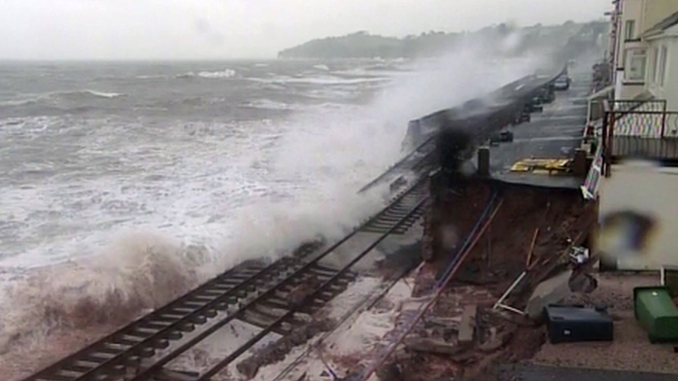
One parallel between this winter and the winter of 2013-14 is the damage done to the main railway line at Dawlish that connects southwest England to the rest of the rail network.
You might remember in February 2014 that the track was left dangling precariously high in the air as storms washed away the protecting sea wall. This winter has also seen a section of sea wall collapse due to the onslaught of storms causing some disruption.
It's worth pointing out that it hasn't been wet everywhere.
North-west England and west Scotland had a much drier January than normal, and parts of the Highlands have only recorded 1mm of rain so far this month.
- Published12 February
- Published2 February
- Published5 February 2024
- Published2 April