Could the remnants of Hurricane Erin bring wet and windy weather to the UK?
- Published
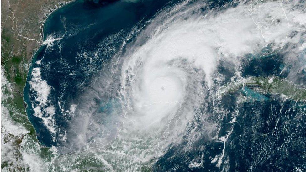
Hurricane Erin is weakening and will track northeastwards into the far North Atlantic this weekend.
Along the eastern US coast, Erin continues to generate life-threatening rip currents, and rough seas are expected to persist for the next few days, despite the storm remaining well offshore.
As Erin moves into higher latitudes, it will decay further and transition into what meteorologists call an "extra-tropical" system, or ex-hurricane.
Its effects may reach Ireland and the UK as early as Tuesday, but impacts are expected to be minimal. Ironically, the tropical air carried by Erin will bring the UK a brief spell of higher temperatures and sunshine before cooler, unsettled weather develops.
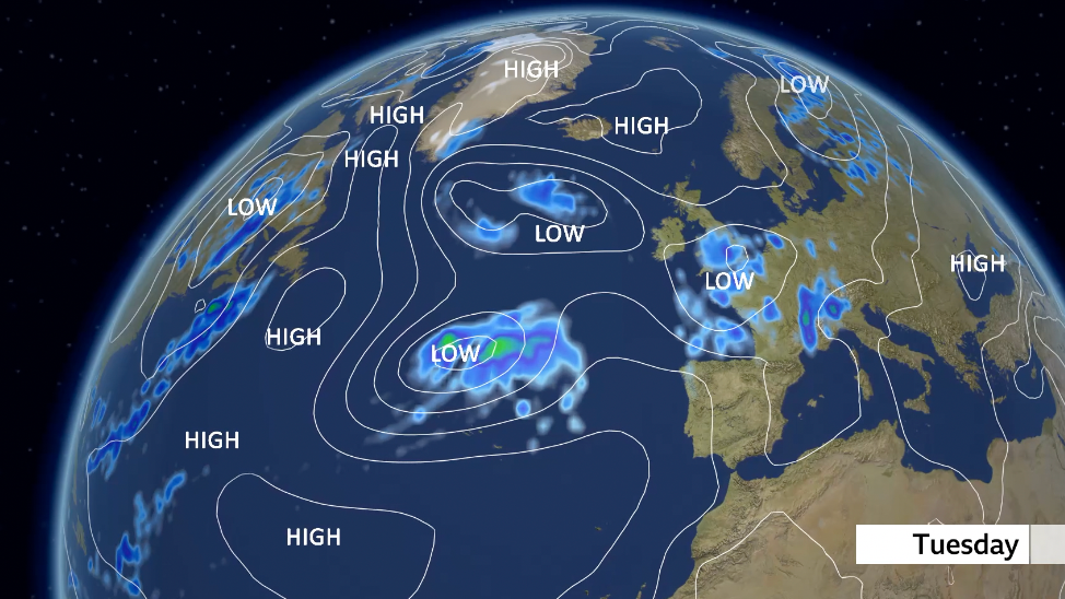
By Tuesday the remnants of ex-Hurricane Erin are still in the mid-Atlantic as an area of low pressure, though uncertainty remains on its track later in the week
A warm weekend courtesy to Erin, followed by an unsettled week ahead
After a brief spell of warmth from Erin on Monday, the weather is expected to turn cooler and more showery for the rest of the week.
By then, the remnants of the storm will have transformed into an area of low pressure, with spiralling rainclouds spreading across much of Europe, bringing an autumnal feel.
While ex-hurricanes can sometimes retain significant strength as they track towards Europe, this time we will be spared any severe gales - although rain may still be heavy at times.
The UK cannot be hit by a 'real hurricane'
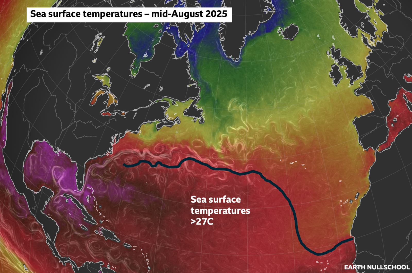
Sea surface temperatures in southern parts of the Atlantic Ocean are above 27C, the temperature needed for the development of hurricanes
Hurricanes need a few atmospheric ingredients to come together to form: a disturbence in atmosphere, sea surface temperatures above 27C, and little changes in wind through the atmosphere.
And it is the warm waters of the Gulf of Mexico, the Caribbean and southern parts of the North Atlantic that can really fuel and supercharge storms to become big hurricanes.
The tropical storms and hurricanes will occasionally affect the Carribean and eastern seaboard of the US before moving east back out into the North Atlantic.
For a while these can often be sustained as hurricanes due to the warm waters.
But eventually, as they move further north and east, the Atlantic gets cooler - 16 to 20C in mid-August - cutting off the energy needed to sustain a tropical storm or hurricane.
This is the reason why the UK will never be affected by a proper hurricane.
Hurricane hype
Ex-hurricanes heading our way can often conjure up wild headlines and speculation.
But in reality the weather that the UK may end up getting is no different to the occasional stormy weather we can sometimes see in autumn and winter.
Strong winds and heavy rain are part of that.
The most noteable ex-hurricane to impact the UK and Ireland was Ophelia in October 2017.
Moving up the west coast of Ireand, strong winds resulted in power cuts and travel disruption in western parts of the UK.
With a southerly airlfow linked to it, Saharan dust and smoke from Portuguese wildfires was also transported to the UK, resulting in eerie red skies.
The Atlantic hurricane season runs from 1 June to 30 November but most tropical storm or hurricane activity occurs from mid-August to mid-October.
So as we enter this period, there is a greater chance these could end up coming across the North Atlantic towards the UK.
- Published22 May 2025
