Cool now, but warmer into April
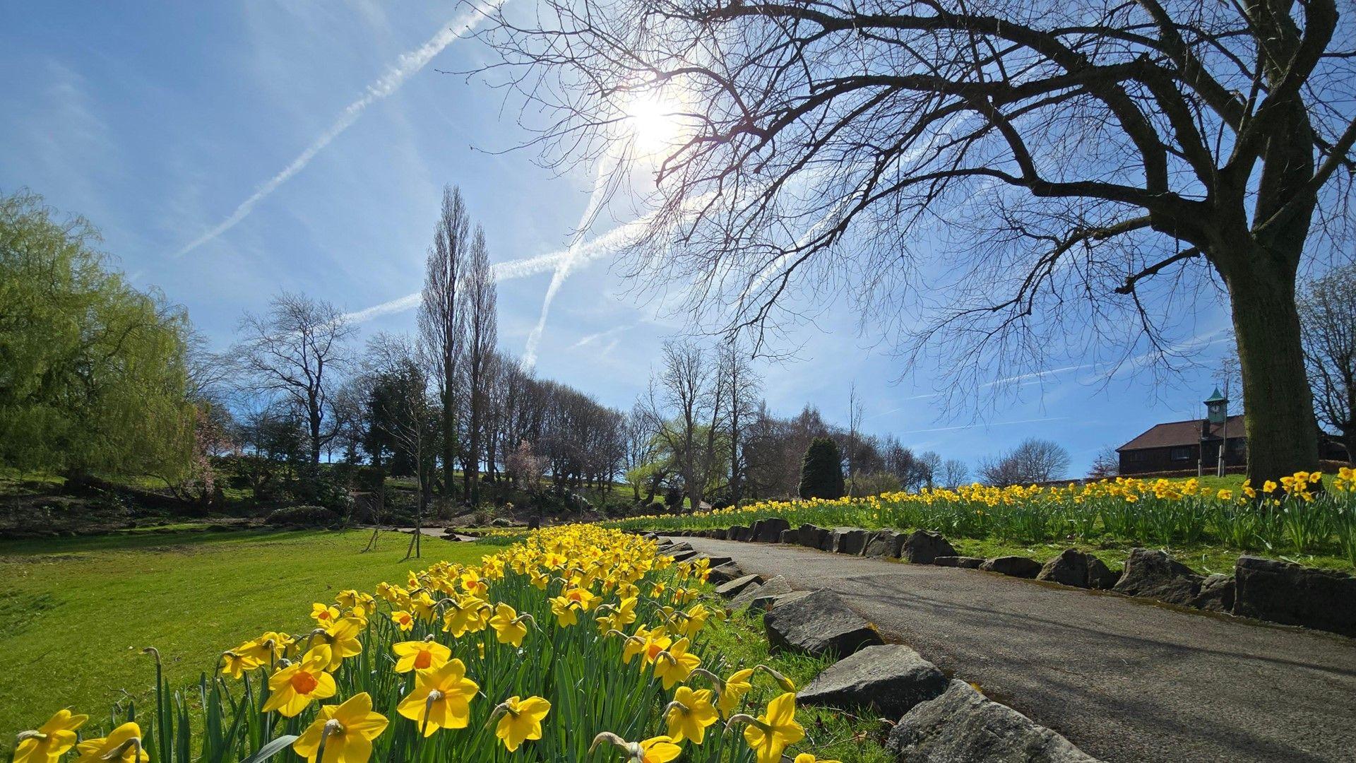
Another lovely day in Wakefield, West Yorkshire on Thursday
- Published
You may have noticed it feeling warmer over the last couple of days but cooler weather has returned in time for the start of the weekend.
The drop in temperature will be accompanied by more unsettled weather, but rain will not fall evenly.
However, temperatures are forecast to rise again into the start of April with plenty of sunshine expected.
Cooler weather expected to be short-lived
It's definitely been feeling warmer than it did than at the start of this week.
On Wednesday, Plymouth in Devon was the warmest place in the country. The temperature here reached 18.6C.
On Thursday, England and Wales have again been warmer than normal for the time of year after early mist and low cloud lifted and the sun came through.
Scotland and Northern Ireland have been much more cloudy with some rain moving in from the Atlantic.
Friday brings a different feel to the weather with stronger north-westerly winds. Temperatures will be around average, or a little below for some, ranging from 8 to 12C, along with chillier nights.
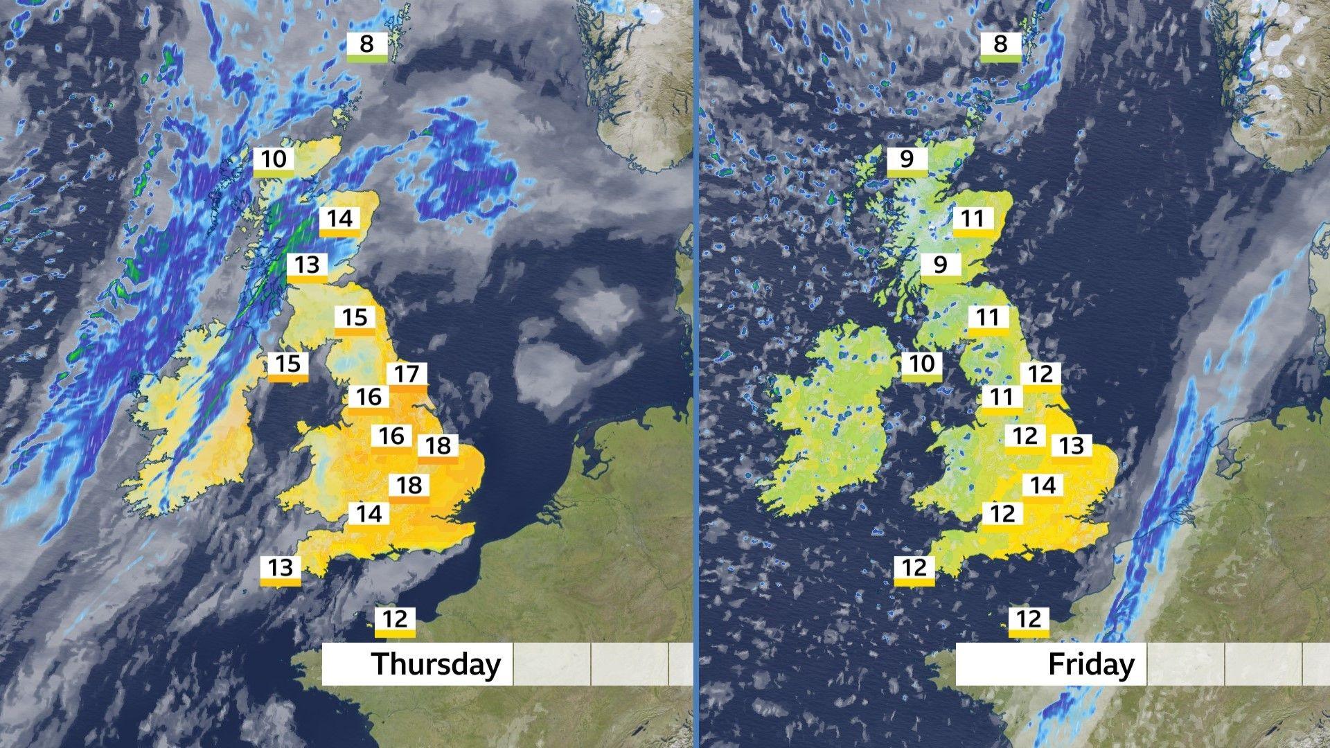
What a difference a day makes. Much cooler on Friday with sunshine and showers.
How much rain will there be?
On Friday, most of the rain will fall as blustery showers - some of which will be heavy with hail and thunder in places. Another spell of rain is expected to move in from the Atlantic on Saturday with a dry day for most of us on Sunday.
The amount of rain to fall will vary significantly across the UK.
North-western parts of the UK will be in the firing line. Highland and Argyll & Bute in Scotland could get 50mm (2 inches) of rain or more.
South-eastern parts of England will get only a few millimetres at most. And here it is shaping up to be a very dry March.
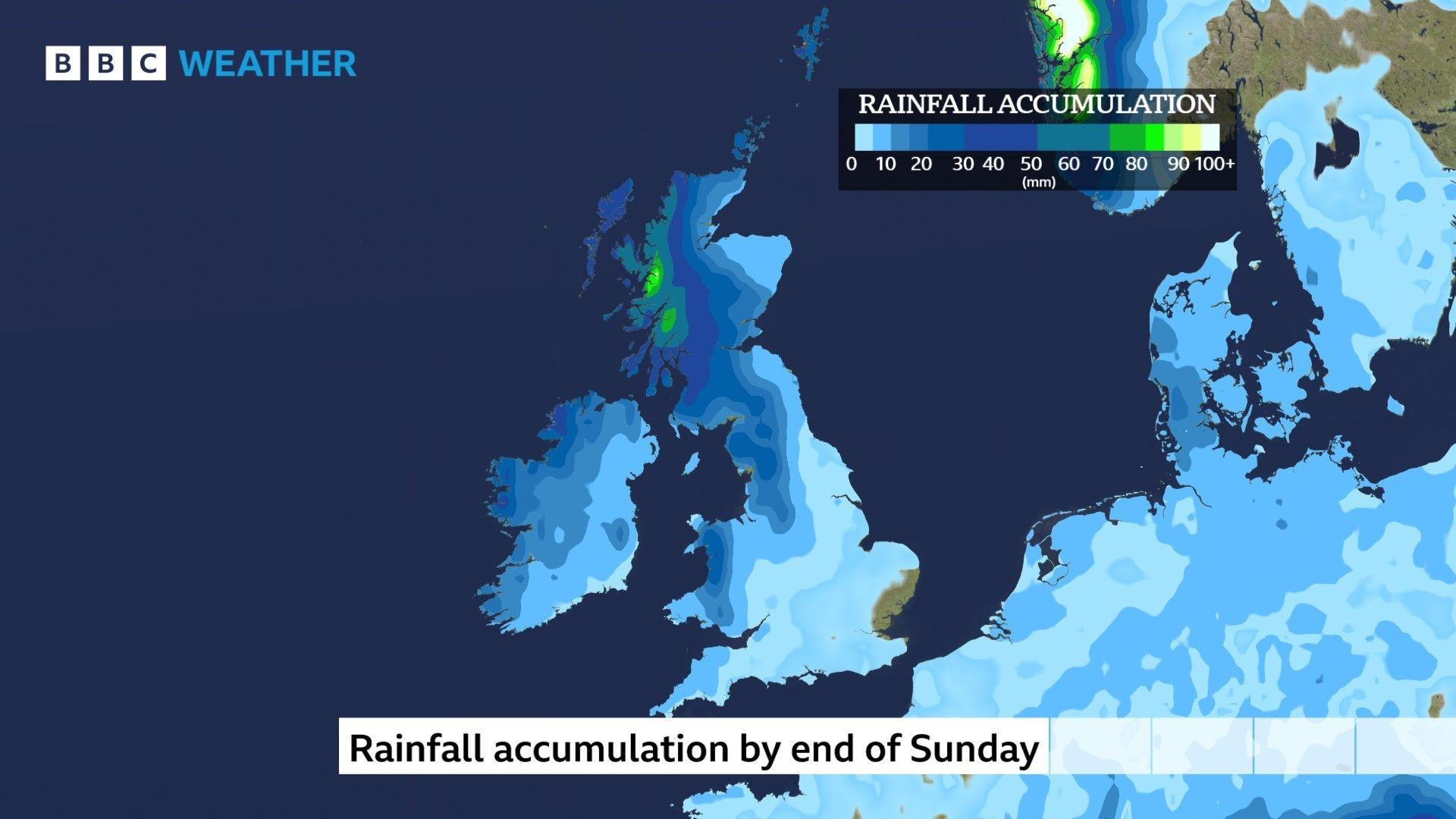
For the rest of March most of the rain will fall over some western hills.
How wet has March been?
Unusually it has been the far north and the far south of the UK that has had most of the wet weather this month.
Lerwick, in Shetland, and St Mary's in the Isles of Scilly had both had their typical rainfall for the whole of March by early this week.
By contrast, many places in England and Wales have been very dry with less than 10% of their March average rainfall.
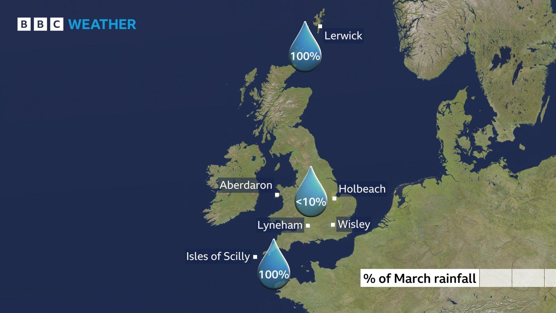
Big differences in the rainfall received across the UK.
More changes for the start of April?
This is a transition time of year as weather patterns move from winter to summer and big fluctuations in the weather are not unusual.
There have been some wild weather stories in the media over the last few days but one story may have merit.
Sunday will see temperatures starting to rise again. But if an area of high pressure builds to the east of the UK next week, that would mean a southerly airflow and more warmth.
Not all weather computer models are in agreement but it is possible that the first week of April could bring the warmest weather of the year so far, exceeding the 21.3C recorded on the spring equinox.
Keep up to date with the longer range forecast here.
- Published22 February 2021
