Internet inspiration - Online maps
Some online maps are: Google; Multimap; Streetmap (UK only). Use them to:
1. Teach countries, continents, oceans and sea names and talk about where learners have been and would like to visit
2. Teach and test the cardinal points
3. Challenge learners to direct each other around the world
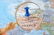
4. Google Street View currently allows you to navigate the streets of the UK, Netherlands, France, Italy and Spain via a series of photos.
Use it to: show your learners a couple of scenes from a city and get them to ask questions to guess where it is; teach directions and descriptions of monuments and useful buildings
Please contact us if you have any other ideas for using online maps in class and we will publish the best ones.
