Proceed up Vallée des Vaux past the Harvest Barn, taking the third left into the lane marked Vailde des Vaux (which becomes Rue du Vieux Moulin). Turn left at the very top of the hill (Rue de la Hauteur), left again at the T-junction (Rue de la Garenne), then first right and immediately left into Rue Becq.
At the next crossroads fork left (Rue de Brabant) past the Little Loft Art Gallery and Brabant Riding Stables on your right, and the back of Trinity Manor. Turn right at the junction of Rue de Brabant and Rue des Monnidres. Pallot’s Steam Museum is on the left at this junction.
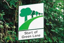
Turn right at the end of the lane, then shortly after left and immediately left again into Rue du Feugerel. Cross over the main St John’s Road, right at the T-junction (Chemin de Hérupe) and second right down the hill into the ‘green lane’ (Rue du Pont). Notice the fine 18th century properties in this lane; the last one on the left is a ‘cod house’ marked by the pineapples on the gate posts.
Cycle straight across the next crossroads, then right at the main road and immediately left into a short leafy lane. At the end turn right (Mont Mado, B52) and follow the main road for a short distance until the second turning on the left, Rue de la Mare des Prés. Be careful at the next junction; carry straight on into Rue des Barraques if you want to take the detour into Bonne Nuit Bay, where you will find cafés and restaurants. The road brings you back up on to our route, but is a very steep climb.
If not, turn sharp right here (still La Rue de La Mare des Prés, becoming Rue des Platons).
There are now no turnings for about 1.5 miles (2.5 km). Just near the BBC radio masts is the highest point of the Island at 149 metres. There are some lovely tracks for walks in this area amongst the valleys and along the coast.
At Rue du Tas du Geon (C97), the turning off along La Vieille Charrière will take you down into Bouley Bay again, this has a steep descent.
At the end of Rue du Tas du Geon, by the Le Vesconte Memorial, turn left into Rue de la Petite Falaise (C96), past the Bouley Bay Hotel.
Keep to the right and turn first left in the direction of Rozel, Route d’Olivet (C95). The second on the left takes you to Jardin d’Olivet, which on a clear day offers excellent views of the Normandy Coast.
Continue towards Rozel along Rue des Bouillons.Turn right at the next T-junction into Rue du Pot du Rocher (ignore the road on the right prior to this) and at the next crossroads is the Jersey Wildlife Preservation Trust. Cross over into Rue de La Piéce Mauger. Turn first right into Rue de la Fosse. Turn left after half a mile (1.3 km) into Rue des Camps Rault.