
Snow in parts of mid and north-west Wales today has caused some travel disruption with school closures in Gwynedd and in Ceredigion.
The air over us has come from the Arctic and as that cold air moves over the warmer Irish Sea it becomes unstable, the air rises and cools forming shower clouds. The wind direction is crucial as to where these showers end up. Monday's wind is from the north or north-west and so the showers have been blown inland affecting the north-west and parts of mid and west Wales with a few lighter showers or flurries in the south.
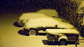
Snow in Blaenau Ffestiniog by Rory Trappe
Monday evening's showers will affect western parts overnight, falling as rain, sleet or hail on the coast and as snow inland, with a few centimetres on the Preseli mountains. Elsewhere it will be dry with a widespread frost, a few freezing fog patches and a warning of icy patches.
On Tuesday morning wintry showers in Pembrokeshire will clear and much of the rest of the country will be dry and bright with plenty of winter sunshine once any freezing fog patches lift. Temperatures will reach 2 to 5°C in the afternoon with a light to moderate north to north-easterly breeze.
The rest of the week will be dry apart from maybe a few showers in Pembrokeshire from Tuesday overnight into Wednesday and a snow flurry in the north.
Sunny spells are likely with widespread overnight frosts. It will remain on the cold side with a noticeable north to north-easterly breeze.
If you’re in Cardiff for the start of the Six Nations rugby tournament on Friday the latest forecast is dry with a high of 5°C.
The weekend should be dry and it looks like high pressure will bring plenty more dry weather next week. Little precipitation (rain, sleet or snow) is expected especially in the south and temperatures may rise closer to the seasonal average.
It currently looks most probable that high pressure and a spell of more settled weather with below average rainfall will dominate the second half of the month.
