
As expected there was a chill in the air over the weekend with a few showers.
Hail and sleet fell in places and it was cold enough for snow on high ground too but thankfully there were some sunny spells, especially on Sunday when RAF Valley on Anglesey enjoyed nearly eight hours of sunshine.
Thanks to everyone who follows me on Twitter. Here are a few pics that have caught my eye recently:
Air photographer, Paul Heasman snapped a nice aerial shot of snow on Snowdonia.
Dani Brockway sent in this one of my beloved Barry Island and here's amagical shot of the view from Y Garn by Jim Martin.
With a clear sky last night there was a widespread frost around Wales.
The weather station near Capel Curig in Snowdonia recorded a low of -3.7°C, making it the coldest night since January 12 2014 when Alwen in Denbighshire recorded a low of -4.5°C.
After a bright start today the weather is now changing with a front moving slowly north-east, bringing rain and a brisk south-easterly wind.
Most of Wales should become dry and clearer again by the end of tonight though.
Temperatures will stay above freezing tonight but a ground frost is likely in the southwest, in Carmarthenshire, Ceredigion and Pembrokeshire, where the temperature will drop as low as 2°C.
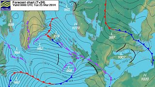
Forecast chart 24 March 2014
The next few days will bring a mixture of weather with some sunshine, a few showers and the risk of ground frost overnight.
Later in the week high pressure over Scandinavia will move westwards between Iceland and Scotland.
This means a spell of brisk easterly winds which is not unusual at this time of year.
There may be some rain and showers next weekend but temperatures should start to recover, perhaps even rising above normal.
Derek
