
Our weather is stuck in a rut at the moment with high pressure keeping it generally dry. The autumn so far is turning out to be better than the summer with rainfall below average and the dry spell is set to continue for the next several days. There has been snow in parts of Europe recently but that is not heading our way. Some torrential rain is likely in southern Italy and the Balkans. Low pressure to the west of Iberia will bring some heavy rain, showers and stronger winds to Portugal and western Spain over the weekend
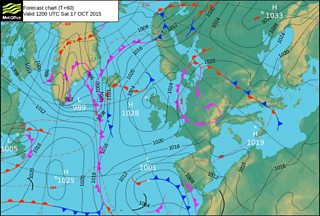
Met Office weather chart for Saturday, 17 October
Compared to last week, temperatures have dropped by a few degrees with colder air arriving from northern Europe and Russia. Some of us have woken up to a frost. At Capel Curig in Snowdonia the temperature has fallen as low as -1°C but there is still enough energy in the sun at this time of year to make it feel pleasantly warm. On Wednesday, Eglwyswen in Pembrokeshire was the warmest spot in Wales with a high of 15°C.
Over the weekend, the dry spell is set to continue. More cloud is likely, but there should be some breaks as well. Sunday may be brighter with sunny spells. Temperatures will be on the cool side reaching 11 to 14°C with a light to moderate breeze from the north east.

Capel Curig taken by Wynn Owen
Next week, high pressure will keep it dry and settled on Monday and Tuesday with overnight fog and frost in places. On Wednesday a front will move south bringing a little rain. Beyond that, it looks like high pressure will give way with more changeable weather expected, with outbreaks of rain interspersed with drier, brighter or sunnier interludes.
Temperatures should rise later next week and the weekend of the 24th/25th October looks more unsettled. As we go into November high pressure may take control again bringing a return to drier, more settled conditions but this is only a possibility and at the moment my confidence in this is low.
