
A blustery wind made it feel cold yesterday, but thankfully the wind is lighter today and it's a lovely start to the week, thanks to high pressure centred close to Ireland.
Over the next few days, there's plenty more fine weather and sunshine to come. It's strong April sunshine too, with moderate to high UV levels, so don't forget the sun-cream.
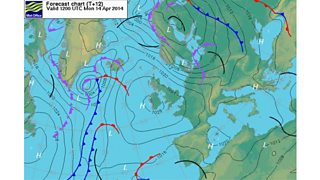
Forecast chart 14 April 2014
It will become a little warmer over the next couple of days, but with a clear sky overnight it'll turn chilly with temperatures falling close to freezing by dawn with a ground frost in rural areas, so gardeners beware.
Later in the week, high pressure will move away into the continent and this will allow a weak front over Scotland and Northern Ireland to move southeast across the UK. This will bring cloudier conditions on Thursday, and also a few spots of light rain, but no more than that.
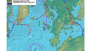
Forecast chart 17 April 2014
At the moment, Good Friday should be largely dry. Saturday will probably be dry and brighten-up from the southeast. Sunday may start fine but there are signs of a breakdown to more unsettled conditions.
So, we're in for some nice weather ahead but Easter weekend might not remain completely dry.
