BBC BLOGS - Paul Hudson's Weather & Climate Blog

Archives for March 2010

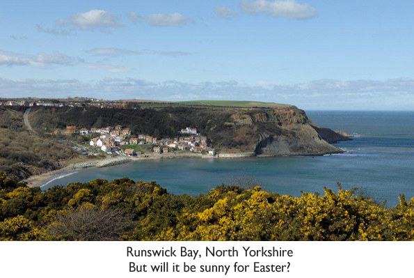
A fine Easter weekend? Don't bank on it!

Paul Hudson |16:48 UK time, Wednesday, 31 March 2010

Comments

It's one of the busiest times of the year at our airports - full of passengers fleeing the country in search of warm sunshine.

And their search for better weather abroad is understandable. A look back over past Easters show that fine, warm, sunny conditions are definitely the exception to the rule.

In 1998, torrential rain on Good Friday brought severe flooding to parts of Central Britain, leading to insurance claims in excess of £1 billion pounds. In fact the inadequacy of the flood warning system led to an inquiry, the result being a much more sophisticated flood warning system that we have relied on heavily ever since.

Easter 2000 was also ruined across parts of the UK with some torrential rain.

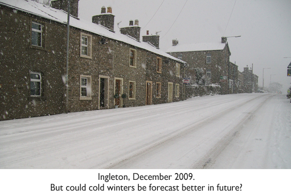
And as strange as it may sound, you are statistically more likely to have a white Easter than a white Christmas. We only have to go back 2 years, to Easter 2008, when heavy snow fell the night before Easter Sunday, leaving virtually the whole of Yorkshire blanketed in several inches of snow.

Easter 1975 was also cold and wintry across Yorkshire with raw Northeast winds. In the Midlands, Birmingham had 6 inches of snow throughout the Easter weekend.

Snow also caused widespread travel disruption across the UK in 1983.

Spring can be a season of large extremes. There is often a lot of cold air left over from winter, and importantly the North sea is at its coldest in March and April, leading to chill sea breezes. But at the same time, the sun is gaining strength day by day, so spells of warm weather can always take us by surprise.

Runswick.jpg

March 1965 was a month of incredible extremes, highlighting just what is possible at this time of the year, producing some truly astonishing statistics.

During the first week of March the temperature had dropped to minus 21.7C across Scotland, making it the coldest day of the year, very unusual for that to occur in March.

But only 3 weeks later, temperatures rocketed 25C in Wakefield, West Yorkshire. This is still the joint UK record for the hottest March day ever. But any thoughts that we were in for a 'barbecue summer' proved unfounded - as temperatures for the rest of Spring and Summer never exceeded those balmy levels, 25C turning out to be the hottest day of the year.

It must have been a wonderful weekend along the coast, with 25C (77F) also recorded in Whitby, on March 29th.

Warm, sunny Easters are rare, but do happen from time to time. And as you might expect, the later Easter falls, the more likely you are to have a warm weekend.

Easter 1949, which fell that year on April 16th, saw temperatures rise to 29C (84F) in London, with temperatures across much of the country exceeding 21C (70F). Easter 1984 fell in late April, with warm and sunny weather for most, and more recently the early April Easter of 2007 was fine and warm.

Unfortunately this Easter weekend is unlikely to deviate from the norm, being mostly cool and unsettled, but with some spells of pleasant sunshine - so although a complete washout is unlikely, showers or longer spells of rain are likely.

We should stand a better chance of warmer weather next year, with Easter falling almost a month later. But don't bank on it!

New biomass facility opens in Yorkshire

Paul Hudson |12:55 UK time, Tuesday, 23 March 2010

Comments


For some time now local authorities and businesses in Yorkshire have expressed an interest in lowering their carbon footprint by switching from traditional oil, gas or coal heating systems to biomass.

Biomass includes material such as Willow and Eucalyptus. Burning it produces heat, and C02 is released, but it's the same amount of C02 as is absorbed by the tree in its lifetime, and so it's crucially a carbon neutral fuel.

The problem has been the lack of a reliable supply.

A local wood pellet processing facility has long been identified as the answer. But with no customers, investors refused to put money into building such a facility. On Thursday, though, England's biggest Biomass wood pellet factory will officially open in Pollington, near Selby.

wood.jpg

It's been a common enough chicken and egg scenario, but Yorkshire Forward decided to break the deadlock and invest £4.5 million pounds into the project through C02sense and private firm Dalkia, making a total investment of £ 6 million. CO2Sense helps businesses and organisations in Yorkshire and Humber to prosper and grow in the new low carbon economy.

The beauty of the new facility is that most of the wood it processes into pellets will be diverted from local authority land fill sites, which would otherwise be buried. This means that not only will local authorities be able to cut the amount of waste, but will be able to take back the processed wood to use to heat their buildings. In most of the school buildings in Wakefield, for example, coal has been traditionally the fuel of choice. This fuel will now be switched to biomass, using processed wood waste from the residents of Wakefield.

And this could be just the beginning. There's planning permission to double the amount of wood pellets produced from 50,000 tonnes to 100,000 tonnes every year. A 52MW biomass power station is currently going through the planning process, a decision on which is expected this summer. And the nearby canal is to be used to transport the material, reducing the carbon footprint of transporting the wood to and from the site.

A breakthrough in long range forecasting?

Paul Hudson |16:10 UK time, Monday, 22 March 2010

Comments


I am indebted to Dr Jarl Ahlbeck, from Abo Akademi University, Finland, who contacted me about his fascinating new piece of research relating to this winters severe cold across much of Europe, and a possible link to the very low solar activity we have been experiencing.

I am aware that there is a hugely varied readership of my blog; those who are very well informed about weather and climate, and others that have an interest in the subject but would struggle with some of the details contained in scientific papers. I have thus asked the author to summarize the main points of the research, and will include a link to the paper for those that feel brave enough to look into it themselves.

Dr Ahlbeck writes:

"Historically, low solar activity periods like the Dalton and Maunder Minima have been connected to cold winters in Europe. It seems very possible that the low solar activity forced areas of low pressures into a southern route or caused a negative Arctic Oscillation, AO, which in turn allowed cold air from the North Pole to flow across Europe. But can we obtain from real measurements that low solar activity really is able to do that?


I found that the mechanism is statistically significant, but it is not very simple to prove. There is no direct statistical relationship saying that low solar activity always should cause a negative Arctic Oscillation (which caused cold air to push further south than normal). But if we consider a second natural parameter, the strength and direction of the stratospheric wind in the Tropics (the Quasi-Biennial Oscillation index, QBO) I found a very interesting result: During periods of low solar activity (few or no sunspots) an easterly QBO causes a negative AO, but a westerly QBO causes a positive AO.

However, during low solar activity the easterly QBO causes a considerably stronger negative AO than the westerly QBO is able to cause a positive AO. Furthermore, easterly QBO is more common than westerly QBO during the Nordic Hemisphere winter.

The conclusion of my work is clear. If the sun goes into a new Dalton and Maunder minimum, we can therefore expect extremely cold winters in North America, Europe and Russia - which is exactly what was experienced during both the Maunder minimum (1600's) and the Dalton minimum (early 1800's)."

ingleton.jpg

In essence what this research shows is that there is a link between the level of solar activity, the stratosphere, and the weather patterns that we experience, and gives more weight to the idea that solar effects may influence our weather (and hence climate) more than is currently accepted or understood.

There are Intriguing possibilities from a long range forecasting point of view. As the QBO is periodic, it's relatively straightforward to forecast for one to two years ahead. We can also usually determine where we are likely to be in the solar cycle for the following season and so the findings of this research could mean that severe winters like the one we have just experienced may be easier to forecast, months in advance.

Professor Stephen Mobbs at the National Centre for Atmospheric Science, commenting on the research told me:

"The stratosphere is very different to the part of the atmosphere we live in. There is a sharp divide at 8-15 km altitude between the troposphere where the weather occurs and the very stable and quiet stratosphere above. Our familiar weather is dominated by turbulent winds, clouds and transport of heat by convection plus phase changes of water from vapour to liquid to ice and vice versa.


By contrast, the stratosphere has smooth winds, virtually no clouds and only small (but very important) amounts of water vapour. Here, radiation dominates the transport of heat. Nevertheless, there is a growing body of evidence for some downward effect of the stratosphere on the troposphere and its weather systems. A curious phenomenon is the Quasi-Biennial Oscillation (QBO) in which the stratospheric winds change from easterlies to westerlies and vice versa, returning to their original state every 25-29 months. In spite of the name, the QBO has nothing to do with the length of the year - it is driven by atmospheric waves propagating up from the lower atmosphere. These waves are caused by mountains, land-sea heat contrasts, tropical convection and weather systems.

The QBO has proved difficult to reproduce in climate models and it is only in recent years that models such as the Met Office climate model have succeeded in doing this. There is now growing evidence that the QBO affects things like hurricane seasons, the monsoon and El Niño.

Since the heat transport in the stratosphere is dominated by radiation, it is quite plausible that solar radiation fluctuations could affect the stratospheric winds and hence the waves which drive the QBO."

You can read Dr Ahlbeck's research paper in PDF format by clicking here [214KB PDF]

2020: Will the lights go out when the wind stops blowing?

Paul Hudson |15:17 UK time, Monday, 15 March 2010

Comments


It struck me early last week how little wind there had been. Of course this will come as no surprise to many of you with an interest in weather, as a large anticyclone dominated our weather.

When I came to work last Monday, I discovered that Humberside Airport had recorded its coldest temperature of the whole winter, at minus 7C. Of course this was not only down to clear skies, but to the lack of wind too. These weather conditions weren't unique to Yorkshire and Lincolnshire. In fact I estimated that approximately 90% of the UK, land and coastal, had calm winds last Sunday night and into Monday morning.

Last week I received an e-mail from one of Look North's viewers. They live at the top of the Pennines and have been thinking about investing in a large wind turbine on their land, which would cost £30,000. But they are nervous, because this winter has been less windy than normal. I re-assured them that winters like these are the exception to the rule and that on average winters in their part of the world are such that they needn't worry about a lack of wind.

But it got me thinking. What are the implications for our future power needs during weather conditions like this winter's, when electricity demand is high? It's not so much a problem now, as only 6% of electricity currently comes from renewable sources. If the wind doesn't blow, our coal and gas fired power stations can take the strain.

But in only 10 years, legally binding targets mean that almost a third of our electricity will need to come from renewables, which when other sources of renewable power like solar and biomass are taken into consideration, means that around a quarter of all our electricity will have to come from onshore and offshore wind turbines.

Windfarm.jpg

So in 2020, when we have the same weather conditions as we had on Monday morning, with 90% of all turbines inactive, where would the electricity come from? Nuclear power gives a constant level of electricity and can't respond to extra demand. The only power plants that can respond to extra demand are coal, gas and biomass.

And it's not just during cold weather in winter when there will be problems with a lack of wind power. Anticyclonic conditions in summer often go hand in hand with warm temperatures which sometimes turn into heatwaves.

And let's not forget that if climate predictions are correct, the summer heatwave that much of Europe experienced in 2003, will be an average event by 2050. We will regularly have our air conditioning units on full, and electricity demand will be high - again at a time when many wind farms may not be able to supply any electricity at all.

So could we find ourselves without enough electricity when the wind doesn't blow?

According to Renewable UK (formally the British Wind Energy Association - BWEA) that just won't happen. They told me yesterday that there is currently a capacity of around 80GW, but the maximum demand on record was only 63GW, and although the mix of power generation will be different in 2020, there will always be back up available from other plants should wind power fall to very low levels.

There will also be a new transmission line linking the UK with the Netherlands, which, together with a French line means if necessary more power could be imported. And, they said, it's important not to forget the bigger picture - that wind power will substantially reduce the UK's carbon footprint.

But the fact remains that there will have to be power plants which simply exist to come on line when wind farms aren't producing enough electricity. This will mean that electricity prices will have to rise over and above the rises that are already in the pipeline to pay for a heavily subsidised renewable sector.

This is because it is very expensive to produce electricity from a power station that is on stand-by, simply because the plant needs to be maintained when it isn't at work, and so on average the cost per unit of electricity from plants standing idle for periods of time will be much higher.

The bottom line is that going green and de-carbonising power generation will not be cheap and all of us can expect electricity bills to rise substantially in the years ahead.

Met Office to drop seasonal forecasts

Paul Hudson |10:55 UK time, Friday, 5 March 2010

Comments


The Met Office have today confirmed to the BBC that they have decided to stop issuing UK seasonal forecasts four times a year. This comes after customer research suggests that the public would find a monthly forecast of more use to them.

The decision comes following criticism during this winter which was the coldest since 1978/79 across the UK. In their preliminary winter assessment in September 2009 the chances of a cold winter were put at 1 in 7 - and follows the 'barbeque summer' forecast last year, and the previous winter which was forecast to be mild, but turned out to be the coldest since 1996/1997.

The news follows a post yesterday evening on my previous blog, which was confimed this morning by the Met Office.

Medium range 'seasonal forecasts' remain the holy grail of the weather industry. Some private weather organisations successfully predicted the cold winter back in Autumn, but the UK remains a very difficult part of the world for forecasters, on the edge of the influence of the milder Atlantic to the west and the much colder Continent to the east. And it's not just the Met Office that have struggled with seasonal forecasts. Despite the success by some private weather companies this winter, their success rate in previous years has been mixed.

The Met Office remain world leaders in short term forecasts. Indeed throughout this winter their guidance and forecasts has been second to none. But the Met Office have been accutely aware that their seasonal, long range forecasts, particularly this winter, have detracted from these short term forecasts for the next few days. And perhaps more serious is the potential damage that incorrect seasonal forecasts for a few months ahead could do to public confidence in the crucial area of climate change projections decades ahead.

You can read the Met Office's press release by clicking here

Blame the jet stream for the coldest winter since '78/79

Paul Hudson |16:06 UK time, Monday, 1 March 2010

Comments

Across the UK, using the UK national temperature dataset which started in 1914, it's been the coldest winter since 1978/79 and was the 7th coldest winter since these records began. Even more impressive were the figures for Scotland, which show it was the coldest winter there since 1962/63.

I've been asked many times what has caused this winter to be the coldest for over 30 years, coming so soon after last winter which was the coldest since 1996/1997. Furthermore is there a connection between these two cold winters, and the succession of poor summers we have experienced?

There is a common factor in both this winter's cold, and the wet summers we experienced in 2007, 2008 and 2009. It's down to the position of the jet stream. In summer when it's to the north of us, our weather is usually warm and settled. When it's over or to the south of us, summers are usually wet and cooler. In winter, a more southerly jet stream leaves us open to cold conditions to the north and east. Normally the jet stream in winter ensures generally mild, and at times wet and windy weather across our shores.

So what has forced the jet stream to assume, on average, a more southerly track over the last 2 or 3 years?

The answer, it seems, could, at least in part, be down to solar influences. Over the last 3 years solar activity has been very low, a subject I've written about before.

In 1972, Professor Lamb of the University of East Anglia conducted research into the effect of solar activity on weather patterns across the Atlantic. He found in his paper that there was a tendency for higher pressure on average in Iceland during solar cycle minima, based on data from 1750-1958. When pressure is higher over Iceland, the jet stream takes on a more southerly track.

More recently in 2005, Bochnicek and Hejda showed that during Jan to March from 1963-2001 high geomagnetic activity was nearly always associated with a positive North Atlantic oscillation (NAO); with low geomagnetic activity associated with negative NAO.

The NAO has been strongly negative this year, and often leads to more blocking (colder) weather in winter. The earth's geomagnetic field is strongly influenced by solar activity.

According to Professor Joanna Haigh at Imperial College London there is now evidence that, on average, the jet stream is slightly further north when the Sun is more active, and further south during periods of lower solar activity. This signal is small, and difficult to detect in innately very variable meteorological data, but the Imperial team is now beginning to explain how it may come about. When the Sun is active it emits much more ultraviolet radiation and this UV is absorbed by the ozone in the stratosphere, causing that region of the atmosphere (above about 15 km altitude) to warm up. This results in a change in temperature structure which influences the winds at this level, the jet streams and the circulation of air below.

More interestingly, the cold winters of 1986/87, and 1995/96 all occurred during solar minimum.

The relationship is not perfect, indeed the cold winters of 1978/79 and 1981/82 actually occurred close to a solar cycle maximum, an indication that there are other factors involved. But it's interesting that the only 4 winters of any note from a cold point of view in the last 25 years, in which most winters have been mild or very mild, actually occurred during these solar cycle minima. And the last 3 poor summers have also being during this solar minima, too.

Winter 2009-2010 statistics

Across the UK, using the UK national temperature dataset which started in 1914 it's been the coldest winter since 1978/79, and was the 7th coldest winter on record. The mean temperature (average of daytime and night-time temperatures) for 2009/2010 was 1.59C; colder than 1981/82 (2.12C) but not as cold as 1978/79 (1.17C).

For Scotland, the mean temperature for winter came in at 0.27C, making it the coldest since 1962/63 (0.16C).

The local statistics for winter in Yorkshire indicate it has been the coldest for over 30 years at Linton-on-Ouse in North Yorkshire, too. The mean figure from 1st December 2009 to 28th February 2010 was 1.56C, colder than 1981/82 (Mean 1.64C), but not as cold as 1978/79 (mean 0.8C).

Because of technical issues Leeming's figures are not yet available.

For Waddington, in South Lincolnshire, (this winter 2.3C), it's been the coldest since 1981/82 (2.1C).