
Disruptive snow possible at the weekend
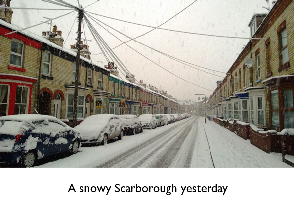
Many parts of Yorkshire and Lincolnshire had their first snowfall of the winter yesterday, with coastal areas suffering the largest falls with around 10cms (4 ins) of fresh snow being reported by yesterday evening.
With high pressure developing across Scandinavia, cold air will be with us for the rest of the week and into the weekend, but for many the next couple of days will be dry, apart from occasional snow showers towards the coast.
Temperatures could easily reach -10C (14F) in rural locations where there's snow cover during the next couple of nights.
But by the end of the week and into the weekend, things will become much more interesting, as weather fronts make the first of what could be two attempts to bring less cold air in from the Atlantic, with a risk of snow and disruption to travel.
As is always the case in these situations there's a lot of uncertainty about how fast the less cold air moves north-eastwards.
Experience suggests that computer models are often too quick to replace cold continental air.
Current indications are that the first Atlantic weather front will push across our area through Friday night and into Saturday as a weakening feature, bringing some increasingly light snow.
The next more active weather front will bring heavier snow on Sunday, which will eventually turn to rain as less cold air spreads eastwards.
But to highlight the uncertainty, some solutions are quicker with the snow and bring it across Yorkshire and Lincolnshire on Friday, with others slower.
There's bound to be changes to the timing of these systems as we get nearer the event, but there's clearly a risk of disruptive snow as we head into the weekend.
Next week looks very unsettled, and although the air will be somewhat less cold, temperatures are still likely to below average, with rain at times which could easily turn to snow in places, especially over the hills.
Follow me on twitter @Hudsonweather
 Hello, I’m Paul Hudson, weather presenter and climate correspondent for BBC Look North in Yorkshire and Lincolnshire. I've been interested in the weather and climate for as long as I can remember, and worked as a forecaster with the Met Office for more than ten years locally and at the international unit before joining the BBC in October 2007. Here I divide my time between forecasting and reporting on stories about climate change and its implications for people's everyday lives.
Page 1 of 2
Comment number 1.
At 17:08 15th Jan 2013, oldgifford wrote:Met office says this which in my opinion isn't really useful
UK Outlook for Sunday 20 Jan 2013 to Tuesday 29 Jan 2013:
Turning more unsettled than of late, with spells of rain, which will be heavy at times in the west and southwest, and some hill snow, which could fall to lower levels at times in the north and east. The best of any drier weather will tend to be towards eastern areas. Windy at first, with the risk of gales in exposed coastal areas, and remaining windy at times throughout the rest of the period, especially in the south and west. There will continue to be fairly widespread frost overnight, as well as the risk of icy stretches, with most areas staying cold or rather cold, although perhaps occasionally near normal in the west and southwest.
Complain about this comment (Comment number 1)
Comment number 2.
At 17:20 15th Jan 2013, waikuku wrote:#1 - The met office summary for the final 2 weeks of Jan appears reasonable to me - there is no way the met office would be any more detailed than that. If it was a book, it is a nice introduction setting the scene for the reader and hinting at some excitement to come . . .
As you will know, I have flagged up the less cold air replacing our mini cold spell by the weekend, Sat or Sunday will be fine !
I agree with Paul that the synoptic situation will become increasingly entertaining during the remainder of January. The colder air will be mainly PM but at the end of Jan it may become more meridional and prelude a colder spell in Feb - we'll see.
Complain about this comment (Comment number 2)
Comment number 3.
At 19:29 15th Jan 2013, cmdocker wrote:"Experience suggests that computer models are often too quick to replace cold continental air"
Int it strange how met office computers always predict a warmer scenario.
Complain about this comment (Comment number 3)
Comment number 4.
At 20:41 15th Jan 2013, Hudsonfan wrote:Time to remind you all of the rules. If it's hot weather it's global warming. If it's cold it's climate change.
Complain about this comment (Comment number 4)
Comment number 5.
At 01:05 16th Jan 2013, ashleyhr wrote:Yawn.
Complain about this comment (Comment number 5)
Comment number 6.
At 07:49 16th Jan 2013, Boanta wrote:John Cogger: greetings from a dry 16th of January area of Scotland where last night it got down to -13C where Piers Corbyn predicted over two weeks ago it would be -16C in the 14th-16th period. In the last 2-3 days the Beeb were gave at least 4 different estimates of minima in the last 48 hrs. Not bad and then there's those blizzards coming on Friday too.
Complain about this comment (Comment number 6)
Comment number 7.
At 07:56 16th Jan 2013, ukpahonta wrote:Beeb reporting -12C in East Anglia, Kismet!
Complain about this comment (Comment number 7)
Comment number 8.
At 08:23 16th Jan 2013, ~9152ebb36ecc58cc61b6f64a52eeaef4cab96175 wrote:The MO seem to do a pretty good job with the weather once they get the type right. So, now it is cold they'll get the associated local/regional pretty accurate. Trouble will come when getting the timing of the change and the extent of any snowfall associated with that transition. But, they can't change the weather only try to give guidance as to what may happen. Unfortunately for the forecasters, most people will stick their head outside and declare it cold enough to snow and be fairly accurate.
The question is do the public actually need the amount of weather forecasts that are put in front of them each day from all manner of media sources not working to any recognised standard. As an example, R4 Today presenters can summarise the weather for their transmission area (UK) in half a dozen words. Paul H spends several minutes on regional tv going into much detail - which is more accurate? No wonder there's so much chattering about how useful all this info is.
Complain about this comment (Comment number 8)
Comment number 9.
At 10:14 16th Jan 2013, QuaesoVeritas wrote:The NCDC/NOAA temperature anomalies have now been published and show very similar changes to those for NASA/GISS, although the fall in SH anomaly is slightly larger than for GISS.
I haven't looked at the monthly rankings in detail but the annual rankings make 2012 the 10th warmest on record, since 1880, i.e. the same as GISS.
This should point to a similarly large fall in the HadCRUT3/4 anomalies, with a HadCRUT3 of below 0.3c for December, which might make the annual figure as low as 0.41c.
newdwr54, please see my comment on GISS rankings in the last post on the previous topic, before it closed.
Complain about this comment (Comment number 9)
Comment number 10.
At 10:38 16th Jan 2013, lateintheday wrote:some things never change . . .
www.bbc.co.uk/news/science-environment-21033083
No impression of any pullback here from Auntie or the consensus. Quite astonishing really.
Complain about this comment (Comment number 10)
Comment number 11.
At 11:28 16th Jan 2013, john_cogger wrote:@6 Boanta
Well strike me down, he nearly got the temperature right, although is East Anglia part of North and Central UK? How's it going on the dry forecast for the whole of the UK? Or the pressure?
Complain about this comment (Comment number 11)
Comment number 12.
At 11:55 16th Jan 2013, Boanta wrote:11 John Cogger: Oh dearie me, you'll be doing Scrooge at next season's Panto next. That MO-Beeb chart and pattern of precipitation for Friday looks very like that profile he put out several weeks ago, doesn't it? Up here in 'Ghillie-Jockoland' we tend to think that Soothmooths believe Cheshire is in the north so goodness knows where East Anglia is in the West Saxon mindset.
Complain about this comment (Comment number 12)
Comment number 13.
At 12:01 16th Jan 2013, john_cogger wrote:@12 Boanta
Ah I see we forget the current forecast and just move on to the next...nothing to see here.... fingers in ears...
Complain about this comment (Comment number 13)
Comment number 14.
At 12:07 16th Jan 2013, Boanta wrote:John Cogger: Actually, it was me who quoted Piers wrongly, as the area he predicted a possible -16C in did include East Anglia, where I gather it also got down to -13C in places. Yes the 14-16th period ends today, so we are moving on to the 17th-21st period on his chart, with the MO-Beeb now concurring with his predictions. Yes move on John, but remove your blindfold before doing so.
Complain about this comment (Comment number 14)
Comment number 15.
At 12:24 16th Jan 2013, widski wrote:All the weather sites seem to agree that we will get some disruptive falls of snow on friday, maybe 6 inches. Not really disruptive tho is it people, the 18 inches of 2010 was disruptive! Just been talking to my friend from Tomsk in Russia - they don't stop their kids from going to school til the temp is in the -30's! and in this country we panic at a few inches of the white stuff. Bless us.
Complain about this comment (Comment number 15)
Comment number 16.
At 12:32 16th Jan 2013, john_cogger wrote:@14 Boanta
Did he say -16 in East Anglia? His forecast says 'Very cold in North and central parts (-16)'
That's North and central UK. No wonder he is always right if you can move places about.
Complain about this comment (Comment number 16)
Comment number 17.
At 12:57 16th Jan 2013, Boanta wrote:John Cogger: Keep wriggling on the hook John My apologies to Piers that I underestimated the area of Britain he was right about
Complain about this comment (Comment number 17)
Comment number 18.
At 13:10 16th Jan 2013, john_cogger wrote:@18 Boanta
He had the whole of the UK as dry, so it's much easier to see how he was wrong on that one.
And not sure how Marham being -13 makes him more right when it's outside of the area he said would be coldest...
Complain about this comment (Comment number 18)
Comment number 19.
At 14:56 16th Jan 2013, greensand wrote:ENSO becoming a focus of attention, some positing an “Unprecedented Third Consecutive La Nina”, for me it is way too early to call and if it does happen how can it be claimed to be “unprecedented”? However it is a fact that SSTs are cooling ENSO areas 1 through 3.4 SSTs have dropped into negative.
BOM have their latest update “Tropical Pacific ENSO neutral”:-
https://www.bom.gov.au/climate/enso/
Which includes their latest POAMA Long-Range Outlook:-
https://www.bom.gov.au/climate/poama2.4/poama.shtml
It shows ENSO on the cool side for the first half of 2013.
Actual ENSO SSTs are heading down with all areas lower in the first 2 weeks of the year than in Dec 2012.
https://www.bom.gov.au/climate/enso/indices.shtml?bookmark=nino3.4
Will be interesting to see how it develops.
Complain about this comment (Comment number 19)
Comment number 20.
At 15:14 16th Jan 2013, lateintheday wrote:well if the ENSO forecast(s) are halfway close to being accurate, that will be another year where continued warming is clearly visible if you squint one eye and stand on one leg etc.
Complain about this comment (Comment number 20)
Comment number 21.
At 15:45 16th Jan 2013, ashleyhr wrote:According to Ben Rich on Radio 4, RAF Marham recorded minus 13.4 C last night/early this morning. Little sign for now at least of a minus 20 C or lower as suggested by the likes of Jonathan Powell.
Complain about this comment (Comment number 21)
Comment number 22.
At 18:11 16th Jan 2013, Ukip wrote:Quake is shivering in his boots, John Cogger is hiding away in a Igloo. Can either of you guys explain why we are having this cold weather, is it anything to do with Global warming, I think not! I can't wait to give me new garage roof a good test on Friday. I suspect the weather the next two months, will be on par with two years ago.
Complain about this comment (Comment number 22)
Comment number 23.
At 19:22 16th Jan 2013, ukpahonta wrote:#22 Ukip
Let's not forget that it is cold because it is winter, it's supposed to be cold in the region that we live in, just like good owd days.
Complain about this comment (Comment number 23)
Comment number 24.
At 19:28 16th Jan 2013, john_cogger wrote:@22 UKIP
Can't wait for the snow and I'd love enough to build an igloo. Why are we having cold weather? It's winter...
https://www.youtube.com/watch?v=TQlHaGhYoF0
Complain about this comment (Comment number 24)
Comment number 25.
At 21:18 16th Jan 2013, Boanta wrote:18 John Cogger: when you have fallen down into an icy chasm, it is not a good idea to dig yoursel deeper into it.
Complain about this comment (Comment number 25)
Comment number 26.
At 21:26 16th Jan 2013, ukpahonta wrote:Heavy snow to bring risk of disruption on Friday
https://www.metoffice.gov.uk/news/releases/archive/2013/heavy_snow_warning
Complain about this comment (Comment number 26)
Comment number 27.
At 22:02 16th Jan 2013, newdwr54 wrote:9. QuaesoVeritas wrote:
"I haven't looked at the monthly rankings in detail but the annual rankings make 2012 the 10th warmest on record, since 1880, i.e. the same as GISS."
Yes, you're right. I don't know where I went wrong. I've re-loaded the GISS data and as you say, 2012 is the 10th warmest since 1880, not the joint 7th as I mistakenly said earlier. You're also right that December 2012 is joint 13th warmest since 1880.
Thanks for pointing these errors out.
Not sure where I went wrong, but I went wrong. It's a bad workman that blames his tools, etc but I think I must have corrupted my own version of the NASA data set somehow. I've re-loaded this now, and will re-load all the other data sets just in case.
Keep keeping me honest (I'll do the same for you).
Complain about this comment (Comment number 27)
Comment number 28.
At 22:16 16th Jan 2013, newdwr54 wrote:Having eaten humble pie (and I don't mind that) I still say 2013 is likely to be slightly warmer than 2012 globally.
If ENSO conditions remain neutral, then I think that all global surface data sets will remain positive and should be warmer than 2012.
If Neil decides to run the 'just for fun' prediction again this year then he should probably use HadCRUT4. If he does, then I'm predicting +0.50 (I'd like to add error bars and other such caveats, but we are above such things on this blog, aren't we? All friends here.).
Complain about this comment (Comment number 28)
Comment number 29.
At 23:14 16th Jan 2013, ukpahonta wrote:JC’s ‘forecast’ for the next 5 years: It looks like the AMO may have peaked, and we remain in the cool phase of the PDO with a predominance of La Nina events expected (unlikely to see a return to do El Nino dominance in the next decade). I predict we will see continuation of the ‘standstill’ in global average temperature for the next decade, with solar playing a role in this as well.’
https://judithcurry.com/2013/01/16/hansen-on-the-standstill/
Complain about this comment (Comment number 29)
Comment number 30.
At 23:32 16th Jan 2013, greensand wrote:@ dw, qv, ukp, et al
Also ukp 29 above (thanks for the link)
I have been looking back at the last thread, there appears, at present, to be a “consensus” (is that acceptable?) around the MO modelling ENSO as a neutral cyclical balance? Both in short and long term model runs.
Has anybody any views on how they handle longer cycles? An acceptance of natural multi-decadal variations appears to be evolving into an acceptable theme? Could this be missing in the previous models? Might it explain why over the last few decades the model projections and observations are diverging?
Complain about this comment (Comment number 30)
Comment number 31.
At 23:55 16th Jan 2013, greensand wrote:29. ukpahonta wrote:
“JC’s ‘forecast’ for the next 5 years:-
“Should we believe the UKMO model prediction? Well, I have more confidence in the UKMO prediction than in Hansen’s back of the envelope reasoning.”
Now this really is becoming interesting, latest comment by RB on the UKMO model prediction:-
"(it's not yet been shown to be useful to anyone, although we hope it will be when we've developed the technique further)"
So I think that really does place JC’s view on Hansen’s reasoning as "back of the envelope"!
Complain about this comment (Comment number 31)
Comment number 32.
At 00:31 17th Jan 2013, ashleyhr wrote:That 'minus 13.4 C' has changed into minus 13.1 C on the Met OOffice website.
A small sign of manmade climate change?
Complain about this comment (Comment number 32)
Comment number 33.
At 06:07 17th Jan 2013, ukpahonta wrote:Seems like a good indication as to why the experimental model is being used:
https://theresilientearth.com/?q=content/science-gets-stratosphere-wrong
Complain about this comment (Comment number 33)
Comment number 34.
At 08:32 17th Jan 2013, waikuku wrote:#33 ukpahonta
Thanks for link. It appears to read, mid stratospheric cooling is much more than the MO figs show. I realise the article then criticises the MO. But it does not de-link the relationship between warming at the surface and corresponding cooling of the stratosphere. The NOAA figures show temp drops >1.5 at the end of the data.
Does this mean there should be a correlated warming at the surface and, if that is holding steady for now (over last few years) does that mean there is a cooling effect at the surface - possibly La Nina? If that is a possibility then does that assist newdwr54's (& others) position that surface warming is currently masked by the cooling La Nina (& other coolants) etc?
I don't know the answer nor do I have an opinion but would welcome some input from those who have a good handle on this sort of thing to - maybe - offer an explanation ?
Complain about this comment (Comment number 34)
Comment number 35.
At 09:15 17th Jan 2013, ukpahonta wrote:#34 Chris
You are probably correct about the inverse link between stratosphere temperatures and the surface as shown at the pole recently with the warming breaking the polar vortex, SSW's etc. As for mid Pacific latitudes Stephen Wilde could probably give us some indication, if he is around, as to a possible cause of ENSO states but the relationship may be inverted with ENSO affecting stratospheric temperatures.
As for surface warming being masked by ENSO activity then I, personally, would change masked to effected, as I think the natural cycles have a greater role to play than they are given credit for.
Complain about this comment (Comment number 35)
Comment number 36.
At 09:35 17th Jan 2013, QuaesoVeritas wrote:#27. - newdwr54 wrote:
"Keep keeping me honest (I'll do the same for you)."
I am sure that no deception was intended on your behalf.
Actually I only arrived at my rankings by "eyeballing" the figures, so I wasn't 100% sure I was right, but I did treble-check.
I haven't worked out my estimate for 2013 yet. Changing to HadCRUT4 will require an update of the trend cycles, which I will try to do as soon as the December figures are in.
Complain about this comment (Comment number 36)
Comment number 37.
At 09:38 17th Jan 2013, NeilHamp wrote:I will be running the "just for fun" prediction again this year newdwr54 (#28)
I quite agree thad HadCRUT4 should be used
I am waiting for the publication of December's HadCRUT3 figure before declaring this year's winner(s).
Your estimate is close to mine because in the past I have used the simple technique of Met Office Forecast (0.57) less O.08.
Complain about this comment (Comment number 37)
Comment number 38.
At 10:06 17th Jan 2013, Boanta wrote:Chris: are you still going for as return of milder westerlies by Sunday/
Complain about this comment (Comment number 38)
Comment number 39.
At 10:42 17th Jan 2013, greensand wrote:33. ukpahonta wrote:
Thanks for the link ukp.
A present I don’t know how to interpret the info, not my area. However it does raise 2 issues, one being that IMHO this generation should focus on providing sound traceable datasets upon which those who follow can base their research/decisions.
Second, if there is a difference between the two “authorities” then lets see it debated, argued, thrashed out. My business experiences leave me wary of all my suppliers being in agreement about everything. It used to be that Phil Jones would champion his datasets over all others, being particularly critical of GISS, this no longer happens, it appears to be of more import that they are all in agreement, competition sits better with my experience of the real world.
Will watch for further developments.
Complain about this comment (Comment number 39)
Comment number 40.
At 12:37 17th Jan 2013, Boanta wrote:Chris: what do you think the probabilities are for an intensification and expansion of the Greenland High?
Complain about this comment (Comment number 40)
Comment number 41.
At 15:41 17th Jan 2013, waikuku wrote:# 38 & #40 Boanta
Ah Ha ! If I didn't know you better I'd thing you were being mischievous with me ! ! (Only joking - synoptic weather is such fun - thankfully)
I have to say the blast from the west appears to be doing what I thought it might a couple of weeks before christmas (back in the days of "The beast from east") and is likely to trough nicely into spain and western france. This affects the progress from the west in as much that Lows will develop NW of Biscay and as these developments approach Uk the cold air is pushed further east but as the Low is likely to sink into france the northern side pulls the cold air back westwards and allows the pesky High to hang around. There's no substitute for a jet 'firing' into a High to shift it. On current forecasts, the net effect is to slow the transition. On the plus side it puts off widespread heavy snow too.
But at the moment I would have to say the 4,500ft (850mb) temp does look likely to stay below -5c, especially in the east, for a few extra days. The low night time temperatures of the last couple of days should ease as more cloud and wind encroaches.
On the second point, there doesn't appear to be any model consistently building that feature in the forecast range.
Complain about this comment (Comment number 41)
Comment number 42.
At 16:59 17th Jan 2013, ukpahonta wrote:Bob wants some input on ENSO prediction:
https://bobtisdale.wordpress.com/2013/01/17/were-expecting-will-it-be-a-boy-a-girl-or-enso-neutral-in-2013/
Complain about this comment (Comment number 42)
Comment number 43.
At 17:22 17th Jan 2013, greensand wrote:42. ukpahonta wrote:
"Bob wants some input on ENSO prediction"
Well if he doesn't know I sure don't, however the resultant discussions could be interesting
Complain about this comment (Comment number 43)
Comment number 44.
At 17:57 17th Jan 2013, falcon492513 wrote:I thought the snow wasn't coming till tomorrow....wel it's been snowning in Doncaster all afternoon
Complain about this comment (Comment number 44)
Comment number 45.
At 19:18 17th Jan 2013, Spanglerboy wrote:Falcon
Paul Hudson just volunteered on Look North that the snow that is falling now was not forecast 24 hours ago. Tricky business predicting the future. Still at least children do know what snow is. So that's another forecast they got wrong. Hey ho.
Complain about this comment (Comment number 45)
Comment number 46.
At 19:25 17th Jan 2013, waikuku wrote:#38/40 Boanta
Further to my comment at 41, less cold air is now approx isle of white to crosby but as the energy from the discontinuity slides into northern france the cold air will feed westwards again pending the next pulse. All very slow.
Complain about this comment (Comment number 46)
Comment number 47.
At 19:50 17th Jan 2013, QuaesoVeritas wrote:#44. - falcon492513 wrote:
"I thought the snow wasn't coming till tomorrow....wel it's been snowning in Doncaster all afternoon"
Yes, the clear sky forecasted for the NE hasn't materialisd and there is now snow in the forecast which wasn't there this morning.
Complain about this comment (Comment number 47)
Comment number 48.
At 19:55 17th Jan 2013, ukpahonta wrote:#46 chris
'discontinuity'.... the jet stream is heading south. It's going to freeze or snow for the next week, at least.
Just to add to the fun further SSW'S being predicted, big time:
https://twitpic.com/bsk4gb/full
Complain about this comment (Comment number 48)
Comment number 49.
At 19:58 17th Jan 2013, ashleyhr wrote:It looks like easterly winds will persist for most beyond Sunday. Apart from south west England and south Wales - where it may turn less cold. Parts of eastern and north eastern England, Cumbria or Scotland could record minus 20 C over the snow that will be lying, if the nights and clear and calm.
Complain about this comment (Comment number 49)
Comment number 50.
At 20:19 17th Jan 2013, waikuku wrote:Precipitation from the initial push from the west reached roughly a line from Yorkshire Wolds to Huntingdon before retreating westwards. Precipitation on the forward edge of the second more vigorous push was roughly in a line from SW Ireland to just west of the Scilly Isles at 5pm today and has now (8pm) moved eastwards to SE Ireland to the Lizard. I suspect this will again eventually slide into northern france during tomrrow but with greater eastwards momentum than the first effort today. Thereafter in the immediate term the cold air will push westwards for a time on its northern flank.
Complain about this comment (Comment number 50)
Comment number 51.
At 20:33 17th Jan 2013, greensand wrote:During the day I have been keeping a watch on the radar via https://www.raintoday.co.uk/
The cloud and precipitation presently over Central England did not seem to come in on a front, it somehow just appeared and accumulate in the areas it now occupies.
Maybe somebody can offer an explanation? Am I interpreting the radar incorrectly.
Complain about this comment (Comment number 51)
Comment number 52.
At 20:53 17th Jan 2013, newdwr54 wrote:51. greensand:
Cloud and precipitation are not dependent upon fronts. They also results from local conditions re temperature, convection and the air's water vapour content.
Complain about this comment (Comment number 52)
Comment number 53.
At 21:03 17th Jan 2013, greensand wrote:52. newdwr54 wrote:
"They also results from local conditions re temperature, convection and the air's water vapour content."
Thanks DW, sort of knew that as a general theme, but what caused this occurrence? It was definitely not forecast, I was watching the forecast front coming in from the west when this lot started to form well east of it. The fact that it was not forecast is the reason for wanting to know the specifics about this instance.
Complain about this comment (Comment number 53)
Comment number 54.
At 21:50 17th Jan 2013, waikuku wrote:# 52/53
An old occlusion where precip. activity is often well aloft and forward of the surface front - the discontinuity was most likely reactivated as it ended its eastward progress and began to regress.
Complain about this comment (Comment number 54)
Comment number 55.
At 21:58 17th Jan 2013, ashleyhr wrote:Message 44
On the ITV News just after 6.30 pm a reporter was standing at a gritting depot in Staffordshire and some snow was falling there too. Today's 'starter' for tomorrow's 'main course' was not in last night's forecast for Thursday, other than for upland Wales (with rain on the coast). And they have also firmed up snow rather than sleet or rain for most of Northern Ireland on Friday.
Complain about this comment (Comment number 55)
Comment number 56.
At 22:02 17th Jan 2013, Boanta wrote:Chris: Latest Beeb forecast gives cold air winning out well into next week, as do the Norwegian MO and Piers Corbyn, you're out on a limb here and those Westerlies---well have gone West.
Complain about this comment (Comment number 56)
Comment number 57.
At 22:05 17th Jan 2013, ashleyhr wrote:https://www.bbc.co.uk/weather/features/21066768
Cold or very cold for the rest of January?
Complain about this comment (Comment number 57)
Comment number 58.
At 22:05 17th Jan 2013, greensand wrote:54. chris wrote:
"often well aloft and forward of the surface front"
Thanks chris, that sort of makes sense. I take it that it would therefore not necessarily show on the normal Will it Rain radar until it lost height?
"likely reactivated as it ended its eastward progress and began to regress."
I am sure this is not the correct terminology but the first signs did appear further east and then moved slowly westwards apparently "seeding" more as it did so. Also then further accumulation grew to the west of the original, eventually they met in the center of the country.
Complain about this comment (Comment number 58)
Comment number 59.
At 23:43 17th Jan 2013, greensand wrote:Now I have had chance to think about chris’s logical explanation of today’s “not forecasted” snowfall, how did its potential manage to evade the eagle eye of our ever vigilant forecasters?
Did it sneak in over the radar? Sorry couldn’t resist!
I can conform that our host simply described it as “not forecasted snowfall” in his late evening presentation.
Complain about this comment (Comment number 59)
Comment number 60.
At 02:50 18th Jan 2013, Mateybass wrote:I'm a complete amateur when it comes to weather forecasting but having looked at the jetstream forecast, for Lincolnshire at least.. the 21st will see a change to warmer temps, then colder with some light snow between afternoon of the 22nd and morning of 23rd then rain from the west, possibly strong winds during 26th and 27th then on the 29th we'll see much warmer temps for a settled end the month.
Just a bit of fun mind, and probably as accurate as most medium range forecasts :)
Complain about this comment (Comment number 60)
Comment number 61.
At 08:16 18th Jan 2013, ukpahonta wrote:Have a look at the animation of the 10 millibar layer and keep an eye on the top left corner:
https://theweathercentre.blogspot.de/2013/01/upper-stratosphere-experiences-polar.html
Complain about this comment (Comment number 61)
Comment number 62.
At 08:22 18th Jan 2013, waikuku wrote:#59 "not forecasted snowfall"
I think that is a fair explanation. The precipitation was not forecast and these unexpected events do crop up from time to time (and will continue to do so). My comment at #54 was offering a possible hindsight explanation to #51.
Complain about this comment (Comment number 62)
Comment number 63.
At 08:48 18th Jan 2013, ukpahonta wrote:It's Friday, I would guess that most are going to have an enforced quiet weekend so lets stir up some activity!
UK Outlook for Saturday 5 Jan 2013 to Saturday 19 Jan 2013:
Rather unsettled weather is likely to persist into the first half of January, with low pressure expected to be dominant near the British Isles bringing further spells of wet and windy weather to most regions. Rainfall amounts are then expected to remain above average for parts of England and Wales whilst temperatures are likely to often be close to or a little above average. Later in this forecast period there is greater than average uncertainty though some marked changes of weather type are possible and the risk of spells of colder than average conditions increases.
Updated: 1259 on Fri 21 Dec 2012
In comparison:
https://climaterealists.com/index.php?id=10967
Sometimes there has to be credit where credit is due.
Complain about this comment (Comment number 63)
Comment number 64.
At 09:11 18th Jan 2013, Boanta wrote:63: Aye indeed, and the 'new' stuff coming in from the East tomorow and affecting Kent to the Wash( and further North at bit) was also predicted weeks out too. Once others flush out the CO2 from between their ears, there might yet be hope.
Complain about this comment (Comment number 64)
Comment number 65.
At 09:21 18th Jan 2013, greensand wrote:63. ukpahonta wrote:
"It's Friday,....."
Good morning ukpahonta, maybe you should check in the mirror, see if the horns are starting to sprout?:-)
Complain about this comment (Comment number 65)
Comment number 66.
At 09:53 18th Jan 2013, ukpahonta wrote:= :-)
Complain about this comment (Comment number 66)
Comment number 67.
At 10:23 18th Jan 2013, QuaesoVeritas wrote:#53. - greensand wrote:
"Thanks DW, sort of knew that as a general theme, but what caused this occurrence? It was definitely not forecast, I was watching the forecast front coming in from the west when this lot started to form well east of it. The fact that it was not forecast is the reason for wanting to know the specifics about this instance."
I may be wrong, but as well as the front coming in from the west, which was bringing most of the snow, there is also a prevailing wind from the approx. SSW, which was bringing the chance of snow from the N.Sea.
Complain about this comment (Comment number 67)
Comment number 68.
At 10:59 18th Jan 2013, greensand wrote:67. QuaesoVeritas wrote:
"which was bringing the chance of snow from the N.Sea."
Thanks QV, you are quite right I could see that on the radar but it did not seem to be connected the accumulation that materialise over the middle of the country. Chris's explanation in 54 above does seem to connect with what I observed. But as I did not know what I was looking at....
Complain about this comment (Comment number 68)
Comment number 69.
At 14:17 18th Jan 2013, QuaesoVeritas wrote:#68. - greensand wrote:
"Thanks QV, you are quite right I could see that on the radar but it did not seem to be connected the accumulation that materialise over the middle of the country."
I don't think it is connected and that we are getting snow from two sources at the moment. I live on the NE coast and although we had quite a lot of snow earlier in the week, all we are getting are the odd light flurry.
However we expect heavier snow this evening, from the front which is moving in from the west.
Complain about this comment (Comment number 69)
Comment number 70.
At 14:21 18th Jan 2013, waikuku wrote:#67 Q'V'
"I may be wrong, but as well as the front coming in from the west, which was bringing most of the snow, there is also a prevailing wind from the approx. SSW, which was bringing the chance of snow from the N.Sea".
Not sure what the question/comment is getting at but try this:
Today there are some showers in the north sea and these are running onto coastal areas on a SE'ly wind - at this time of year showers (shallower than their summer equivalent) will be driven by the wind at approx 850-700Mb (4500 to 9000ft). The frontal activity will generally be steered by higher level winds - say 500Mb (15000).
As you probably know, at any point on the surface looking directly up, winds tend to veer (clockwise) with height. In Lincolnshire the winds at various levels at 12Z today were (approx):
Surface: SE to ESE 15 to 20kt Actual
925Mb (2400ft): SE 25 to 30kt Fcast
850Mb (4500ft): SE'S 25 to 30kt Fcast
500Mb (15000ft): W to W'N 20Kt Fcast
300Mb (20000ft): NW 20Kt Fcast
So it will be possible to get the odd shower onto SE facing coasts of E England whilst the frontal activity gradually pushed in from the west. But note, the winds at 500Mb were forecast to be N of West by 12Z. This means that the frontal activity will increasingly get steered south east, so the advancement of the frontal activity northwards will be hampered by the head-wind. Hence why the forecast for Lincs and east Yorks has been modified to play down the amount of snowfall expected.
It is that steering to the south east which holds up the milder air as the Low will slide away to france and allow the cold air to come back across the Uk on its northern flank.
It is not as accurate as 1 + 1 = 2, but there is a science to it, albeit one that is never spot on.
It was amusing that the media grabbed hold of the RED WARNING given by the MO yesterday, especially as it was for the Brecon Beacons. Whilst important for those living in that 400 sq miles it was hardly representative of where most folk live in the Uk
Complain about this comment (Comment number 70)
Comment number 71.
At 21:29 18th Jan 2013, Rhys wrote:I live in Beverley and about half an hour ago I saw a flash outside. When I listened, I heard a clear thunder roll. This was whilst it was pelting down with snow. A snow storm in Beverley - hell !!
Complain about this comment (Comment number 71)
Comment number 72.
At 22:03 18th Jan 2013, ashleyhr wrote:Thundersnow.
Complain about this comment (Comment number 72)
Comment number 73.
At 14:32 19th Jan 2013, Spanglerboy wrote:Ashley no
thundered then
Complain about this comment (Comment number 73)
Comment number 74.
At 17:16 19th Jan 2013, mjmwhite wrote:It could be so much worse
https://rt.com/news/winter-snow-russia-weather-275/
"Snowpocalypse Russia: 'Snow tsunami' swallows streets, cars, buildings (PHOTOS)"
Complain about this comment (Comment number 74)
Comment number 75.
At 17:35 19th Jan 2013, thesnowman wrote:@ 74
Interesting to compare with BBC coverage of USA heatwave this summer and bushfires in Australia a week ago - I don't remember seeing anything about this on the beeb over the past few weeks, has anyone else?
'Russia is enduring its harshest winter in over 70 years, with temperatures plunging as low as -50 degrees Celsius. Dozens of people have already died, and almost 150 have been hospitalized. The country has not witnessed such a long cold spell since 1938, meteorologists said, with temperatures 10 to 15 degrees lower than the seasonal norm all over Russia. Across the country, 45 people have died due to the cold, and 266 have been taken to hospitals. In total, 542 people were injured due to the freezing temperatures, RIA Novosti reported.'
Where is Roger when we need him?
Complain about this comment (Comment number 75)
Comment number 76.
At 19:13 19th Jan 2013, waikuku wrote:#75
Thank you for the Russian update - it really does put our 'plight' into perspective doesn't it. Goodness knows what we would do if the 'beast from the east' really did get a hold on the UK.
So, the mild westerly has been held up just a little. The return of the low temperatures of last week seem unlikely now and gradually less cold each day likely until the westerly gets in proper later in the week.
The important thing to remember is the original claim that this was going to last 3 weeks with -15 or -20 implied as widespread and prolonged. By tomorrow it will have been here a whole week - nothing remarkable for a UK winter. Nothing remarkable when compared to the report at #75.
Complain about this comment (Comment number 76)
Comment number 77.
At 19:40 19th Jan 2013, ukpahonta wrote:Took the little one sledging today and saw an igloo being built. Amazed at how quick it goes up, layer one was down when we arrived and they were finishing the centre of the roof when we left two hours later. They were using what looked like a plastic under bed storage box to build the blocks and shaping the ends with their shovel to fit.
Complain about this comment (Comment number 77)
Comment number 78.
At 21:08 19th Jan 2013, ashleyhr wrote:This was interesting (when the westerlies well and truly failed):
https://www.bbc.co.uk/iplayer/episode/b01q9d86/Winterwatch_1963_The_Big_Freeze/
The charts at present are fairly similar to early January 1963.
Complain about this comment (Comment number 78)
Comment number 79.
At 08:54 20th Jan 2013, lateintheday wrote:my kids are disappointed. Here in Lincs we've only seen about 2cm all week.
Complain about this comment (Comment number 79)
Comment number 80.
At 09:09 20th Jan 2013, oldgifford wrote:53.
At 21:03 17th Jan 2013, greensand wrote:
"It was definitely not forecast, I was watching the forecast front coming in from the west when this lot started to form well east of it. "
It seems the Met Office did sort of forecast it but they didn't know exactly where or when it would hit us.
Met Office 3-month Outlook
Period: January 2013 – March 2013 Issue date: 20.12.12
Some model scenarios suggest that during January the UK could be the
battleground between cold air of Scandinavian or Russian origins, and
mild Atlantic air, meaning that substantial changes in weather type are
quite possible, although equally one or other type could prevail. Some
heavy snow can be expected at the boundary between the warm and cold
air, although whether that would be over the UK is far from clear. As we
move into February and March mild westerly or southwesterly winds
become more likely, although cold outbreaks are still possible.
Complain about this comment (Comment number 80)
Comment number 81.
At 09:42 20th Jan 2013, ukpahonta wrote:Many areas will see a few snow flurries at some stage. However, more significant snowfall will spread into southeastern then eastern England, the north Midlands and northeast Wales, giving fresh accumulations of a few centimetres of snow in many places.
https://www.metoffice.gov.uk/weather/uk/uk_forecast_weather.html
Pass the suger Dear!
YELLOW WARNING of SNOW for southeast England, East Anglia, the east and north midlands and parts of northeast England.
A band of snow is likely to spread northwards across parts of southeastern and eastern England during Sunday afternoon and evening, bringing accumulations of 2-5 cm snow to some areas, and perhaps in excess of 8 cm towards coastal counties of southeast and eastern England. The public should be aware of the risk of disruption to travel.
https://www.bbc.co.uk/weather/2635167
Might have to keep an eye on this, could be problems getting to work tommorrow!
Britain faces another week of travel disruption as forecasters warn there is more snow and ice on the way.
With travel chaos across the country and Britain's busiest airport cancelling more than 110 flights, forecasters predicted further misery in the coming days.
https://news.sky.com/story/1040376/britains-big-freeze-here-to-stay
Panic, get down to the shops and buy everything!
Complain about this comment (Comment number 81)
Comment number 82.
At 09:57 20th Jan 2013, waikuku wrote:#78
The Winterwatch look back to '63 (I saw last 30 mins) was well structured. Enjoyed the chart analysis and the '7 stages'.
Can't imagine a similar program examining a harsh UK winter in the future would make any reference/comparison to 2012/13.
Complain about this comment (Comment number 82)
Comment number 83.
At 11:52 20th Jan 2013, QuaesoVeritas wrote:#79. - lateintheday wrote:
"my kids are disappointed. Here in Lincs we've only seen about 2cm all week."
Children have been spoiled recently.
Tell em that until recently there were winters when we hardly got any snow at all.
Complain about this comment (Comment number 83)
Comment number 84.
At 14:29 20th Jan 2013, ashleyhr wrote:Presumably the main reason why the forecast is saying that the current weather system will bring heavier snowfalls to Yorkshire and the north east than is happening further south is that in the north the continental influence is less - so the temperature will creep slightly above freezing and the snow will have a higher water content (and probably produce larger flakes).
Complain about this comment (Comment number 84)
Comment number 85.
At 20:28 20th Jan 2013, ashleyhr wrote:And the word now is that the spell of severe weather may gradually peter out, with the high pressure edging to the south east or east and milder conditions returning from the west to all areas of the UK by next Sunday. But further snow likely for the next three days, and also some cold and possibly foggy nights till around Friday.
Complain about this comment (Comment number 85)
Comment number 86.
At 11:10 21st Jan 2013, oldgifford wrote:A glimpse of the sun and blue sky here in North Bristol/South Gloucestershire.
Doesn't tie in with the local weather map forecast at the moment.
https://www.bbc.co.uk/weather/2654675
Tomorrow look like snow again.
Complain about this comment (Comment number 86)
Comment number 87.
At 11:12 21st Jan 2013, greensand wrote:Suddenly Boris is very PC!
https://www.telegraph.co.uk/comment/columnists/borisjohnson/9814618/Its-snowing-and-it-really-feels-like-the-start-of-a-mini-ice-age.html
Complain about this comment (Comment number 87)
Comment number 88.
At 11:30 21st Jan 2013, QuaesoVeritas wrote:#87. - greensand wrote:
"Suddenly Boris is very PC!"
In my view there are only a couple of problems with this theory, 1947 and 1963, two very cold winters when solar activity, in the form of sunspots, was increasing.
In fact, the highest ssn max on record was in 1958 and the 10 year mean ssn was at it's peak in 1965.
Complain about this comment (Comment number 88)
Comment number 89.
At 11:47 21st Jan 2013, oldgifford wrote:I see Piers is forecasting doom and gloom so we can compare forecasts.
https://www.weatheraction.com/displayarticle.asp?a=513&c=5
=> Our WeatherAction expectation for another Sudden Stratospheric Warming and quite likley even heavier snow in UK, Ireland and Europe at end Jan/start Feb still stands (see forecast link below for detail)
The following are a collection of weather forecasts and all seem to be at odds with Piers’ forecast.
Whereas the Met Office says
UK Outlook for Friday 25 Jan 2013 to Sunday 3 Feb 2013:
Many southern and central regions are likely to start dry on Friday but generally rather cloudy. However, more unsettled conditions with spells of rain, sleet and snow along with increasing winds, will develop over northwestern parts. The unsettled conditions are then expected to spread erratically southeastwards over the weekend. Remaining cold initially, with hard overnight frosts, widespread ice and some freezing fog patches, these locally slow to clear from some areas. However, during the weekend and into the new working week onwards, conditions are likely to turn rather less cold, as more-unsettled Atlantic weather systems push into the UK. This change to more unsettled conditions is likely to be accompanied by spells of snow in some areas. Later in the period, snow will be mainly restricted to upland areas.
UK Outlook for Monday 4 Feb 2013 to Monday 18 Feb 2013:
There is greater than average uncertainty throughout this period. The most likely scenario is for conditions at the start of this period to be less cold than at the moment but also on the unsettled side. However, colder weather and below average temperatures then probably come to dominate once more towards mid-month. In terms of rain and snowfall, southern parts in particular will probably start wetter than average, but trend to nearer normal by mid-month, while the north will probably see drier than average conditions for much of the period. Meanwhile, the frequency of snow events during this period may be greater than average.
Issued at: 0400 on Mon 21 Jan 2013
https://www.weatheronline.co.uk/cgi-app/reports?MENU=Month-ahead
*19/1/13 to 31/1/13*
The regime of a strong block of high pressure close to the UK may be coming to an end, although there is evidence to suggest that although Atlantic low pressure will be making inroads it may not be sufficiently powerful to break the pattern, the transition rather 'messy' with an anticipated mix of rain, sleet and snow across many areas through to the end of the month.
*1/2/13 to 5/2/13*
There is just a hint that milder weather may just break through temporarily with a south-westerly flow erasing much of the snow cover, this rather cloudy, misty and damp interlude soon replaced by cooler westerly regime returns through all regions into early February.
*6/2/13 to 10/2/13*
This cool westerly looks set to hold, with an associated unsettled period through until about the end of the 1st week of the month, when colder weather to the north slips southwards once more.
https://www.netweather.tv/index.cgi?action=10day;sess=
Suggests for Bristol January is going to warm up from the 25th
https://www.accuweather.com/en/gb/bristol/bs1-2/daily-weather-forecast/327328?day=10
From the 26th rainy with temperatures well above freezing rising to 53 F on the 29th.
https://www.metcheck.com/UK/14days.asp?zipcode=bs34
Shows sunshine and daily average of about 5 C from the 31st to the 5th Feb
Yahoo weather shows highs of 6 & 7 on the 29th and 30th with sunshine.
https://www.theweatheroutlook.com/forecast/30-day-uk-weather-forecast
22/1 to 31/1
Unsettled weather with showers or longer spells of rain at times across all regions. Some sleet or snow is likely at times over northern high ground, and possibly down to lower levels at times. Temperatures close to the seasonal average, but colder at times in northern regions. Note: Forecast confidence at this extended range is low as usual.
https://www.meteoprog.co.uk/en/weather/London/6_10/
Until 1st Feb, No snow forecast
Complain about this comment (Comment number 89)
Comment number 90.
At 11:49 21st Jan 2013, QuaesoVeritas wrote:Still no HadCRUT figures for December, but if the fall is similar to those in NASA/GISS and NCDC/NOAA, the HadCRUT3 figure will be around 0.24c, compared with 0.48c in November, making the 2012 average anomaly about 0.4c.
In view of recent theories that the "missing heat" from global atmospheric temperatures is in the Ocean Heat Content, presumably that means that there has been an increase in the OHC in December.
Does anyone know if that is the case?
Complain about this comment (Comment number 90)
Comment number 91.
At 11:51 21st Jan 2013, greensand wrote:88. QuaesoVeritas wrote:
"In my view there are only a couple of problems with this theory,"
There are loads in my view, I just don't understand his theory, so I stay well away. The reason for mentioning the article is because it is by the Lord Mayor of London (albeit Boris) and is the main op-ed article in a major broadsheet (albeit The Torygraph), far from being a common occurrence, but all good PR for PC!
Knowing the showman element in PC it should provoke another round of dramatic forecasts. I have never been able to really tie down his, or for that matter any other's forecasts over a few a days out.
Good fun to watch though.
Complain about this comment (Comment number 91)
Comment number 92.
At 11:55 21st Jan 2013, greensand wrote:89. oldgifford wrote:
"I see Piers is forecasting doom and gloom"
Thanks OG, comments crossed, the PC forecast/announcement was to be expected, too much of a showman to miss out. Whether he is right only time will tell.
Thanks also for the other info, will try to keep a "weather eye"
Complain about this comment (Comment number 92)
Comment number 93.
At 11:56 21st Jan 2013, widski wrote:Where I live in Sheffield the comment below by Weather Action has been spot on. We have had treble the amount forcasted by the Beeb and MO and its still coming down! Also Yorkshire hardly got a mention on the Countryfile weather forcast last night where as a whole news programme was dedicated to the snow down south. Beeb, please stop being regionist(probably a made up word) but you get the idea.
Comment from Weather Action website.
"What to Do
- To help cope with the dangerous very cold and snowy/blizzardy weather in UK, Eire, and Europe and USA**, and also Asia or anywhere in the world.
(i) DOUBLE OR TREBLE all snow amount forecasts on TV from 24/12 hr ahead.
(ii) EXPAND ALL THE WARNING REGIONS GIVEN on TV
(iii) INCREASE ALL WINDS (fronts will become more active and isobars tighter)
NOTE for Europe /Britain & Ireland Greenland and / or Scandinavian Highs are likely to strengthen - encouraging colder blasts and impeding less cold air from the West.
(iv) HELP others at risk"
Go Piers!
Complain about this comment (Comment number 93)
Comment number 94.
At 12:01 21st Jan 2013, QuaesoVeritas wrote:#91. - greensand wrote:
"There are loads in my view,"
Sorry, I should have said "at least two".
By "the theory", I meant the simplistic one, that lower sunspot numbers = colder winters.
Complain about this comment (Comment number 94)
Comment number 95.
At 12:05 21st Jan 2013, QuaesoVeritas wrote:#89. - oldgifford wrote:
"I see Piers is forecasting doom and gloom so we can compare forecasts."
I find it very difficult to compare verbal forecasts, especially when they contain so many caveats, alternative probabilities and "hints".
I prefer numeric forecasts which could be directly compared with observations.
Complain about this comment (Comment number 95)
Comment number 96.
At 12:06 21st Jan 2013, greensand wrote:90. QuaesoVeritas wrote:
“presumably that means that there has been an increase in the OHC in December.”
Don’t know about OHC, not really been looking at it, there was some squabbling over the data last time I looked. Might have another go and see if I can find a reliable source, maybe somebody knows one?
However Reynolds SSTs show Dec at +0.22C down from +0.24C in Nov, usually needed to add about +0.15C to equate to HadSST3, first two weeks in Jan showing further reduction to about +0.16C.
Complain about this comment (Comment number 96)
Comment number 97.
At 12:38 21st Jan 2013, QuaesoVeritas wrote:#96. - greensand wrote:
"Don’t know about OHC, not really been looking at it, there was some squabbling over the data last time I looked. Might have another go and see if I can find a reliable source, maybe somebody knows one?
Yes, I was being lazy and hoping that someone else would point to one. I was looking but couldn't find one although I thought I had seen some Argo data recently, but I couldn't find it again.
"However Reynolds SSTs show Dec at +0.22C down from +0.24C in Nov, usually needed to add about +0.15C to equate to HadSST3, first two weeks in Jan showing further reduction to about +0.16C."
HadSST2 was down from 0.399c to 0.342c but that is only the surface and I don't think that there are any claims that is where the "missing heat" resides.
There is a page for OHC on Climate4You, using NODC data to 700m, but the most recent figure is for September.
There are links to obtain actual data via KNMI Climate Explorer but I am not very keen on using that.
https://www.climate4you.com/SeaTemperatures.htm oceanic heat content 0-700 m depth
Complain about this comment (Comment number 97)
Comment number 98.
At 12:51 21st Jan 2013, greensand wrote:97. QuaesoVeritas wrote:
"I was being lazy and hoping that someone else would point to one"
More like being realistic, no need to re-invent the wheel, somebody out there will have the answer.
I have been playing at NOAA:-
https://www.nodc.noaa.gov/cgi-bin/OC5/3M_HEAT/showfig.pl?action=start
Not with much success, can get nice pictures but can't find time series data.
Looking at the 2000m depth, the buoy locations look rather sparse:-
https://www.nodc.noaa.gov/cgi-bin/OC5/3M_HEAT/showfig.pl?navigationM=t_dd_19551955_26_01-03_back_77
Complain about this comment (Comment number 98)
Comment number 99.
At 12:59 21st Jan 2013, QuaesoVeritas wrote:#98. - greensand wrote:
"Looking at the 2000m depth, the buoy locations look rather sparse:-"
Slightly biased towards the W Pacific I would say.
On the face of it, the Argo coverage seems more comphrehensive:
https://en.wikipedia.org/wiki/Argo_%28oceanography%29
There is a link to data ftp sites, but I haven't worked out the formats yet.
Complain about this comment (Comment number 99)
Comment number 100.
At 13:21 21st Jan 2013, greensand wrote:I am not a fan of PC nor do I think the MO should be fair game to bash about their weather forecasts. Forecasting weather for anything longer than 4 or 5 days seems to make fools of us all.
But every once in awhile the MO does produce something that really astounds me:-
“Impacts on the UK energy industry”
“Using our climate models to assess future temperature increases, we looked at how this could effect all aspects of the energy industry. This included factoring in issues such as the affect of heat on the efficiency of thermal power stations. We also studied the potential changes in demand as our seasons are altered under climate change - such as an expected shift in peak power demand to the summer as people rely more on air conditioning.”
https://www.metoffice.gov.uk/services/climate-services/uk/ukcp/impacts/energy
“such as an expected shift in peak power demand to the summer as people rely more on air conditioning.”
In the UK seriously?
Complain about this comment (Comment number 100)
Page 1 of 2