We may not say this often enough, but YOU are our kind of person! Not only are you one of an ever growing band of wonderful Weather Watchers, but like us, you're probably becoming increasingly aware - dare I say obsessed - with the intricacies and drama that unfolds in the skies overhead every day.
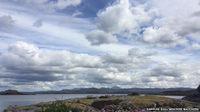
A perfect scene for some cloud spotting in Drumbeg, Highland.
I confess, I can't leave a building without immediately casting my eyes upwards, looking for clues as to what the weather may do next.
My first job in weather was as a Met Office Weather Observer so you may understand my own personal obsession, but do you know your cloud types? And do you know what certain clouds can reveal about what may/will happen next?
The history of clouds
The practice of naming/classifying clouds began with the pharmacist and amateur meteorologist Luke Howard, back in 1802.
After years of studying and sketching clouds he realised that the forms the clouds were taking overhead weren't completely random. Clouds at different heights above the ground had a different appearance, and different structures to the clouds could determine whether it was likely to rain or not.
The basis of the naming convention he developed, which we still largely use today, is whether the clouds are at LOW altitudes (cumulus or stratus), MEDIUM altitudes (alto), or HIGH altitudes (cirrus or cirro).
Most of the names are also based on whether they are lumpy in appearance (cumuloform) or flat (stratiform).
In addition to these, words such as nimbus (rain-bearing), castellanus (castle-like), lenticularis (lens-shaped) among others, can be added to further describe the cloud.
So here's our very own cloud-spotting guide to help you get more out of taking your wonderful Weather Watchers photos.
Low clouds (cloud base 0-2000m)
Cumulus
These are lumpy looking clouds that can mean drastically different types of weather. Caused by columns of warm air rising and cooling, small cotton wool-like clouds (cumulus humilis) are those of a fair weather day.

Fair weather cumulus humilis clouds in Whitfield, Kent.
Cumulus clouds that stretch further up into the sky and have a crisp cauliflower appearance (cumulus congestus) are ones that can bring intense sudden showers.
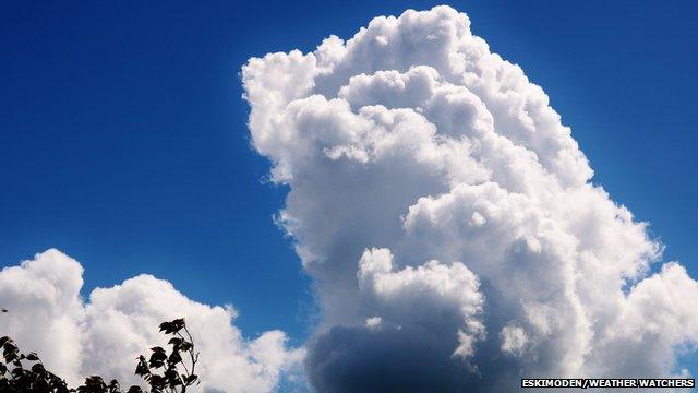
Cumulus congestus clouds, also known as towering cumulus, loom over Bidford-on-Avon, Warwickshire.
Stratus
These are low ragged looking clouds (grey or white-grey) in appearance. They often appear under rain clouds and can also be from the lifting and breaking up of fog. If thick enough they can produce drizzle or very light snow.
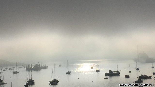
Low lying stratus cloud on a misty morning in Falmouth, Cornwall.
Stratocumulus
This is a general layer of clumpy-looking cloud that can be either white or grey in appearance depending on how thick the cloud is. This sort of cloud can appear in any type of weather situation, but when thick enough light precipitation can result.
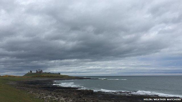
Thick stratocumulus clouds in Craster, Northumberland.
Cumulonimbus
When one of these clouds comes along it's time to take cover!
From a distance, these majestic looking clouds stretch far into the sky with the top of the clouds taking on a fuzzy anvil appearance - this is caused by ice crystals at the top of the cloud. Once under the cloud you can expect a very dark sky, torrential rain, heavy snow, hail, gusty winds or (on very rare occasions) a tornado.
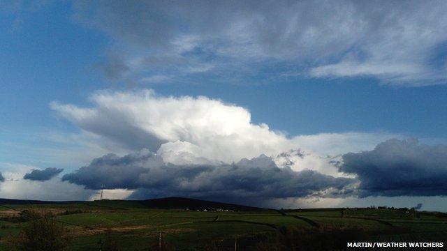
Stunning example of a cumulonimbus cloud in the Peak District.
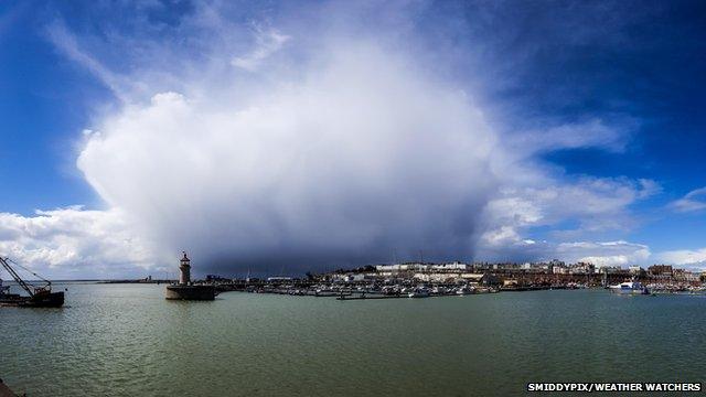
This impressive cumulonimbus formation was spotted in Ramsgate, Kent.
One other thing to look out for on the base of the cloud are strange udder shapes. These are mammatus clouds.
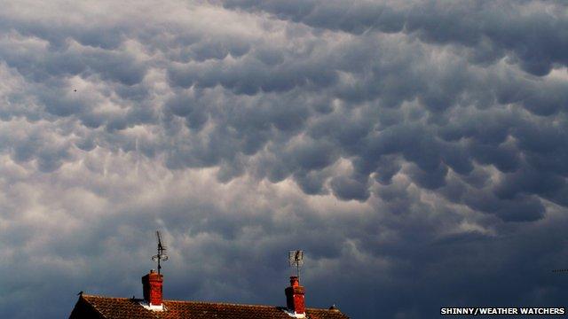
Dramatic mammatus clouds over Newport, Essex.
Medium clouds (cloud base 2000-6000m)
Nimbostratus
'Dark grey and looming' can also describe the appearance of these clouds. However, unlike cumulonimbus clouds they are much more featureless, and the weather they produce isn't as severe. Instead, expect a long spell of moderate to heavy rain or snow linked to the presence of a weather front.
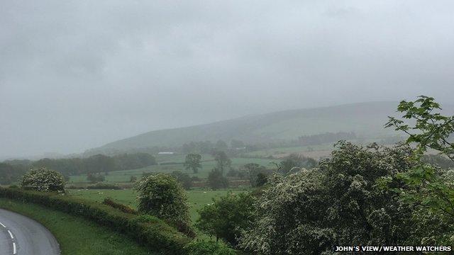
Grey nimbostratus clouds in Egremont, Cumbria.
Altostratus
Another cloud that can produce rain/snow. It often appears as a bland featureless layer of cloud either ahead of, or following the passage of a weather front. If thin enough (translucidus), the sun appears as a bright disc through it.
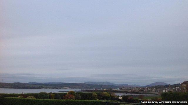
'Bland' altostratus clouds in Helensburgh, Argyll and Bute.
Altocumulus
Formed from either columns of rising air in the medium layer of the atmosphere, or from the break-up of altostratus clouds, these generally look like clumps of cloud spread out in a layer. Occasionally they'll produce those showers that are nothing more than a few big spots of rain.
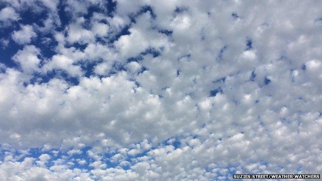
Cotton wool-like altocumulus clouds fill the sky in Toddington, Bedfordshire.
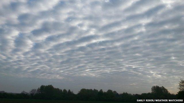
This formation of altocumulus cloud is often called a mackerel sky. Photo taken in Habrough, Lincolnshire.
Altocumulus clouds that appear like castle turrets (castellanus) can be a precursor to thunderstorms, whilst those that look like UFOs (lenticularis) are caused by air 'bouncing' over hills.
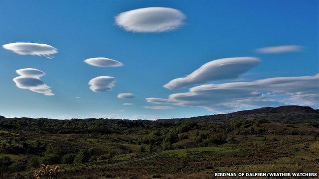
Altocumulus lenticularis, commonly called UFO clouds. These amazing looking clouds were seen over Taynuilt, Argyll and Bute.
High clouds (cloud base over 6000m high)
Cirrus
Clouds made entirely out of ice crystals. They are white and wispy in appearance and produce no weather at the ground. Aircraft contrails (homogenitus) are a form of cirrus cloud.
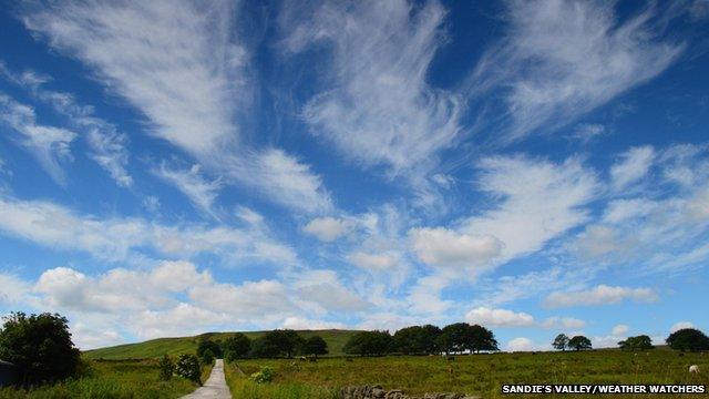
Pretty cirrus uncinus - or mares tails - together with cumulus formations - seen over Meltham, West Yorkshire.
Cirrocumulus
Made up of ice crystals and droplets of supercooled water, these are the clumpier form of cirrus clouds. The clumps are very small and can almost give the sky the appearance of fish scales.
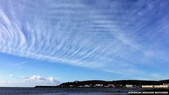
Both cirrocumulus and altocumulus clouds can produce a "mackerel sky", although cirrocumulus clouds are less common. This formation was seen in Douglas, Isle of Man.
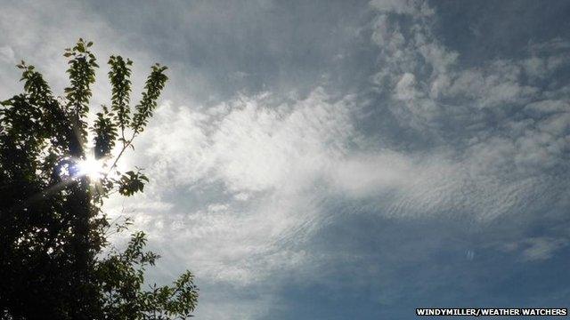
A dappled formation of cirrocumulus clouds in Hemingstone, Suffolk.
Cirrostratus
Quite often the first sign in the sky of an approaching weather front, this is a uniform layer of cirrus clouds. The sun is clearly visible through these clouds, but the presence of these clouds in front of the sun can cause optical effects such as a sun halo or parhelion.
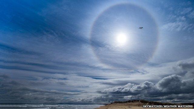
A sun halo is seen through cirrus clouds in Lossiemouth, Moray.