After recent heavy rain and storms bringing floods and disruption, there's another storm on the way to the United Kingdom this week.
Storm Ciarán is the third named storm of the season and will bring damaging winds and heavy rain to areas where the ground is already saturated.
Met Office severe weather warnings are already in force along with flood warnings.
Impacts are likely from late Wednesday and through into the weekend.
This autumn has already been very wet with some parts of the UK having well over the normal monthly rainfall.
For some locations in eastern areas, such as Wattisham in Suffolk and Aboyne in Aberdeenshire, it has been the wettest October on record.
The prospect therefore of another storm - Ciarán (pronounced Keer-on) - will not be welcome for those already suffering from recent flooding after heavy rain and Storm Babet only a couple of weeks ago.
- In Pictures: Storm Babet flooding in Scotland
- Businesses still suffering after flooding
- Agnes, Ciarán and Olga among 2023-24 storm names
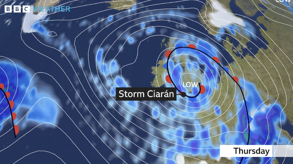
Storm Ciarán is being driven by a very powerful jet stream - winds high in the atmosphere - with speeds of around 200mph. A jet stream this powerful contains a lot of energy for low pressure systems to develop.
This low pressure system could indeed be one of the deepest areas of low pressure recorded in November in the UK, close to the current record of 948.4hPa in 1954.

A deep area of low pressure called Storm Ciarán will approach from the Atlantic late on Wednesday into Thursday
Strong winds
Winds will strengthen from later on Wednesday into Thursday as Storm Ciarán approaches from the south-west.
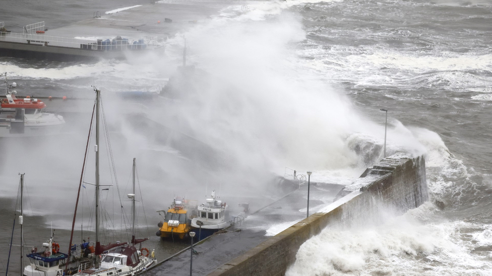
Strongest winds are initially likely across southern England and the Channel Islands where they could be around 80mph (130km/h) to perhaps 90mph (145km/h) in the most exposed locations.
These wind strengths have the potential to bring damage to trees and power lines with transport disruption likely. Cross channel ferries could be especially disrupted.
Inland gusts across southern parts of the UK could be as high as 50-60mph (80-97km/h) which again can bring some disruption and damage.
Heavy rain
Much of the week will be dominated by periods of rain which will in turn lead to some localised flooding in the short term, especially in eastern areas of Northern Ireland where an amber warning is in place.
Rain associated with Storm Ciarán will move north-east from Wednesday evening and throughout Thursday.
Persistent and heavy rain will be followed by heavy showers and thunderstorms.
There are severe weather warnings in force for southern England, south Wales, north-east England and Northern Ireland suggesting widely 20-40mm (1-2in) of rainfall with 40-60mm (2-3in) possible over high ground.
Flooding
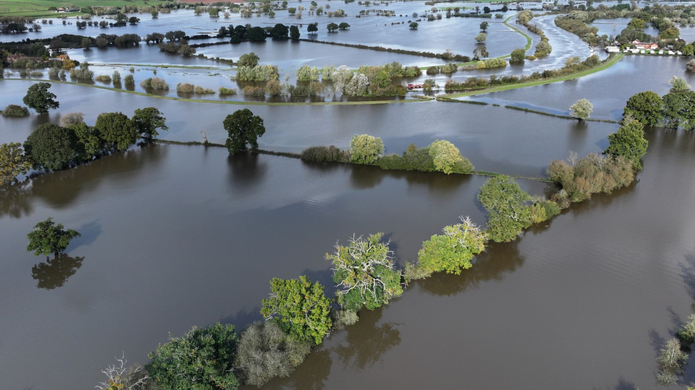
While rainfall totals expected with Storm Ciarán are not necessarily high or unusual with autumn storms, problems are likely as it comes after a very wet period for many.
River levels remain high with ground already very saturated. There are also still around 70 flood warnings in force across the UK.
By the end of the week some of the highest rainfall totals will be across southern England, south Wales, parts of northern England, Northern Ireland and eastern Scotland.

River and groundwater levels remain high after recent heavy rain so flooding will continue to be a problem
Stay tuned for updates
While there are already wind and rain warnings issued for Storm Ciarán, these will be tweaked and upgraded as necessary in the coming days.
While we are pretty certain to get some stormy weather, there are still some uncertainties in the finer details of the forecast, primarily because Storm Ciarán is likely to still be intensifying as it hits the UK.
In this situation, the exact track and timing can change and therefore the location of the most damaging winds could shift slightly.
It would therefore be worth staying across the forecast and warnings on our BBC Weather website or social channels.

How are you affected by Storm Ciarán? Share your pictures and experiences by emailing haveyoursay@bbc.co.uk, external.
Please include a contact number if you are willing to speak to a BBC journalist. You can also get in touch in the following ways:
WhatsApp: +44 7756 165803
Tweet: @BBC_HaveYourSay, external
Please read our terms & conditions and privacy policy
If you are reading this page and can't see the form you will need to visit the mobile version of the BBC website to submit your question or comment or you can email us at HaveYourSay@bbc.co.uk, external. Please include your name, age and location with any submission.