Ex-Hurricane Humberto forecast to bring wind and rain to the UK this weekend

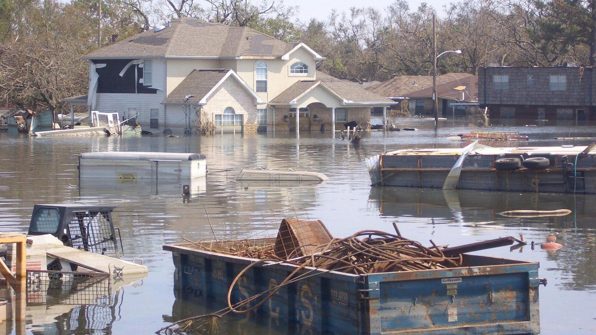
Storm Ophelia in 2017 was one of the most notorious ex-hurricanes to hit the UK
- Published
Two hurricanes churning away in the western Atlantic are both set to influence the weather in the UK over the next week or so.
Hurricane Humberto is unusually close to a second hurricane - Imelda - and both these storms are set to sweep eastwards across the Atlantic.
Whilst we won't see actual hurricanes arriving in the UK, the remnants of these storms may bring spells of disruptive weather with strong winds and heavy rainfall through the weekend and possibly into next week too.
These twin storms are currently bringing a threat of large waves, heavy rain and rip currents to portions of the the US east coast and Bermuda before they head closer to the UK later in the week.
How to stay safe during a storm and what to do in a power cut
- Published12 February
Cyclones, Typhoons, Hurricanes - what's the difference? Video, 00:01:49
- Published12 July 2019
Storm surges: What makes them happen?
- Published27 September 2024
Headed for Bermuda

Hurricanes Imelda and Humberto are only around 310 miles (500km) apart, off the southeast coast of the USA
Both storms are forecast to steer towards the north-east and then accelerate across the Atlantic.
Bermuda will experience the largest impacts from both storm systems. Humberto will pass around 200miles (321km) to the north late on Tuesday, whilst Imelda is forecast to move within 25 miles (40km) of the island and has the potential to make a direct landfall by Wednesday night. Damaging winds, heavy rain and large swells will be the main hazards here.
Whilst Bermuda is well accustomed to the impacts of hurricanes, a direct landfall on the island is rare. However, the last hurricane to hit Bermuda was Hurricane Ernesto just over a year ago in August 2024.

Humberto and Imelda will both track close to Bermuda then north-eastwards across the Atlantic
Portions of the east coast of the USA from Florida to North Carolina are also likely to experience large swells and dangerous rip currents from Humberto and Imelda.
From midweek onwards, as the storms both drift further out into the Atlantic, they are forecast to get swept up by the jet stream and pushed north-eastwards towards the UK and north-west Europe.
Will we get a named UK storm this weekend?

A change in weather type later this week brings the threat of heavy rain to western Scotland before the possible arrival of Humberto's remnants by the weekend
The UK weather is set to turn more unsettled from midweek onwards, with frontal systems approaching from the north-west. The Met Office have issued a yellow rain warning for parts of western Scotland from 17:00 Wednesday until 06:00 Friday.
However, it is into the weekend that strong winds and heavy rain are likely to become more widespread. A rapidly deepening area of low pressure is expected to approach the north-west. This system is likely to contain some of the moisture and energy from Hurricane Humberto, but it is unclear at this stage whether the storm would continue to be named 'Humberto' or whether it would form a separate storm which would be named 'Amy'. Travel and power disruption due to rain, wind and large waves is likely, which could lead to further weather warnings being issued.
Hurricane Imelda will remain further out at sea for several more days and it is unclear whether it will eventually follow a similar path to Humberto towards the UK.
At this stage, the details remain uncertain, and one hurricane can notoriously affect the confidence of weather forecasts, let alone two of them in such close proximity.
It is too soon to say whether we'll see the first named storm of the season, but keep tuned to the forecast by checking the BBC Weather website or App.

By Friday the remnants of Humberto are likely to move into the north-west of the UK whilst Imelda remains a hurricane in the mid-Atlantic
Will the storms combine?
When two storms develop in such close proximity, they have the potential to have a big influence on each other's track and potential strength. It is a a process called the 'Fujiwhara effect', external, named after Sakuhei Fujiwhara, the Japanese meteorologist who first described it.
When storms are within around 870miles (1400km) of each other, they can start to interact in several possible ways.
Firstly the storms may orbit each other, rotating around a shared central point, rather like two spinning dancers holding hands in the middle.
Secondly, the storms may merge into one larger system, the stronger storm 'sucking in' the smaller storm.
Alternatively, the storms deflect each other, altering their expected paths and keeping away from each other like two repelling magnets.
The most likely outcome with Humberto and Imelda is that whilst Humberto moves eastwards faster, some of its residual energy and moisture will get incorporated into storm Imelda.
- Published22 May 2025
- Published29 August 2025