Could Hurricane Melissa impact the weather in the UK?

- Published
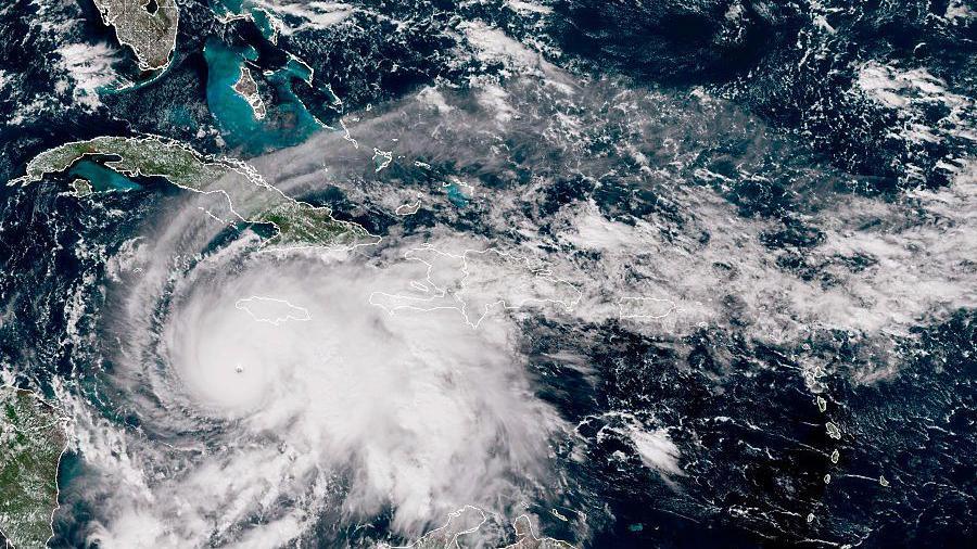
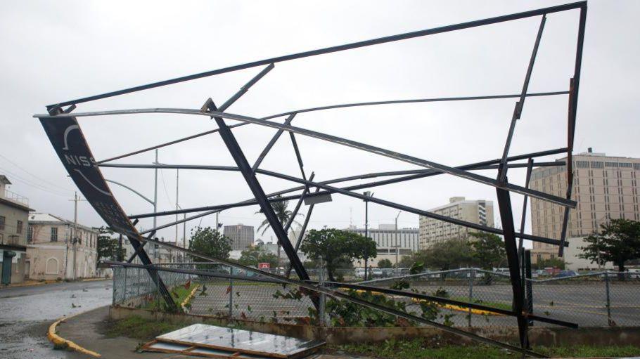
Hurricane Melissa - one of the most powerful landfalling Atlantic hurricanes on record - left a trail of devestation across the Carribean.
After moving north-east in the western Atlantic it has weakened to a category 1 hurricane while giving a glancing blow to Bermuda.
Melissa will degrade further, becoming an ex-hurricane before taking a track across the North Atlantic over the weekend.
Ex-hurricanes can sometimes impact the United Kingdom but on this occasion any remnants of Melissa will have only minor affects on our weather early next week.
Hurricane Melissa death toll rises as aid struggles to reach parts of Jamaica
- Published31 October 2025
Before and after: Satellite images reveal hurricane devastation in Jamaica
- Published30 October 2025
Hurricane Melissa route
Hurricane Melissa is now moving at pace north-east in the western Atlantic with sustained wind speeds of 90mph (145km/h).
By the weekend Melissa will pass to the east of Newfoundland, Canada.
But as it enounters much cooler sea surface temperartures and the jet stream - the fast moving wind high in the atmosphere - it will undergo what meterologists call "extra tropical transition".
In other words, it will no longer be a tropical storm or hurricane and will just be an area of low pressure, despite having the remnants and signature of Melissa.
This area of low pressure will then move east across the Atlantic interacting with other weather systems and is likely to stall around the south-east of Iceland.
Any effects to the UK will be limited, but a weather front wrapped around this area of low pressure may bring some heavy rain on Monday.
It may also turn a bit windy but the weather will be nothing more than a typical autumn day.

Remnants of ex-hurricane Melissa are expected to pass close to the south of Iceland on Monday with associated weather fronts across the UK
Wet and windy at times
The weather in the UK over the next few days remains quite changeable with areas of low pressure bringing wet and windy weather for many of us at times.
Further rain, heavy at times with the odd thunderstorm is expected on Friday evening and overnight.
And then the weekend and into early next week remains unsettled with further bouts of rain and breezy conditions.
This is nothing unusual for November but you can check your more detailed weather forecast here or on the BBC Weather app.
Hurricane hype
Ex-hurricanes heading our way can often conjure up wild headlines and speculation.
But in reality the weather that the UK may end up getting is no different to the occasional stormy weather we can sometimes see in autumn and winter.
Strong winds and heavy rain are part of that.
The most notable ex-hurricane to impact the UK and Ireland was Ophelia in October 2017.
Moving up the west coast of Ireland, strong winds resulted in power cuts and travel disruption in western parts of the UK.
With a southerly airflow linked to it, Saharan dust and smoke from Portuguese wildfires were also transported to the UK, resulting in eerie red skies.
The Atlantic hurricane season runs from 1 June to 30 November.
- Published28 October 2025
- Published6 November 2025