Wen Hurricane Milton go hit Florida?
Wia dis foto come from, Reuters
- Author, Brandon Drenon and James FitzGerald
- Role, BBC News, Washington and London
- Read am in 5 mins
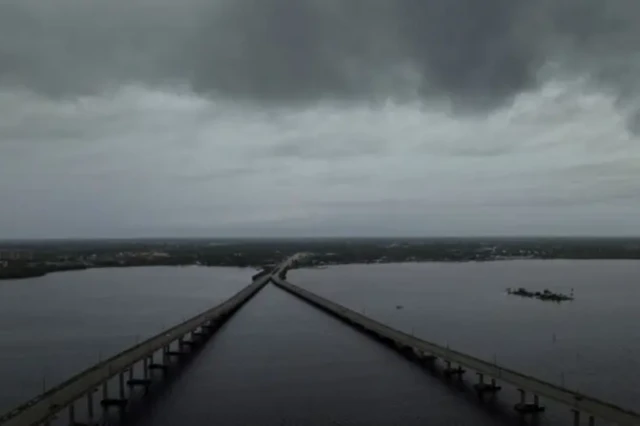
Millions of people for Florida dey rush to leave dia homes, as Hurricane Milton dey race towards di state west coast
Milton - category four storm - dey expected to hit di Tampa area tonight, packing strong winds of up to 165mph (270km/h)
"Dis na di 11th hour," officials ask pipo for evacuation zones on Florida west coast
US President Joe Biden warn say leaving na a matter of "life and death", as di state undertake im largest evacuation effort in years
It comes less dan two weeks after Hurricane Helene hit di Gulf Coast as a category four storm, killing at least 225 people across Florida, Georgia, South Carolina, Tennessee, Virginia and North Carolina.
Milton na di one of di most powerful storms to form for North Atlantic in recent years.
Wen Hurricane Milton go hit Florida?
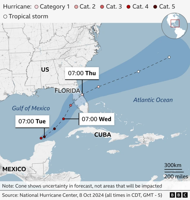
Di National Hurricane Center (NHC) expect Milton to make landfall as "extremely dangerous major hurricane" late on Wednesday night or early on Thursday morning, local time.
E fit hit Florida at about 02:00 EDT (07:00 BST) on Thursday, according to a forecaster from CBS News, BBC US partner.
Milton fit strike near di city of Tampa, wey im wider metropolitan area get a population of more dan three million pipo.
Forecasters dey warn of torrential rain, flash flooding, high winds and possible storm surge - wey dey occur wen water move inland from di coast.
Dem say Milton fit be di worst storm to hit di area in about a century - with a surge of 10-15ft (3-4.5m) possible, and localised rainfall of up to 1.5ft.
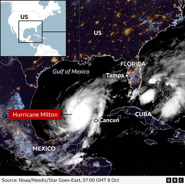
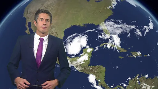
Wia Hurricane Milton dey - and wetin dey im path?
Milton become category-one hurricane on Sunday and e dey move steadily towards di east, through di Gulf of Mexico, afta e pass Mexico Yucatan peninsula.
BBC weather presenter Chris Fawkes say under 24 hour period, e don intensify, wit sustained wind gusts of 200mph (321km/h).
Dem don put am for di most powerful hurricane category - five - although e dey fluctuate in strength, and sake of dat, dem don downgrade am to category four.
Di hurricane dey expected to drop di intensity before im arrive for Florida west coast.
E dey due to cut straight across di peninsula bifor e go end up for Atlantic Ocean.
Wia be Hurricane Milton evacuation zones?
Most counties dey official state of emergency, for Florida west coast authorities dia don order for evacuations.
Disaster management authorities don release list and map of di evacuation orders.
Airports wey dey for Milton expected path don close, and traffic queues dey now as pipo start to leave dia homes.

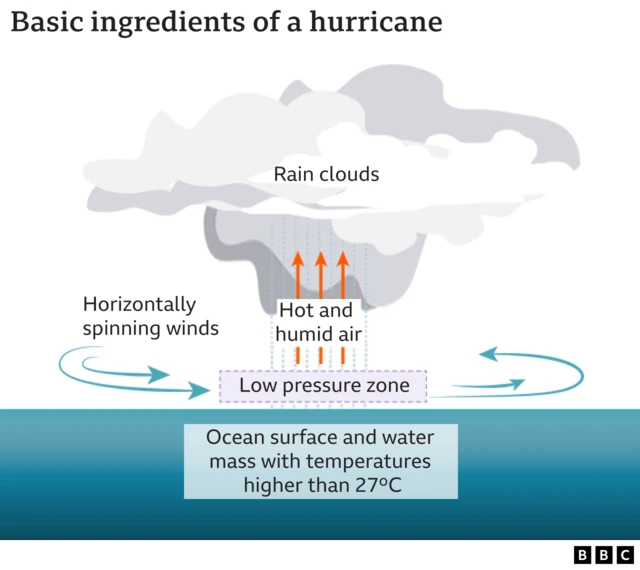
Wetin be hurricane and how e dey form?
Hurricanes – wey some pipo know as cyclones or typhoons – na a type of tropical storm wey dey form for North Atlantic. E dey carry strong winds and heavy rain.
Wen ocean air dey warm and moist, e dey rise, wen e rise, e go start to cool – dis dey cause clouds to form.
Sometimes dis rising air fit move away for di top of di hurricane sharp-sharp, pass di way e go take replace for di surface, dis action go cause di surface pressure to fall.
Di falling pressure go cause di winds to accelerate wit more air den e go begin pull am in as di hurricane dey strong.
The National Oceanic Atmospheric Association (Noaa) predict say di 2024 hurricane season go dey more active dan usual.
Rising average sea level temperatures sake of human-caused climate change dey partly to blame, e tok.
Wetin be category five hurricane?
Di National Oceanic Atmospheric Association (Noaa) dey consider Category five hurricanes as "catastrophic".
E dey carry wind speeds wey dey greater dan 155mph (249km/h) and dey cause "very serious and extensive damage".
Di US goment agency call for "massive evacuations" in residential areas near shorelines, since category-five hurricane fit also bring storm surges wey pass 18ft (5m) and destroy many homes.
Trees and power lines fit go down, dis fit cause di isolation of residential areas and lengthy power cuts. Noaa say affected areas fit turn place pipo no fit stay -uninhabitable - for weeks or months.
US worst category-five hurricanes?
Database from Noaa show at least 40 storms for Atlantic wey don reach category-five status since 1924, though only four don actually hit land at dat strength. Dis na some of di most damaging:
Hurricane Camille
Camille crash into Mississippi for1969, e produce a peak storm surge of 24ft and destroy almost eviritin along di coast.
E kill 259 pipo, most of dem for Virginia, cause about $1.4bn (£1.06bn) in damage.
Hurricane Andrew
Hurricane Andrew land southern Florida for 1992 wit sustained wind speeds of up to 165mph and gusts as high as 174mph.
E kill 26 pipo directly and dem blame am for dozens of oda deaths. Afta e cause $30bn in damage, E dey considered as di costliest natural disaster for US history at dat time.
Hurricane Michael
Hurricane Michael slam into Florida for 2018 wit 160mph wind speeds and di strongest storm to make landfall for di Sunshine State.
At least 74 deaths dey linked to di storm - 59 for US and 15 for Central America - and Michael cause an estimated $25.1bn in damage.
Lower-category storms
Milton dey come less dan two weeks afta Hurricane Helene hit di US as a category-four storm, e kill more dan 200 pipo and e become di deadliest hurricane to strike di US mainland since Hurricane Katrina for 2005.